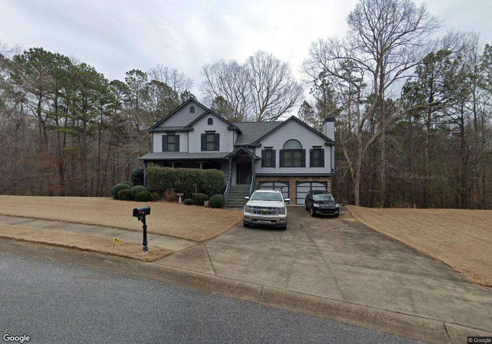
210 Ashleys Way Waleska, GA 30183
Estimated Value: $484,000 - $484,973
4
Beds
3
Baths
2,357
Sq Ft
$206/Sq Ft
Est. Value
About This Home
This home is located at 210 Ashleys Way, Waleska, GA 30183 and is currently estimated at $484,487, approximately $205 per square foot. 210 Ashleys Way is a home located in Cherokee County with nearby schools including R. M. Moore Elementary School, Teasley Middle School, and Cherokee High School.
Ownership History
Date
Name
Owned For
Owner Type
Purchase Details
Closed on
Sep 8, 2005
Sold by
David Hunt Const Inc
Bought by
Walker Ronny E and Walker Julia
Current Estimated Value
Home Financials for this Owner
Home Financials are based on the most recent Mortgage that was taken out on this home.
Original Mortgage
$195,210
Outstanding Balance
$102,625
Interest Rate
5.77%
Mortgage Type
New Conventional
Estimated Equity
$381,862
Create a Home Valuation Report for This Property
The Home Valuation Report is an in-depth analysis detailing your home's value as well as a comparison with similar homes in the area
Home Values in the Area
Average Home Value in this Area
Purchase History
| Date | Buyer | Sale Price | Title Company |
|---|---|---|---|
| Walker Ronny E | $216,900 | -- |
Source: Public Records
Mortgage History
| Date | Status | Borrower | Loan Amount |
|---|---|---|---|
| Open | Walker Ronny E | $195,210 |
Source: Public Records
Tax History Compared to Growth
Tax History
| Year | Tax Paid | Tax Assessment Tax Assessment Total Assessment is a certain percentage of the fair market value that is determined by local assessors to be the total taxable value of land and additions on the property. | Land | Improvement |
|---|---|---|---|---|
| 2025 | $989 | $183,520 | $38,800 | $144,720 |
| 2024 | $958 | $176,120 | $33,600 | $142,520 |
| 2023 | $802 | $170,600 | $33,600 | $137,000 |
| 2022 | $914 | $148,600 | $32,000 | $116,600 |
| 2021 | $864 | $114,920 | $24,000 | $90,920 |
| 2020 | $834 | $106,000 | $20,000 | $86,000 |
| 2019 | $806 | $98,600 | $20,000 | $78,600 |
| 2018 | $2,445 | $87,800 | $19,200 | $68,600 |
| 2017 | $2,395 | $213,500 | $19,200 | $66,200 |
| 2016 | $2,376 | $209,800 | $17,200 | $66,720 |
| 2015 | $2,351 | $205,700 | $14,800 | $67,480 |
| 2014 | $2,145 | $187,800 | $14,800 | $60,320 |
Source: Public Records
Map
Nearby Homes
- 1010 Cable Rd
- 990 Cable Rd
- 994 Cable Rd
- 1017 Cable Rd
- 1717 Darby Rd
- 1723 Darby Rd
- 134 Brookwood Trail
- 2020 Darby Rd
- 4441 Fincher Rd
- 6231 Reinhardt College Pkwy
- 6434 Reinhardt College Pkwy
- 424 Cable Rd
- 240 Land Rd
- 1175 Bartow St
- 544 Sardis Cir
- 437 Mccurry Trail
- 737 Sardis Cir
- 735 Sardis Cir
- 865 Old Mill Ln
- 520 George Gray Ln
- 208 Ashleys Way
- 212 Ashleys Way
- 213 Ashleys Way
- 216 Ashleys Way
- 214 Ashleys Way
- 206 Ashleys Way
- 1305 Darby Rd
- 204 Ashleys Way
- 108 Brookwood Trail
- 958 Cable Rd
- 207 Ashleys Way
- 1327 Darby Rd
- 202 Ashleys Way
- 960 Cable Rd
- 956 Cable Rd
- 948 Cable Rd
- 952 Cable Rd
- 205 Ashleys Way
- 962 Cable Rd
- 203 Ashleys Way