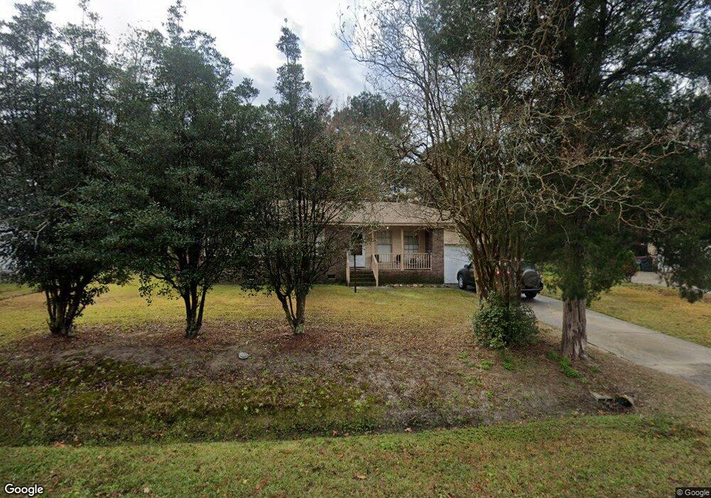
210 Cardinal Dr Summerville, SC 29485
Estimated Value: $206,000 - $271,222
3
Beds
2
Baths
1,099
Sq Ft
$216/Sq Ft
Est. Value
About This Home
This home is located at 210 Cardinal Dr, Summerville, SC 29485 and is currently estimated at $237,806, approximately $216 per square foot. 210 Cardinal Dr is a home located in Dorchester County with nearby schools including James H. Spann Elementary School, Alston Middle School, and Summerville High School.
Ownership History
Date
Name
Owned For
Owner Type
Purchase Details
Closed on
Aug 5, 2009
Sold by
#80 Base Hit House Llc
Bought by
White Dorothy G
Current Estimated Value
Home Financials for this Owner
Home Financials are based on the most recent Mortgage that was taken out on this home.
Original Mortgage
$10,412
Outstanding Balance
$6,806
Interest Rate
5.26%
Mortgage Type
Purchase Money Mortgage
Estimated Equity
$231,000
Purchase Details
Closed on
Mar 25, 2002
Sold by
Jasper White and Jasper Dorothy G
Bought by
Sarver Gregory
Create a Home Valuation Report for This Property
The Home Valuation Report is an in-depth analysis detailing your home's value as well as a comparison with similar homes in the area
Home Values in the Area
Average Home Value in this Area
Purchase History
| Date | Buyer | Sale Price | Title Company |
|---|---|---|---|
| White Dorothy G | $10,412 | -- | |
| Sarver Gregory | $7,500 | -- |
Source: Public Records
Mortgage History
| Date | Status | Borrower | Loan Amount |
|---|---|---|---|
| Open | White Dorothy G | $10,412 |
Source: Public Records
Tax History Compared to Growth
Tax History
| Year | Tax Paid | Tax Assessment Tax Assessment Total Assessment is a certain percentage of the fair market value that is determined by local assessors to be the total taxable value of land and additions on the property. | Land | Improvement |
|---|---|---|---|---|
| 2024 | $955 | $7,889 | $3,400 | $4,489 |
| 2023 | $955 | $4,253 | $1,000 | $3,253 |
| 2022 | $859 | $4,250 | $1,000 | $3,250 |
| 2021 | $859 | $4,250 | $1,000 | $3,250 |
| 2020 | $783 | $3,720 | $800 | $2,920 |
| 2019 | $835 | $3,720 | $800 | $2,920 |
| 2018 | $678 | $3,720 | $800 | $2,920 |
| 2017 | $674 | $3,720 | $800 | $2,920 |
| 2016 | $664 | $3,720 | $800 | $2,920 |
| 2015 | $662 | $3,720 | $800 | $2,920 |
| 2014 | $642 | $92,400 | $0 | $0 |
| 2013 | -- | $3,700 | $0 | $0 |
Source: Public Records
Map
Nearby Homes
- 120 Robin St
- 316 Owens Dr
- 72 Branch Creek Trail
- 203 Bennett Ln
- 305 E 1st St N
- 207 Branch Creek Trail
- 301 E Richardson Ave
- 1015 Mourning Warbler Way Unit Cc3-17-7p
- 211 E Richardson Ave
- 210 S Gum St
- 507 E 5th St N
- 184 W Boundary St
- 214 Seele St
- 343 Dickerson Ln
- 217 Seele St
- 505 Yukon Ct
- 328 Dickerson Ln
- 226 Seele St
- DAWSON Plan at Founders Corner
- RUBY Plan at Founders Corner