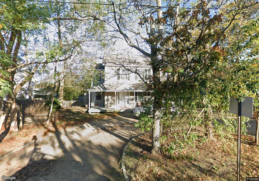
210 County Rd Oak Bluffs, MA 02557
Oak Bluffs NeighborhoodEstimated Value: $1,143,842 - $1,277,000
3
Beds
3
Baths
1,474
Sq Ft
$830/Sq Ft
Est. Value
About This Home
This home is located at 210 County Rd, Oak Bluffs, MA 02557 and is currently estimated at $1,223,711, approximately $830 per square foot. 210 County Rd is a home with nearby schools including Oak Bluffs Elementary School, Martha's Vineyard Regional High School, and Vineyard Montessori School.
Ownership History
Date
Name
Owned For
Owner Type
Purchase Details
Closed on
Oct 6, 2003
Sold by
Martin Elizabeth A
Bought by
Andrews-Maltais Cheryl and Maltais Daniel B
Current Estimated Value
Home Financials for this Owner
Home Financials are based on the most recent Mortgage that was taken out on this home.
Original Mortgage
$230,000
Interest Rate
6.25%
Mortgage Type
Purchase Money Mortgage
Create a Home Valuation Report for This Property
The Home Valuation Report is an in-depth analysis detailing your home's value as well as a comparison with similar homes in the area
Home Values in the Area
Average Home Value in this Area
Purchase History
| Date | Buyer | Sale Price | Title Company |
|---|---|---|---|
| Andrews-Maltais Cheryl | $195,000 | -- |
Source: Public Records
Mortgage History
| Date | Status | Borrower | Loan Amount |
|---|---|---|---|
| Open | Andrews-Maltais Cheryl | $280,000 | |
| Closed | Andrews-Maltais Cheryl | $230,000 |
Source: Public Records
Tax History Compared to Growth
Tax History
| Year | Tax Paid | Tax Assessment Tax Assessment Total Assessment is a certain percentage of the fair market value that is determined by local assessors to be the total taxable value of land and additions on the property. | Land | Improvement |
|---|---|---|---|---|
| 2025 | $4,877 | $965,700 | $481,600 | $484,100 |
| 2024 | $4,802 | $918,100 | $437,700 | $480,400 |
| 2023 | $4,494 | $851,200 | $425,300 | $425,900 |
| 2022 | $4,616 | $679,800 | $320,300 | $359,500 |
| 2021 | $4,248 | $576,400 | $275,200 | $301,200 |
| 2020 | $4,027 | $541,300 | $262,100 | $279,200 |
| 2019 | $3,863 | $502,300 | $228,600 | $273,700 |
| 2018 | $3,760 | $480,200 | $206,500 | $273,700 |
| 2017 | $3,547 | $435,200 | $195,700 | $239,500 |
| 2016 | $3,299 | $406,800 | $201,800 | $205,000 |
| 2015 | $3,116 | $391,400 | $201,800 | $189,600 |
| 2014 | $2,962 | $379,200 | $185,900 | $193,300 |
Source: Public Records
Map
Nearby Homes
- 60 -R Carol Ln
- 6 Sachem Way
- 0-A California Ave Unit Part lot 79
- 0-B California Ave Unit Part lot 79
- 0 California Ave Unit 76 42933
- 70 Carol Ln
- 60R Carol Ln
- 25 Windy Hill Rd
- 72 Washington Ave
- 38 Rogers Way
- 8 Hitchings Cir
- 28 Barling Ave
- 1 Jessie Leigh Mitchell Way
- 30 Franklin Ave
- 0 Pennsylvania Ave Unit 43914
- 9 Bayview Ave
- 5 Seth's Path
- 26 Winthrop Ave
- 113 Dukes County Ave Unit Multi-Family
- 181 Circuit Ave
- 226 County Rd
- 200 County Rd
- 216 County Rd
- 21 Upper Douglas Ln
- 15 Upper Douglas Ln
- 5 Upper Douglas Ln
- 11 Upper Douglas Ln
- 27 Upper Douglas Ln
- 216 County Rd
- 6 Upper Douglas Ln
- 213 County Rd
- 269 County Rd
- 291 County Rd
- 245 County Rd
- 251 County Rd
- 247 County Rd
- 2 Douglas Ln
- 10 Barnes Rd
- 120 Wing Rd
- 220 County Rd