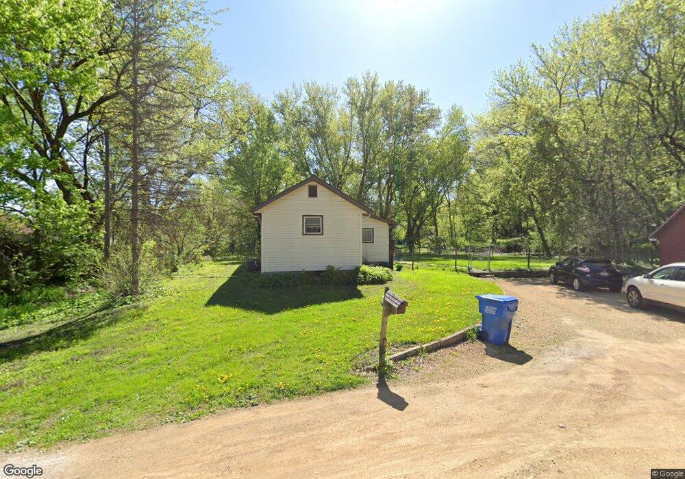
210 Daniels St S Mankato, MN 56001
Estimated Value: $141,000 - $188,000
2
Beds
1
Bath
896
Sq Ft
$186/Sq Ft
Est. Value
About This Home
This home is located at 210 Daniels St S, Mankato, MN 56001 and is currently estimated at $166,473, approximately $185 per square foot. 210 Daniels St S is a home located in Blue Earth County with nearby schools including Roosevelt Elementary School, Dakota Meadows Middle School, and Mankato West Senior High School.
Ownership History
Date
Name
Owned For
Owner Type
Purchase Details
Closed on
Mar 2, 2012
Sold by
Engelen Mark A
Bought by
Engelen Thomas P and Engelen Sandie K
Current Estimated Value
Home Financials for this Owner
Home Financials are based on the most recent Mortgage that was taken out on this home.
Original Mortgage
$62,700
Outstanding Balance
$43,112
Interest Rate
3.89%
Mortgage Type
New Conventional
Estimated Equity
$123,361
Create a Home Valuation Report for This Property
The Home Valuation Report is an in-depth analysis detailing your home's value as well as a comparison with similar homes in the area
Home Values in the Area
Average Home Value in this Area
Purchase History
| Date | Buyer | Sale Price | Title Company |
|---|---|---|---|
| Engelen Thomas P | $66,000 | None Available | |
| Engelen Thomas P | $66,000 | -- |
Source: Public Records
Mortgage History
| Date | Status | Borrower | Loan Amount |
|---|---|---|---|
| Open | Engelen Thomas P | $62,700 |
Source: Public Records
Tax History Compared to Growth
Tax History
| Year | Tax Paid | Tax Assessment Tax Assessment Total Assessment is a certain percentage of the fair market value that is determined by local assessors to be the total taxable value of land and additions on the property. | Land | Improvement |
|---|---|---|---|---|
| 2025 | $1,160 | $149,000 | $31,200 | $117,800 |
| 2024 | $1,160 | $131,600 | $31,200 | $100,400 |
| 2023 | $1,240 | $138,500 | $31,200 | $107,300 |
| 2022 | $996 | $128,500 | $31,200 | $97,300 |
| 2021 | $904 | $105,500 | $31,200 | $74,300 |
| 2020 | $824 | $91,900 | $22,300 | $69,600 |
| 2019 | $816 | $91,900 | $22,300 | $69,600 |
| 2018 | $622 | $91,700 | $21,700 | $70,000 |
| 2017 | $548 | $83,400 | $21,700 | $61,700 |
| 2016 | $498 | $80,900 | $21,700 | $59,200 |
| 2015 | $5 | $75,800 | $21,700 | $54,100 |
| 2014 | $612 | $75,800 | $21,700 | $54,100 |
Source: Public Records
Map
Nearby Homes
- 210 Bird St S
- 204 Sturgis St N
- 204 204 N Sturgis St
- 607 Blue Earth St
- 627 Park Ln
- 237 237 W Skyline Ct
- 237 W Skyline Ct
- 19 19 Skyline Dr
- 602 Park Ln
- 1030 Oak Terrace Dr
- 1030 1030 Oak Terrace Dr
- 1614 Le Sueur Ave
- 201 Tile St
- 407 407 W 8th St
- 426 426 W 6th St
- 513 513 W 3rd St
- 407 407 W 6 St Unit sixth
- 233 Allan Ave
- 1002 Dr
- 1002 Oak Terrace Dr
- 811 Le Hillier St
- 809 Lehillier St
- 813 Le Hillier St
- 809 Le Hillier St
- 809 Chapman St
- 213 Bird St S
- 807 Le Hillier St
- 211 Bird St S
- 211 Bird St S Unit 211 S Bird Street
- 211 S Bird St
- 217 Bird St S
- 219 Bird St S
- 209 Daniels St S
- 803 Le Hillier St
- 825 Le Hillier St
- 214 Bird St S
- 0 Tbd S Bird St
- 218 Bird St S
- 713 Le Hillier St
- 615 S Bend Ave