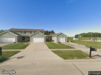
210 Deerpath St Unit 3 Tolono, IL 61880
Estimated Value: $156,000 - $168,000
2
Beds
1
Bath
1,024
Sq Ft
$156/Sq Ft
Est. Value
About This Home
This home is located at 210 Deerpath St Unit 3, Tolono, IL 61880 and is currently estimated at $160,045, approximately $156 per square foot. 210 Deerpath St Unit 3 is a home located in Champaign County with nearby schools including Unity High School.
Ownership History
Date
Name
Owned For
Owner Type
Purchase Details
Closed on
Oct 18, 2024
Sold by
Swope Patricia K
Bought by
Jones Ryan
Current Estimated Value
Home Financials for this Owner
Home Financials are based on the most recent Mortgage that was taken out on this home.
Original Mortgage
$123,000
Outstanding Balance
$122,422
Interest Rate
6.35%
Mortgage Type
New Conventional
Estimated Equity
$37,623
Purchase Details
Closed on
Oct 1, 2007
Sold by
Natschke Grant M and Natschke Jennifer L
Bought by
Swope Patricia K and Misenheimer Mary Olive
Purchase Details
Closed on
Nov 25, 2003
Sold by
Gam Properties Llc
Bought by
Hutton J Dennis
Home Financials for this Owner
Home Financials are based on the most recent Mortgage that was taken out on this home.
Original Mortgage
$275,000
Interest Rate
5.5%
Mortgage Type
Construction
Create a Home Valuation Report for This Property
The Home Valuation Report is an in-depth analysis detailing your home's value as well as a comparison with similar homes in the area
Home Values in the Area
Average Home Value in this Area
Purchase History
| Date | Buyer | Sale Price | Title Company |
|---|---|---|---|
| Jones Ryan | $154,000 | None Listed On Document | |
| Swope Patricia K | $122,000 | None Available | |
| Hutton J Dennis | $32,000 | -- |
Source: Public Records
Mortgage History
| Date | Status | Borrower | Loan Amount |
|---|---|---|---|
| Open | Jones Ryan | $123,000 | |
| Previous Owner | Swope Patricuia K | $123,000 | |
| Previous Owner | Hutton J Dennis | $275,000 |
Source: Public Records
Tax History Compared to Growth
Tax History
| Year | Tax Paid | Tax Assessment Tax Assessment Total Assessment is a certain percentage of the fair market value that is determined by local assessors to be the total taxable value of land and additions on the property. | Land | Improvement |
|---|---|---|---|---|
| 2024 | $2,403 | $40,520 | $6,420 | $34,100 |
| 2023 | $2,403 | $37,620 | $5,960 | $31,660 |
| 2022 | $2,283 | $34,960 | $5,540 | $29,420 |
| 2021 | $2,182 | $33,170 | $5,260 | $27,910 |
| 2020 | $2,159 | $32,420 | $5,140 | $27,280 |
| 2019 | $2,307 | $31,970 | $5,070 | $26,900 |
| 2018 | $2,280 | $31,970 | $5,070 | $26,900 |
| 2017 | $1,847 | $30,590 | $4,850 | $25,740 |
| 2016 | $1,780 | $29,250 | $4,640 | $24,610 |
| 2015 | $1,346 | $28,200 | $4,470 | $23,730 |
| 2014 | $1,379 | $28,660 | $4,540 | $24,120 |
| 2013 | $2,177 | $39,470 | $4,540 | $34,930 |
Source: Public Records
Map
Nearby Homes
- 520 N James St Unit 2D
- 712 N Bourne St
- 201 S 1st St
- 307 S Elizabeth St
- 301 Philip Dr
- 708 E Larmon St
- 0 County Road 700 Rd N Unit RMAQC4259116
- 112 Shiloh Dr
- 105 Astoria Dr
- 102 Astoria Dr
- 115 Astoria Dr
- 5 Cedar Grove Ct
- 1004 Cascade Dr
- 10 Fletcher Ct
- 407 Sutton St
- 306 Sutton St
- 411 Newhaven Ln
- 210 Denton Dr
- 313 W Church St
- 1505 Winterberry Rd
