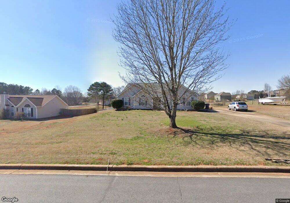
210 Ferguson Ave Locust Grove, GA 30248
Estimated Value: $248,743 - $264,000
3
Beds
2
Baths
1,326
Sq Ft
$194/Sq Ft
Est. Value
About This Home
This home is located at 210 Ferguson Ave, Locust Grove, GA 30248 and is currently estimated at $256,686, approximately $193 per square foot. 210 Ferguson Ave is a home located in Henry County with nearby schools including Locust Grove Elementary School, Locust Grove Middle School, and Locust Grove High School.
Ownership History
Date
Name
Owned For
Owner Type
Purchase Details
Closed on
Jul 22, 1999
Sold by
Brenco Inc
Bought by
Brumback Jose A and Brumback Diane L
Current Estimated Value
Home Financials for this Owner
Home Financials are based on the most recent Mortgage that was taken out on this home.
Original Mortgage
$95,512
Outstanding Balance
$26,965
Interest Rate
7.66%
Mortgage Type
FHA
Estimated Equity
$229,721
Create a Home Valuation Report for This Property
The Home Valuation Report is an in-depth analysis detailing your home's value as well as a comparison with similar homes in the area
Home Values in the Area
Average Home Value in this Area
Purchase History
| Date | Buyer | Sale Price | Title Company |
|---|---|---|---|
| Brumback Jose A | $96,300 | -- |
Source: Public Records
Mortgage History
| Date | Status | Borrower | Loan Amount |
|---|---|---|---|
| Open | Brumback Jose A | $95,512 |
Source: Public Records
Tax History Compared to Growth
Tax History
| Year | Tax Paid | Tax Assessment Tax Assessment Total Assessment is a certain percentage of the fair market value that is determined by local assessors to be the total taxable value of land and additions on the property. | Land | Improvement |
|---|---|---|---|---|
| 2025 | $410 | $93,560 | $14,000 | $79,560 |
| 2024 | $410 | $86,800 | $14,000 | $72,800 |
| 2023 | $353 | $99,560 | $14,000 | $85,560 |
| 2022 | $403 | $76,160 | $14,000 | $62,160 |
| 2021 | $405 | $61,960 | $14,000 | $47,960 |
| 2020 | $1,280 | $55,760 | $12,000 | $43,760 |
| 2019 | $1,520 | $48,560 | $12,000 | $36,560 |
| 2018 | $1,471 | $46,800 | $10,800 | $36,000 |
| 2016 | $1,377 | $41,920 | $10,000 | $31,920 |
| 2015 | $1,270 | $38,400 | $10,000 | $28,400 |
| 2014 | $1,160 | $35,360 | $12,000 | $23,360 |
Source: Public Records
Map
Nearby Homes
- 143 Massey Ln
- 231 Ferguson Ave
- 239 Ferguson Ave
- 1064 Lear Dr
- 565 Carleton Place
- 150 Aster Ave
- Cali Plan at Cedar Ridge - Locust Grove Station
- Belfort Plan at Cedar Ridge - Locust Grove Station
- Galen Plan at Cedar Ridge - Locust Grove Station
- Hayden Plan at Cedar Ridge - Locust Grove Station
- Packard Plan at Cedar Ridge - Locust Grove Station
- Flora Plan at Cedar Ridge - Locust Grove Station
- Penwell Plan at Cedar Ridge - Locust Grove Station
- 1537 Jackson St
- 0 Locust Rd Unit 10495072
- 0 Locust Rd Unit 19967321
- 269 Baumgard Way
- 188 Sophie Cir
- 501 Grove Park Dr
- 0 Jackson St Unit 10554689
- 208 Ferguson Ave
- 300 Harris Ave
- 206 Ferguson Ave
- 209 Ferguson Ave
- 214 Ferguson Ave
- 211 Ferguson Ave
- 117 Massey Ln
- 304 Harris Ave
- 207 Ferguson Ave
- 213 Ferguson Ave
- 205 Ferguson Ave
- 115 Massey Ln
- 137 Massey Ln Unit (LOT BS13)
- 216 Ferguson Ave
- 306 Harris Ave
- 141 Massey Lane (Lot 11) Unit LOT 11
- 137 Massey Lane (Lot Bs13) Unit BS LOT 13
- 123 (BS LOT 20) Massey Ln Unit BS LOT 20
- 1564 Denver Way
- 1564 Denver Way Unit 76