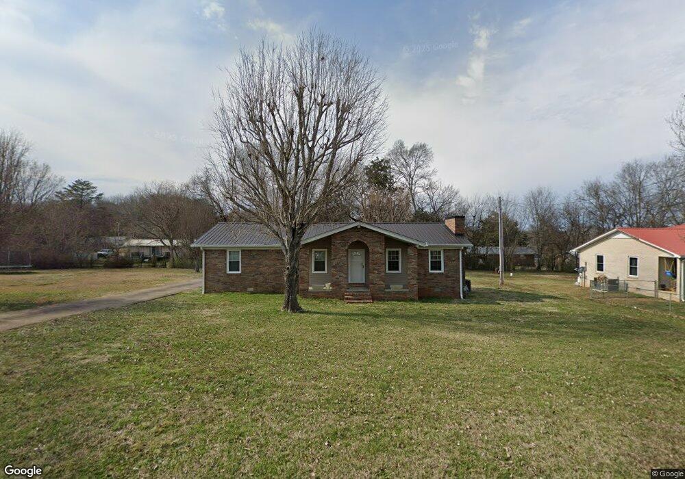
210 Forrest Ave Clifton, TN 38425
Estimated Value: $110,849 - $158,000
3
Beds
2
Baths
1,404
Sq Ft
$102/Sq Ft
Est. Value
About This Home
This home is located at 210 Forrest Ave, Clifton, TN 38425 and is currently estimated at $142,712, approximately $101 per square foot. 210 Forrest Ave is a home located in Wayne County.
Ownership History
Date
Name
Owned For
Owner Type
Purchase Details
Closed on
Aug 26, 2021
Sold by
Warren Eaves Sandra Geannine
Bought by
Kelley Cassandra and Staggs Jordan
Current Estimated Value
Home Financials for this Owner
Home Financials are based on the most recent Mortgage that was taken out on this home.
Original Mortgage
$80,500
Outstanding Balance
$73,249
Interest Rate
2.8%
Mortgage Type
Purchase Money Mortgage
Estimated Equity
$69,463
Purchase Details
Closed on
Mar 27, 2012
Sold by
Warren Wilma Hazel
Bought by
Eaves Sandra Warren
Purchase Details
Closed on
Feb 25, 2000
Sold by
Ethel Ferguson Mary
Bought by
Guy Warren and Guy Wilma H
Purchase Details
Closed on
Aug 23, 1979
Bought by
Ferguson Mary Ethel
Purchase Details
Closed on
Jan 1, 1979
Purchase Details
Closed on
Aug 12, 1976
Create a Home Valuation Report for This Property
The Home Valuation Report is an in-depth analysis detailing your home's value as well as a comparison with similar homes in the area
Home Values in the Area
Average Home Value in this Area
Purchase History
| Date | Buyer | Sale Price | Title Company |
|---|---|---|---|
| Kelley Cassandra | $80,500 | Ross James Y | |
| Eaves Sandra Warren | $81,600 | -- | |
| Guy Warren | $15,000 | -- | |
| Ferguson Mary Ethel | -- | -- | |
| -- | $35,000 | -- | |
| -- | -- | -- |
Source: Public Records
Mortgage History
| Date | Status | Borrower | Loan Amount |
|---|---|---|---|
| Open | Kelley Cassandra | $80,500 |
Source: Public Records
Tax History Compared to Growth
Tax History
| Year | Tax Paid | Tax Assessment Tax Assessment Total Assessment is a certain percentage of the fair market value that is determined by local assessors to be the total taxable value of land and additions on the property. | Land | Improvement |
|---|---|---|---|---|
| 2024 | $614 | $28,350 | $1,250 | $27,100 |
| 2023 | $799 | $28,350 | $1,250 | $27,100 |
| 2022 | $799 | $28,350 | $1,250 | $27,100 |
| 2021 | $644 | $28,350 | $1,250 | $27,100 |
| 2020 | $664 | $20,125 | $1,150 | $18,975 |
| 2019 | $463 | $20,125 | $1,150 | $18,975 |
| 2018 | $664 | $20,125 | $1,150 | $18,975 |
| 2017 | $664 | $20,125 | $1,150 | $18,975 |
| 2016 | $544 | $20,125 | $1,150 | $18,975 |
| 2014 | $554 | $20,409 | $0 | $0 |
Source: Public Records
Map
Nearby Homes
- 701 James K Polk St W
- 0 Tennessee 114
- 0 Main St
- 650 W Pillow St
- 000 Linden Hwy
- 51 Billy Nance Hwy
- 00 Nance Bend Rd
- 00 Riverview Rd
- 125 Airport Rd
- LOTS 41-52 Chaparral(off Tom Baker Rd) Ln
- 116 Sunset Dr
- 198 Treece Ln
- 1-12 Chaparral Rd
- 980 Skyline Dr
- 0 Ross Creek Ridge
- 895 Hassell Dr
- 000 Cotton Court Rd
- Lot 32 Scenic Ln
- Lot 33 Scenic Ln
- 625 River Rd
- 711 James K Polk St
- 211 Forrest Ave
- 715 James K Polk St
- 207 Forrest Ave
- 216 Forrest Ave
- 707 James K Polk St
- 215 Forrest Ave
- 205 Forrest Ave
- 710 James K Polk St
- 714 James K Polk St
- 217 Forrest Ave
- 708 James K Polk St
- 218 Forrest Ave
- 203 Forrest Ave
- 606 Walnut St
- 201 Forrest Ave
- 602 Vine St
- 108 Frank Hughes St
- 109 Hurst St
- 125 Forrest Ave