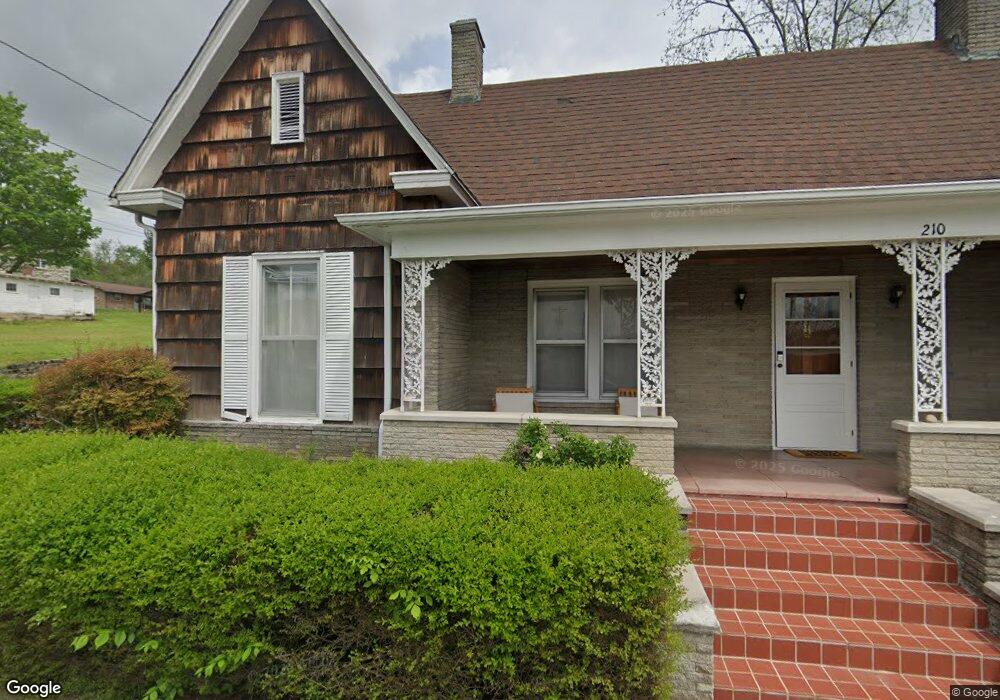
210 Hardin St Tazewell, TN 37879
Estimated Value: $169,849 - $222,000
--
Bed
1
Bath
1,748
Sq Ft
$117/Sq Ft
Est. Value
About This Home
This home is located at 210 Hardin St, Tazewell, TN 37879 and is currently estimated at $204,712, approximately $117 per square foot. 210 Hardin St is a home with nearby schools including Heriage Christian Academy.
Ownership History
Date
Name
Owned For
Owner Type
Purchase Details
Closed on
Sep 1, 2023
Sold by
Mccollough Samuel
Bought by
Mccollough Samuel
Current Estimated Value
Purchase Details
Closed on
Jan 28, 2011
Sold by
Mccollough Pauline Hardin
Bought by
Mccollough Samuel Franklin
Purchase Details
Closed on
Jun 10, 1996
Sold by
Hardin E J Mattie
Bought by
Mccollough Pauline H
Purchase Details
Closed on
Jun 6, 1991
Bought by
Mccollough Pauline
Purchase Details
Closed on
Jan 1, 1937
Bought by
Hardin Hardin E and Hardin Mattie
Create a Home Valuation Report for This Property
The Home Valuation Report is an in-depth analysis detailing your home's value as well as a comparison with similar homes in the area
Home Values in the Area
Average Home Value in this Area
Purchase History
| Date | Buyer | Sale Price | Title Company |
|---|---|---|---|
| Mccollough Samuel | -- | None Listed On Document | |
| Mccollough Samuel Franklin | $97,000 | -- | |
| Mccollough Pauline H | $12,000 | -- | |
| Mccollough Pauline | $12,000 | -- | |
| Hardin Hardin E | -- | -- |
Source: Public Records
Tax History Compared to Growth
Tax History
| Year | Tax Paid | Tax Assessment Tax Assessment Total Assessment is a certain percentage of the fair market value that is determined by local assessors to be the total taxable value of land and additions on the property. | Land | Improvement |
|---|---|---|---|---|
| 2024 | $806 | $34,425 | $4,350 | $30,075 |
| 2023 | $806 | $34,425 | $4,350 | $30,075 |
| 2022 | $689 | $34,425 | $4,350 | $30,075 |
| 2021 | $623 | $24,175 | $3,325 | $20,850 |
| 2020 | $623 | $24,175 | $3,325 | $20,850 |
| 2019 | $623 | $24,175 | $3,325 | $20,850 |
| 2018 | $623 | $24,175 | $3,325 | $20,850 |
| 2017 | $623 | $24,175 | $3,325 | $20,850 |
| 2016 | $641 | $24,850 | $3,325 | $21,525 |
| 2015 | $616 | $24,850 | $3,325 | $21,525 |
| 2014 | $616 | $24,846 | $0 | $0 |
Source: Public Records
Map
Nearby Homes
- 0 Longshore Dr Unit 1235182
- 1702 Haynes St
- 307 Old Kentucky Rd
- 498 Miley Dr
- 1612 Stone St
- 290 Highway 25e S
- 308 Mimosa St
- 0 Fulkerson St
- 1404 Tazewell Rd
- 1356 Old Highway 25e
- 1315 Eugene St
- 1934 Ball St
- 0 Windward Blvd Unit 1311003
- 0 Windward Blvd Unit 1306996
- 323 Wilson Hurst St
- 1719 Boone Cir
- 326 Wilson Hurst St
- 1828 Cherokee Cir
- 404 Cedar Fork Rd
- 330 Wilson Hurst St
- 1720 Eppes St
- 1710 Eppes St Unit 4
- 1710 Eppes St Unit 3
- 1710 Eppes St Unit 2
- 1710 Eppes St Unit 1
- 207 Montgomery St
- 1705 Eppes St
- 1724 Main St
- 1719 Main St
- 1723 Main St
- 1702 Eppes St
- 1708 Church St
- 1702 Main St
- 1725 Main St
- 1751 N Broad St
- 1704 Church St
- 0 Longshore Dr Unit 1068465
- 0 Buchanan Sub Unit 33 643371
- 0 Cosby Cr
- 0 Longshore Dr Unit 794262