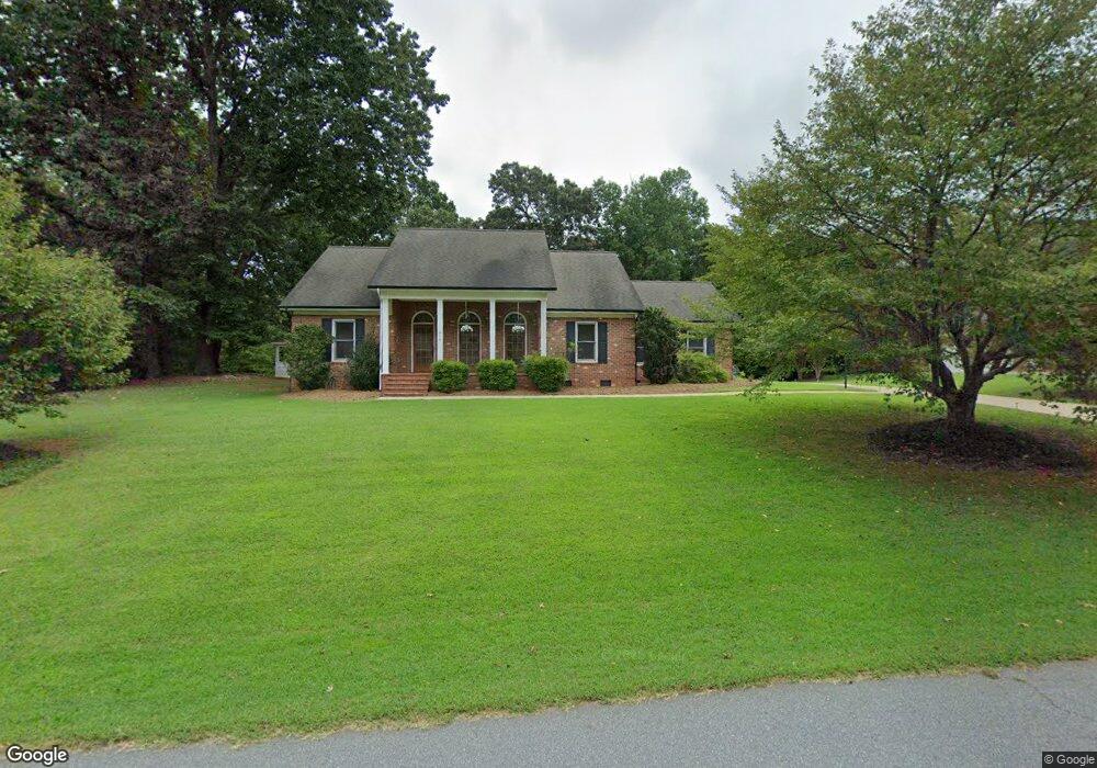
210 Lariat Dr Lincolnton, NC 28092
Estimated Value: $426,000 - $489,000
3
Beds
2
Baths
2,037
Sq Ft
$219/Sq Ft
Est. Value
About This Home
This home is located at 210 Lariat Dr, Lincolnton, NC 28092 and is currently estimated at $446,317, approximately $219 per square foot. 210 Lariat Dr is a home located in Lincoln County with nearby schools including Iron Station Elementary School, North Lincoln Middle School, and North Lincoln High School.
Ownership History
Date
Name
Owned For
Owner Type
Purchase Details
Closed on
Oct 10, 2016
Sold by
Moore Gregory Scott and Moore Cynthia B
Bought by
Vasile Beth E and Vasile Alex
Current Estimated Value
Home Financials for this Owner
Home Financials are based on the most recent Mortgage that was taken out on this home.
Original Mortgage
$211,200
Outstanding Balance
$169,316
Interest Rate
3.46%
Mortgage Type
New Conventional
Estimated Equity
$277,001
Purchase Details
Closed on
Aug 8, 1997
Bought by
Moore Gregory Scott and Moore Cynthia B
Create a Home Valuation Report for This Property
The Home Valuation Report is an in-depth analysis detailing your home's value as well as a comparison with similar homes in the area
Home Values in the Area
Average Home Value in this Area
Purchase History
| Date | Buyer | Sale Price | Title Company |
|---|---|---|---|
| Vasile Beth E | $264,000 | None Available | |
| Moore Gregory Scott | $24,000 | -- |
Source: Public Records
Mortgage History
| Date | Status | Borrower | Loan Amount |
|---|---|---|---|
| Open | Vasile Beth E | $211,200 |
Source: Public Records
Tax History Compared to Growth
Tax History
| Year | Tax Paid | Tax Assessment Tax Assessment Total Assessment is a certain percentage of the fair market value that is determined by local assessors to be the total taxable value of land and additions on the property. | Land | Improvement |
|---|---|---|---|---|
| 2025 | $2,384 | $359,618 | $48,633 | $310,985 |
| 2024 | $2,364 | $359,618 | $48,633 | $310,985 |
| 2023 | $2,359 | $359,618 | $48,633 | $310,985 |
| 2022 | $1,969 | $249,152 | $38,708 | $210,444 |
| 2021 | $1,969 | $249,152 | $38,708 | $210,444 |
| 2020 | $1,804 | $249,152 | $38,708 | $210,444 |
| 2019 | $1,754 | $249,152 | $38,708 | $210,444 |
| 2018 | $1,700 | $223,292 | $45,000 | $178,292 |
| 2017 | $1,587 | $223,292 | $45,000 | $178,292 |
| 2016 | $1,587 | $223,292 | $45,000 | $178,292 |
| 2015 | $1,642 | $223,292 | $45,000 | $178,292 |
| 2014 | $1,797 | $248,288 | $45,000 | $203,288 |
Source: Public Records
Map
Nearby Homes
- 370 Sherrill Farm Rd
- 2583 Wallace Acres Ln
- 2914 Weatherfield Dr
- 2983 Tavistock Ln
- 2911 Weatherfield Dr
- 2984 N Carolina 27
- lot 22 Weatherwood Dr Unit 22
- 2794 N Carolina Highway 150
- 3164 Andrew Link Rd
- 2546 N Carolina Highway 150
- 000 Curveview Rd
- 3478 N Carolina Highway 150
- 1404 Old Mill Rd
- 1471 Arden Dr
- 1335 Huckleberry Dr
- 741 Sunridge Dr
- 575 Hill Rd
- 1894 N Carolina 73
- 00 Mcalister Rd
- 2202 Carpenter Farms Dr
- 196 Lariat Dr
- 226 Lariat Dr
- 213 Lariat Dr
- 186 Lariat Dr
- 195 Lariat Dr
- 3405 Asbury Church Rd
- 3193 Fair Oaks Dr
- 3193 Fair Oaks Dr Unit 9
- 250 Lariat Dr
- 174 Lariat Dr
- 3409 Asbury Church Rd
- 3361 Asbury Church Rd
- 249 Lariat Dr
- 3184 Fair Oaks Dr
- 3419 Asbury Church Rd
- 3347 Asbury Church Rd
- 3183 Fair Oaks Dr
- 3427 Asbury Church Rd
- 266 Lariat Dr
- 266 Lariat Dr Unit 26,27