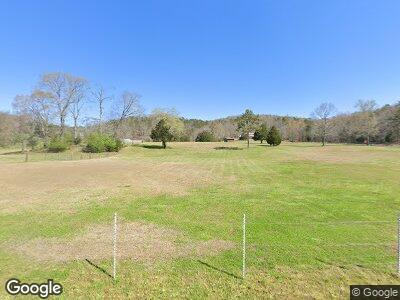
210 Lumpkin Rd SW Lindale, GA 30147
Estimated Value: $268,000 - $345,000
--
Bed
--
Bath
2,052
Sq Ft
$148/Sq Ft
Est. Value
About This Home
This home is located at 210 Lumpkin Rd SW, Lindale, GA 30147 and is currently estimated at $304,530, approximately $148 per square foot. 210 Lumpkin Rd SW is a home with nearby schools including Pepperell Middle School and Pepperell High School.
Ownership History
Date
Name
Owned For
Owner Type
Purchase Details
Closed on
Jan 5, 1998
Sold by
P and R
Bought by
P and R
Current Estimated Value
Purchase Details
Closed on
Aug 9, 1985
Sold by
Rogers John O
Bought by
Rogers John O and Rogers Martha S
Purchase Details
Closed on
Jun 18, 1984
Sold by
P\R
Bought by
Rogers John O
Purchase Details
Closed on
Nov 30, 1983
Sold by
Manis Bill
Bought by
P\R
Purchase Details
Closed on
Sep 30, 1977
Sold by
Paris Albert
Bought by
Manis Bill
Purchase Details
Closed on
Jan 1, 1977
Bought by
Paris Albert
Create a Home Valuation Report for This Property
The Home Valuation Report is an in-depth analysis detailing your home's value as well as a comparison with similar homes in the area
Home Values in the Area
Average Home Value in this Area
Purchase History
| Date | Buyer | Sale Price | Title Company |
|---|---|---|---|
| P | -- | -- | |
| Rogers John O | $11,700 | -- | |
| Rogers | -- | -- | |
| Rogers John O | $23,300 | -- | |
| P\R | -- | -- | |
| Manis Bill | $47,500 | -- | |
| Paris Albert | -- | -- |
Source: Public Records
Tax History Compared to Growth
Tax History
| Year | Tax Paid | Tax Assessment Tax Assessment Total Assessment is a certain percentage of the fair market value that is determined by local assessors to be the total taxable value of land and additions on the property. | Land | Improvement |
|---|---|---|---|---|
| 2024 | $1,862 | $92,667 | $38,440 | $54,227 |
| 2023 | $895 | $90,754 | $38,440 | $52,314 |
| 2022 | $2,400 | $84,084 | $38,440 | $45,644 |
| 2021 | $2,322 | $94,245 | $38,440 | $55,805 |
| 2020 | $2,487 | $84,915 | $38,440 | $46,475 |
| 2019 | $1,678 | $85,021 | $38,440 | $46,581 |
| 2018 | $1,696 | $85,885 | $38,440 | $47,445 |
| 2017 | $1,965 | $95,053 | $38,440 | $56,613 |
| 2016 | $1,881 | $91,840 | $38,440 | $53,400 |
| 2015 | $1,920 | $91,960 | $38,440 | $53,520 |
| 2014 | $1,920 | $91,960 | $38,440 | $53,520 |
Source: Public Records
Map
Nearby Homes
- 2709 Old Cedartown Hwy SE
- 386 Miller Mountain Rd SW
- 5165 Cave Spring Rd SW
- 1 Oakmont Dr SW
- 0 Oakmont Dr SW Unit 7514157
- 0 Oakmont Dr SW Unit 10446438
- 0 College View Dr SW Unit 20148725
- 0 College View Dr SW Unit 20148724
- 596 Doyle Rd SE
- 0 Booger Hollow Rd
- 211 Vanns Valley Rd SW
- 530 Chubb Rd SW
- 11 Leawood Ct SE
- 1380 Old Cedartown Rd SE
- 10 Leawood Ct SE
- 26 The Trail SE
- 1261 Old Cedartown Rd SE
- 81 Hughes Dairy Rd
- 900 Chubb Rd
- 210 Lumpkin Rd SW
- 270 Lumpkin Rd SW
- 0 Lumpkin Rd
- 150 Lumpkin Rd SW
- 304 Lumpkin Rd SW
- 279 Lumpkin Rd SW
- 336 Lumpkin Rd SW
- 336 Lumpkin Rd SW
- 345 Lumpkin Rd SW
- 130 Lumpkin Rd SW
- 129 Lumpkin Rd SW
- 88 Lumpkin Rd SW
- 748 Booger Hollow Rd SW
- 728 Booger Hollow Rd SW
- 12 Lumpkin Rd SW
- 498 Lumpkin Rd SW
- 87 Lumpkin Rd SW
- 788 Booger Hollow Rd SW
- 401 Lumpkin Rd SW
- 691 Booger Hollow Rd SW
