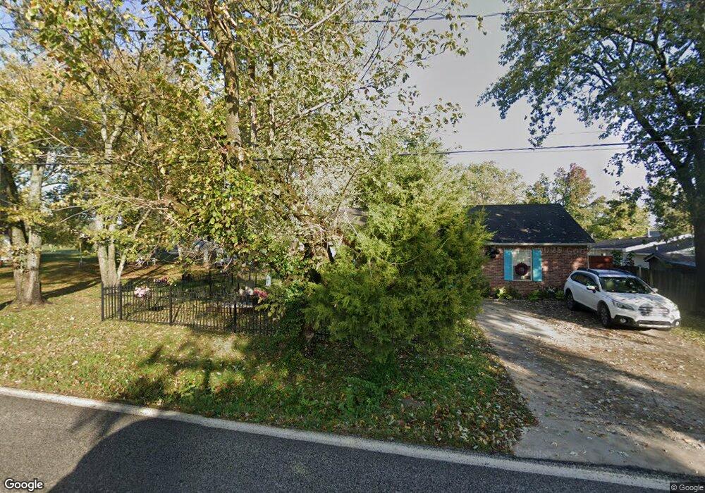
210 Main St West Fork, AR 72774
Estimated Value: $210,000 - $242,000
3
Beds
2
Baths
1,260
Sq Ft
$178/Sq Ft
Est. Value
About This Home
This home is located at 210 Main St, West Fork, AR 72774 and is currently estimated at $223,992, approximately $177 per square foot. 210 Main St is a home located in Washington County with nearby schools including West Fork Elementary School, West Fork Middle School, and West Fork High School.
Ownership History
Date
Name
Owned For
Owner Type
Purchase Details
Closed on
Dec 21, 2009
Sold by
Jennings Lindon and Frederick Billy Jo
Bought by
Adams Alan and Adams Ronissa
Current Estimated Value
Home Financials for this Owner
Home Financials are based on the most recent Mortgage that was taken out on this home.
Original Mortgage
$94,999
Outstanding Balance
$62,062
Interest Rate
5.01%
Mortgage Type
VA
Estimated Equity
$161,930
Purchase Details
Closed on
Oct 7, 2005
Sold by
Johnson Daran W and Johnson Kimberly D
Bought by
Winn Marvin L and Winn Freda J
Home Financials for this Owner
Home Financials are based on the most recent Mortgage that was taken out on this home.
Original Mortgage
$83,600
Interest Rate
5.73%
Mortgage Type
Fannie Mae Freddie Mac
Purchase Details
Closed on
Mar 16, 1993
Bought by
Ozark Auto Transportation Inc
Purchase Details
Closed on
Dec 15, 1988
Bought by
Creamer Marvin and Creamer Lance
Purchase Details
Closed on
Jun 9, 1988
Bought by
Neal Neal S and Neal Icie
Purchase Details
Closed on
Jan 1, 1985
Bought by
Neal Art
Create a Home Valuation Report for This Property
The Home Valuation Report is an in-depth analysis detailing your home's value as well as a comparison with similar homes in the area
Home Values in the Area
Average Home Value in this Area
Purchase History
| Date | Buyer | Sale Price | Title Company |
|---|---|---|---|
| Adams Alan | $93,000 | Lenders Title Company | |
| Winn Marvin L | $115,000 | Lenders Title Co | |
| Ozark Auto Transportation Inc | -- | -- | |
| Creamer Marvin | $10,000 | -- | |
| Neal Neal S | -- | -- | |
| Neal Art | -- | -- |
Source: Public Records
Mortgage History
| Date | Status | Borrower | Loan Amount |
|---|---|---|---|
| Open | Adams Alan | $94,999 | |
| Previous Owner | Winn Marvin L | $83,600 |
Source: Public Records
Tax History
| Year | Tax Paid | Tax Assessment Tax Assessment Total Assessment is a certain percentage of the fair market value that is determined by local assessors to be the total taxable value of land and additions on the property. | Land | Improvement |
|---|---|---|---|---|
| 2025 | $766 | $38,580 | $5,000 | $33,580 |
| 2024 | $804 | $38,580 | $5,000 | $33,580 |
| 2023 | $827 | $38,580 | $5,000 | $33,580 |
| 2022 | $817 | $25,380 | $3,500 | $21,880 |
| 2021 | $766 | $25,380 | $3,500 | $21,880 |
| 2020 | $715 | $25,380 | $3,500 | $21,880 |
| 2019 | $648 | $19,260 | $2,700 | $16,560 |
| 2018 | $673 | $19,260 | $2,700 | $16,560 |
| 2017 | $644 | $19,260 | $2,700 | $16,560 |
| 2016 | $644 | $19,260 | $2,700 | $16,560 |
| 2015 | $644 | $19,260 | $2,700 | $16,560 |
| 2014 | $633 | $19,050 | $4,000 | $15,050 |
Source: Public Records
Map
Nearby Homes
- 0000 Highway 170
- 224 Maple Ave
- 185 Wheeler St
- 222 Rivendale Dr
- 0 W Smith St Unit 1334508
- Springs 1445 Plan at Rolling Plains
- Eureka 1536 Plan at Rolling Plains
- Oak 1463 Plan at Rolling Plains
- Magnolia 1556 Plan at Rolling Plains
- Ashton 1496 Plan at Rolling Plains
- Ouachita 1669 Plan at Rolling Plains
- Osage 1567 Plan at Rolling Plains
- Maple 1659 Plan at Rolling Plains
- 106 Pleasant St
- 365 W Smith St
- 353 W Smith St
- 327 W Smith St
- 385 W Smith St
- 503 Clark Ave
- 338 Hidden Creek Place