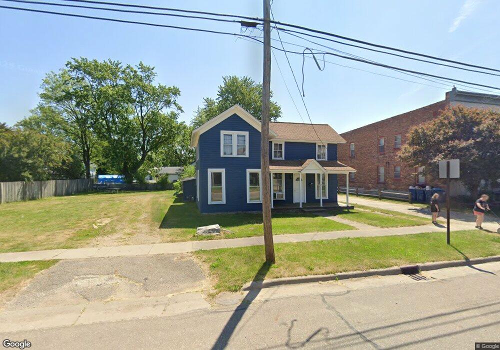
210 N Matteson St Bronson, MI 49028
Estimated Value: $153,000 - $188,000
4
Beds
1
Bath
1,500
Sq Ft
$112/Sq Ft
Est. Value
About This Home
This home is located at 210 N Matteson St, Bronson, MI 49028 and is currently estimated at $168,168, approximately $112 per square foot. 210 N Matteson St is a home located in Branch County with nearby schools including Anderson Elementary School, Ryan Elementary School, and Bronson Junior/Senior High School.
Ownership History
Date
Name
Owned For
Owner Type
Purchase Details
Closed on
Jun 4, 2020
Sold by
Eichorn Joel F
Bought by
Todd Taylor and Bradley Keith
Current Estimated Value
Home Financials for this Owner
Home Financials are based on the most recent Mortgage that was taken out on this home.
Original Mortgage
$69,714
Outstanding Balance
$61,911
Interest Rate
3.3%
Mortgage Type
FHA
Estimated Equity
$106,257
Purchase Details
Closed on
Apr 10, 2019
Sold by
Padgett Kerry Lynn
Bought by
Eichorn Joel F
Purchase Details
Closed on
Oct 20, 2018
Sold by
Padgett Kelley Ann
Bought by
Padgett Kerry Lynn
Purchase Details
Closed on
Aug 21, 2015
Sold by
Swift Lee and Swift Karen
Bought by
Padgett Kerry Lynn and Padgett Kelley Ann
Create a Home Valuation Report for This Property
The Home Valuation Report is an in-depth analysis detailing your home's value as well as a comparison with similar homes in the area
Home Values in the Area
Average Home Value in this Area
Purchase History
| Date | Buyer | Sale Price | Title Company |
|---|---|---|---|
| Todd Taylor | $71,000 | Patrick Abstract & Ttl Offic | |
| Eichorn Joel F | $30,000 | None Available | |
| Padgett Kerry Lynn | -- | None Available | |
| Padgett Kerry Lynn | $60,000 | Lighthouse Title Inc |
Source: Public Records
Mortgage History
| Date | Status | Borrower | Loan Amount |
|---|---|---|---|
| Open | Todd Taylor | $69,714 |
Source: Public Records
Tax History Compared to Growth
Tax History
| Year | Tax Paid | Tax Assessment Tax Assessment Total Assessment is a certain percentage of the fair market value that is determined by local assessors to be the total taxable value of land and additions on the property. | Land | Improvement |
|---|---|---|---|---|
| 2025 | $1,709 | $55,300 | $0 | $0 |
| 2024 | $1,072 | $52,800 | $0 | $0 |
| 2023 | $999 | $45,100 | $0 | $0 |
| 2022 | $1,579 | $42,100 | $0 | $0 |
| 2021 | -- | $35,700 | $0 | $0 |
| 2020 | -- | $30,100 | $0 | $0 |
| 2019 | -- | $29,600 | $0 | $0 |
| 2018 | -- | $31,100 | $0 | $0 |
| 2017 | -- | $28,900 | $0 | $0 |
| 2016 | -- | $27,600 | $0 | $0 |
| 2015 | -- | $25,000 | $0 | $0 |
| 2014 | -- | $24,200 | $0 | $0 |
| 2013 | -- | $24,300 | $0 | $0 |
Source: Public Records
Map
Nearby Homes
- 313 N Matteson St
- 214 E Chicago St
- 147 Winona St
- 151 E Corey St
- 337 N Walker St
- 150 Washington St
- 410 Franklin St
- 544 E Chicago St
- 325 N Lincoln St
- 609 E Railroad St
- 695 W Chicago Rd
- V/L Prairie River Rd
- 769 Kosmerick Rd
- 130 Osborn Rd
- 1052 Carpenter Rd
- 406 Taggart Rd
- 786 W Colon Rd
- 912 W Colon Rd
- 1232 Smoker Rd
- 0 Rierson Rd
- 130 N Matteson St
- 214 N Matteson St
- 124 N Matteson St
- 222 N Matteson St
- 127 N Matteson St
- 127 Buchanan St
- 219 N Matteson St
- 277 N Matteson St
- 120 N Matteson St
- 123 N Matteson St
- 121 N Matteson St
- 225 N Matteson St
- 230 N Matteson St
- 151 Buchanan St
- 119 N Matteson St
- 111 E Chicago St
- 113 E Chicago St
- 113 N Matteson St
- 115 E Chicago St
- 103 E Chicago St