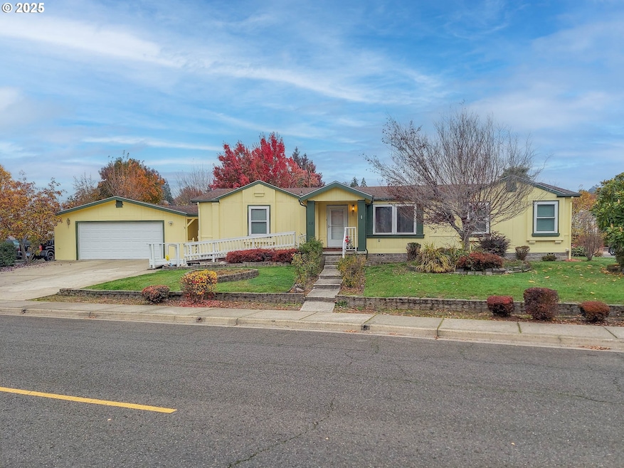
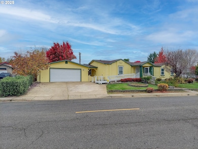
210 NW Timothy Ave Winston, OR 97496
Estimated payment $2,026/month
Highlights
- City View
- No HOA
- Double Pane Windows
- Corner Lot
- 2 Car Detached Garage
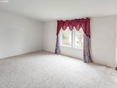
- Living Room
About This Home
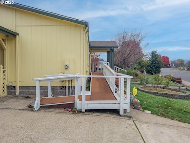
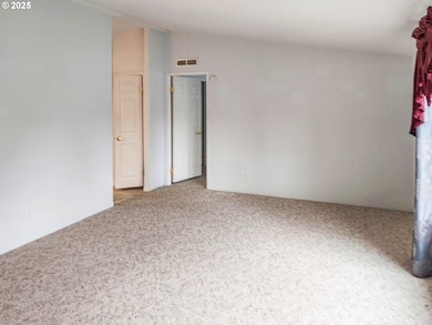
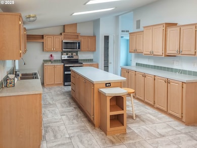
Extremely nice 1999 triple-wide on a beautiful corner lot. Features 3 bedrooms, 2 baths with a large kitchen, living, and family rooms. There is also a gas fireplace, new heat pump, and an extra large 2-car garage. Outside has a covered deck, patio, mature landscaping, and fenced yard with sprinkler and drip system.
Property Details
Home Type
- Mobile/Manufactured
Est. Annual Taxes
- $2,123
Year Built
- Built in 1999 | Remodeled
Lot Details
- 0.25 Acre Lot
- Corner Lot
- Level Lot
Parking
- 2 Car Detached Garage
- Driveway
Home Design
- Composition Roof
- Plywood Siding Panel T1-11
- Concrete Perimeter Foundation
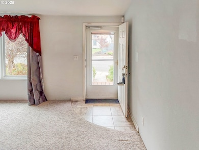
Interior Spaces
- 1,848 Sq Ft Home
- 1-Story Property
- Gas Fireplace
- Double Pane Windows
- Vinyl Clad Windows
- Family Room
- Living Room
- Dining Room
- City Views
- Crawl Space
Bedrooms and Bathrooms
- 3 Bedrooms
- 2 Full Bathrooms
Accessible Home Design
- Accessibility Features
- Level Entry For Accessibility
Schools
- Mcgovern Elementary School
- Winston Middle School
- Douglas High School
Mobile Home
- Manufactured Home With Land
Utilities
- Forced Air Heating and Cooling System
- Heating System Uses Gas
Community Details
- No Home Owners Association
Listing and Financial Details
- Assessor Parcel Number R70151
Map
Home Values in the Area
Average Home Value in this Area
Tax History
| Year | Tax Paid | Tax Assessment Tax Assessment Total Assessment is a certain percentage of the fair market value that is determined by local assessors to be the total taxable value of land and additions on the property. | Land | Improvement |
|---|---|---|---|---|
| 2025 | $2,123 | $127,734 | -- | -- |
| 2024 | $2,063 | $124,013 | -- | -- |
| 2023 | $2,905 | $174,496 | $0 | $0 |
| 2022 | $2,819 | $169,414 | $0 | $0 |
| 2021 | $2,743 | $164,480 | $0 | $0 |
| 2020 | $2,647 | $159,690 | $0 | $0 |
| 2019 | $2,600 | $155,039 | $0 | $0 |
| 2018 | $2,531 | $150,524 | $0 | $0 |
| 2017 | $2,280 | $139,454 | $0 | $0 |
| 2016 | $2,201 | $134,335 | $0 | $0 |
| 2015 | $2,115 | $128,441 | $0 | $0 |
| 2014 | $2,377 | $143,318 | $0 | $0 |
| 2013 | -- | $134,931 | $0 | $0 |
Property History
| Date | Event | Price | List to Sale | Price per Sq Ft |
|---|---|---|---|---|
| 11/10/2025 11/10/25 | For Sale | $350,000 | -- | $189 / Sq Ft |
Purchase History
| Date | Type | Sale Price | Title Company |
|---|---|---|---|
| Interfamily Deed Transfer | -- | None Available | |
| Interfamily Deed Transfer | -- | None Available | |
| Warranty Deed | $139,000 | First American Title Ins Co | |
| Warranty Deed | $139,000 | First American Title Ins Co |
Mortgage History
| Date | Status | Loan Amount | Loan Type |
|---|---|---|---|
| Open | $111,200 | New Conventional |
Source: Regional Multiple Listing Service (RMLS)
MLS Number: 643238632
APN: R70151
Disclaimer: Certain information contained herein is derived from information provided by parties other than Homes.com. All information provided is deemed reliable, but is not guaranteed to be accurate and should be independently verified.
![]() The content relating to real estate for sale on this web site comes in part from the IDX program of the RMLS™ of Portland, Oregon. Real estate listings held by brokerage firms other than Ten-X are marked with the RMLS™ logo, and detailed information about these properties includes the names of the listing brokers. Listing content is copyright © 2025 RMLS™, Portland, Oregon. Some properties which appear for sale on this web site may subsequently have sold or may no longer be available. All information provided is deemed reliable but is not guaranteed and should be independently verified.
The content relating to real estate for sale on this web site comes in part from the IDX program of the RMLS™ of Portland, Oregon. Real estate listings held by brokerage firms other than Ten-X are marked with the RMLS™ logo, and detailed information about these properties includes the names of the listing brokers. Listing content is copyright © 2025 RMLS™, Portland, Oregon. Some properties which appear for sale on this web site may subsequently have sold or may no longer be available. All information provided is deemed reliable but is not guaranteed and should be independently verified.
- 364 NW Teal St
- 222 NW Broc Dr
- 841 NW Lori St
- 109 Citation Ct
- 13224 Lookingglass Rd
- 139 Teresa Ln
- 0 Danielle Dr Unit 122251646
- 165 Danielle Dr
- 102 Sarah Bear Ln
- 0 NW Galaxy Dr
- 635 Wil Way
- 0 Wil Way Unit 24292479
- 0 Wil Way Unit 24094727
- 0 Wil Way Unit 24278136
- 150 Wil Way
- 160 Wil Way
- 2414 Brockway Rd
- 308 NW Civil Bend Ave
- 240 Wil Way
- 301 NW Midway St
