Estimated Value: $330,179 - $417,000
5
Beds
2
Baths
3,696
Sq Ft
$99/Sq Ft
Est. Value
About This Home
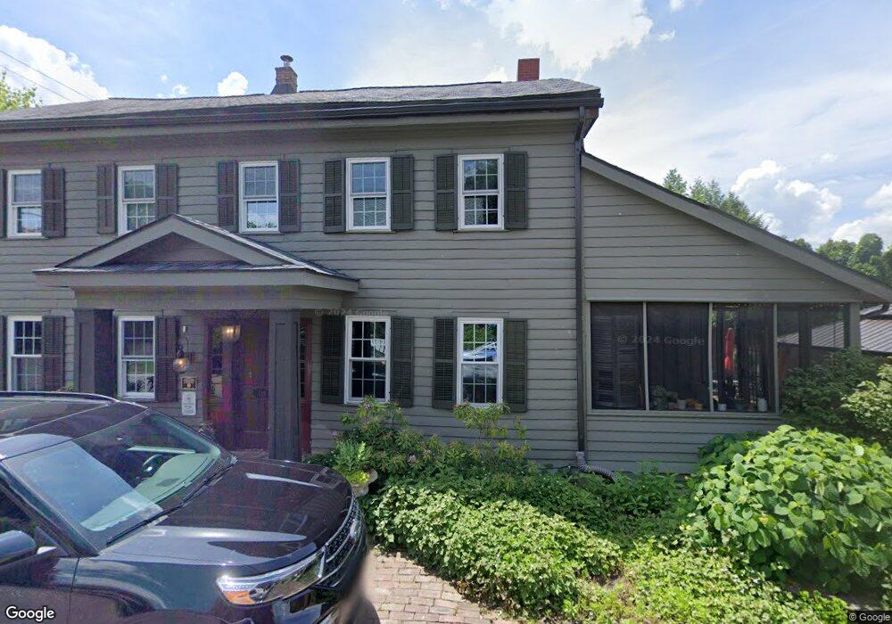
This home is located at 210 W 4th St, Zoar, OH 44697 and is currently estimated at $367,295, approximately $99 per square foot. 210 W 4th St is a home with nearby schools including Tuscarawas Valley Primary School, Tuscarawas Valley Intermediate School, and Tuscarawas Valley Middle School.
Ownership History
Date
Name
Owned For
Owner Type
Purchase Details
Closed on
Dec 2, 2021
Sold by
Gergley Gary A
Bought by
Marburger Andrew J and Marburger Lauren
Current Estimated Value
Home Financials for this Owner
Home Financials are based on the most recent Mortgage that was taken out on this home.
Original Mortgage
$290,080
Interest Rate
3.09%
Mortgage Type
VA
Purchase Details
Closed on
Mar 30, 2018
Sold by
Gergley Loni K
Bought by
Gergley Gary A
Purchase Details
Closed on
Jul 7, 1992
Sold by
Buckley Buckley J J and Buckley Susannah S
Bought by
Gergley Gary A and Gergley Loni K
Purchase Details
Closed on
Sep 7, 1990
Sold by
Maloney Richard H and Maloney Keokee M
Bought by
Gergley Gary A and Gergley Loni K
Create a Home Valuation Report for This Property
The Home Valuation Report is an in-depth analysis detailing your home's value as well as a comparison with similar homes in the area
Home Values in the Area
Average Home Value in this Area
Purchase History
| Date | Buyer | Sale Price | Title Company |
|---|---|---|---|
| Marburger Andrew J | $280,000 | None Available | |
| Gergley Gary A | -- | Alban Title | |
| Gergley Gary A | $149,000 | -- | |
| Gergley Gary A | $135,000 | -- |
Source: Public Records
Mortgage History
| Date | Status | Borrower | Loan Amount |
|---|---|---|---|
| Previous Owner | Marburger Andrew J | $290,080 |
Source: Public Records
Tax History
| Year | Tax Paid | Tax Assessment Tax Assessment Total Assessment is a certain percentage of the fair market value that is determined by local assessors to be the total taxable value of land and additions on the property. | Land | Improvement |
|---|---|---|---|---|
| 2024 | $4,294 | $89,610 | $7,420 | $82,190 |
| 2023 | $4,294 | $256,040 | $21,210 | $234,830 |
| 2022 | $6 | $89,614 | $7,424 | $82,191 |
| 2021 | $3,812 | $64,523 | $10,290 | $54,233 |
| 2020 | $3,341 | $56,463 | $5,198 | $51,265 |
| 2019 | $3,179 | $56,463 | $5,198 | $51,265 |
| 2018 | $3,279 | $56,460 | $5,200 | $51,260 |
| 2017 | $3,311 | $56,460 | $5,200 | $51,260 |
| 2016 | $3,293 | $56,460 | $5,200 | $51,260 |
| 2014 | $3,440 | $56,300 | $5,200 | $51,100 |
| 2013 | $2,883 | $56,300 | $5,200 | $51,100 |
Source: Public Records
Map
Nearby Homes
- 214 Main St
- 9490 State Route 212 NE
- 0 Lafont Cir NE Unit 5185381
- VL Hess Mill Rd NE
- 9556 Wilkshire Blvd NE Unit B
- 792 Kingwood Dr NE
- 0 State Route 212 Unit 4441887
- 10476 Welton Rd NE
- 1513 Meadow Square NE
- 10884 Madlyn St NE
- 797 Glenda St NE
- 827 Melissa St NE
- 807 Melissa St NE
- 11006 Madlyn St NE
- 8397 French Hill Rd NW
- 11441 Glenpark Rd NE
- 3258 New Zoarville Rd NE
- 1296 Russell Dr NW
- 680 Willow Dale St NW
- 9173 Kennison Ave NE
Your Personal Tour Guide
Ask me questions while you tour the home.