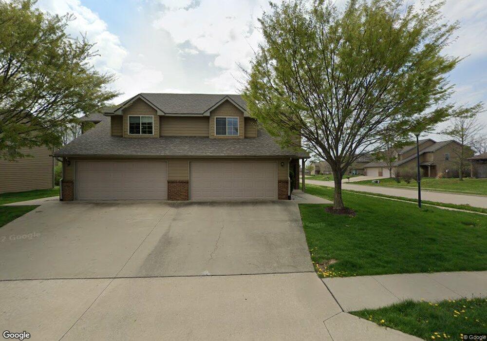
210 White River Dr Unit 212 Columbia, MO 65202
Estimated Value: $255,000 - $381,678
6
Beds
6
Baths
3,302
Sq Ft
$97/Sq Ft
Est. Value
About This Home
This home is located at 210 White River Dr Unit 212, Columbia, MO 65202 and is currently estimated at $318,670, approximately $96 per square foot. 210 White River Dr Unit 212 is a home located in Boone County with nearby schools including Derby Ridge Elementary School, Smithton Middle School, and David H. Hickman High School.
Ownership History
Date
Name
Owned For
Owner Type
Purchase Details
Closed on
Feb 1, 2024
Sold by
Bf Cross Creek Llc
Bought by
Columbia Townhomes North Llc
Current Estimated Value
Home Financials for this Owner
Home Financials are based on the most recent Mortgage that was taken out on this home.
Original Mortgage
$9,104,000
Outstanding Balance
$8,030,776
Interest Rate
6.61%
Mortgage Type
New Conventional
Estimated Equity
-$7,712,106
Create a Home Valuation Report for This Property
The Home Valuation Report is an in-depth analysis detailing your home's value as well as a comparison with similar homes in the area
Home Values in the Area
Average Home Value in this Area
Purchase History
| Date | Buyer | Sale Price | Title Company |
|---|---|---|---|
| Columbia Townhomes North Llc | -- | None Listed On Document | |
| Bf Cross Creek Sub Llc | -- | None Listed On Document |
Source: Public Records
Mortgage History
| Date | Status | Borrower | Loan Amount |
|---|---|---|---|
| Open | Columbia Townhomes North Llc | $9,104,000 |
Source: Public Records
Tax History Compared to Growth
Tax History
| Year | Tax Paid | Tax Assessment Tax Assessment Total Assessment is a certain percentage of the fair market value that is determined by local assessors to be the total taxable value of land and additions on the property. | Land | Improvement |
|---|---|---|---|---|
| 2025 | $2,532 | $41,268 | $6,650 | $34,618 |
| 2024 | $2,532 | $37,525 | $6,650 | $30,875 |
| 2023 | $2,511 | $37,525 | $6,650 | $30,875 |
| 2022 | $2,411 | $36,081 | $6,650 | $29,431 |
| 2021 | $2,416 | $36,081 | $6,650 | $29,431 |
| 2020 | $2,472 | $34,694 | $6,650 | $28,044 |
| 2019 | $2,472 | $34,694 | $6,650 | $28,044 |
| 2018 | $2,490 | $0 | $0 | $0 |
| 2017 | $2,460 | $34,694 | $6,650 | $28,044 |
| 2016 | $2,455 | $34,694 | $6,650 | $28,044 |
| 2015 | $2,255 | $34,694 | $6,650 | $28,044 |
| 2014 | $2,262 | $34,694 | $6,650 | $28,044 |
Source: Public Records
Map
Nearby Homes
- LOT 70 Aspen Ridge Dr
- 5212 Silver Mill Dr
- LOT 18 Lookout Peak Dr
- LOT 22 Lookout Peak Dr
- 107 Snow Peak Ct
- LOT 23 Lookout Peak Dr
- 201 Copper Mountain Dr
- 5 Copper Mountain Dr
- 5261 N Burning Bush Rd
- L401-L430 Forest Ridge Plat 4
- 5221 N Burning Bush Rd
- 4981 N Burning Bush Ct
- 240 E Tully Ct
- 387 E Hackberry Blvd
- LOT 502 Sullivan St
- 561 E Clearview Dr
- LOT 148 Sullivan St
- LOT 149 Sullivan St
- LOT 143 Sullivan St
- 576 E Clearview Dr
- 214 White River Dr Unit 216
- 5004 Panorama Ln Unit 5006
- 204 White River Dr Unit 206
- 204-206 White River Dr
- 5101 Flurry Dr Unit 5103
- 218 White River Dr Unit 220
- 5005 Panorama Ln Unit 5007
- 205-207 White River Dr
- 5105 Flurry Dr
- 205 White River Dr Unit 207
- 5100 Flurry Dr Unit 5102
- 5100-5102 Flurry Dr
- 5000 Panorama Ln Unit 5002
- 200 White River Dr Unit 202
- 200 White River Dr
- 200-202 White River Dr
- L246 Alpine Ridge Dr
- 5109 Flurry Dr
- 4916 Panorama Ln Unit 4918
- 5104 Flurry Dr Unit 5106