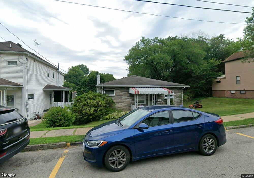
210 Whittier St Vandergrift, PA 15690
Estimated Value: $68,000 - $123,000
2
Beds
2
Baths
1,140
Sq Ft
$87/Sq Ft
Est. Value
About This Home
This home is located at 210 Whittier St, Vandergrift, PA 15690 and is currently estimated at $99,359, approximately $87 per square foot. 210 Whittier St is a home located in Westmoreland County with nearby schools including Kiski Area High School and Orchard Hills Christian Academy.
Ownership History
Date
Name
Owned For
Owner Type
Purchase Details
Closed on
Jun 29, 2009
Sold by
Spencer Randy and Spencer Susan
Bought by
Montgomery Paul W
Current Estimated Value
Home Financials for this Owner
Home Financials are based on the most recent Mortgage that was taken out on this home.
Original Mortgage
$65,786
Outstanding Balance
$40,867
Interest Rate
4.86%
Mortgage Type
FHA
Estimated Equity
$58,492
Create a Home Valuation Report for This Property
The Home Valuation Report is an in-depth analysis detailing your home's value as well as a comparison with similar homes in the area
Home Values in the Area
Average Home Value in this Area
Purchase History
| Date | Buyer | Sale Price | Title Company |
|---|---|---|---|
| Montgomery Paul W | $67,000 | None Available |
Source: Public Records
Mortgage History
| Date | Status | Borrower | Loan Amount |
|---|---|---|---|
| Open | Montgomery Paul W | $65,786 |
Source: Public Records
Tax History
| Year | Tax Paid | Tax Assessment Tax Assessment Total Assessment is a certain percentage of the fair market value that is determined by local assessors to be the total taxable value of land and additions on the property. | Land | Improvement |
|---|---|---|---|---|
| 2026 | $1,736 | $10,380 | $1,330 | $9,050 |
| 2025 | $1,694 | $10,380 | $1,330 | $9,050 |
| 2024 | $1,613 | $10,380 | $1,330 | $9,050 |
| 2023 | $1,485 | $10,380 | $1,330 | $9,050 |
| 2022 | $1,454 | $10,380 | $1,330 | $9,050 |
| 2021 | $1,454 | $10,380 | $1,330 | $9,050 |
| 2020 | $1,451 | $10,380 | $1,330 | $9,050 |
| 2019 | $1,446 | $10,380 | $1,330 | $9,050 |
| 2018 | $1,425 | $10,380 | $1,330 | $9,050 |
| 2017 | $1,394 | $10,380 | $1,330 | $9,050 |
| 2016 | $1,375 | $10,380 | $1,330 | $9,050 |
| 2015 | $1,375 | $10,380 | $1,330 | $9,050 |
| 2014 | $1,368 | $10,380 | $1,330 | $9,050 |
Source: Public Records
Map
Nearby Homes
- 221 Holmes St
- 208 Whittier St
- 231 Whittier St
- 924 Wallace St
- 303 Lowell St
- 1020 Poe St
- 314 Lowell St Unit 1/2
- 327 Lowell St
- 300 Longfellow St
- 802 Mckinley Ave
- 325 Walnut St
- 410 Longfellow St
- 439 Longfellow St
- 512 Watson St
- 512 Longfellow St
- 510 Franklin Ave
- 1206, 1207, 1210 Wysocki Ave
- 1206 Wysocki Ave
- 528 Longfellow St
- 517 Sycamore St
- 212 Whittier St
- 214 Whittier St
- 206 Whittier St
- 204 Whittier St
- 216 Whittier St
- 207 Holmes St
- 1010 Hancock Ave
- 218 Whittier St
- 1008 Hancock Ave
- 205 Holmes St
- 1012 Hancock Ave
- 203 Holmes St
- 1014 Hancock Ave
- 201 Holmes St
- 209 Holmes St
- 1016 Hancock Ave Unit 1018
- 220 Whittier St
- 1000 Hancock Ave
- 211 Whittier St
- 211 Whittier St
Your Personal Tour Guide
Ask me questions while you tour the home.