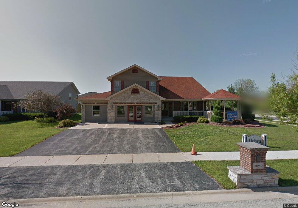
2100 Debra Ct Bourbonnais, IL 60914
Estimated Value: $382,000 - $397,000
4
Beds
3
Baths
2,460
Sq Ft
$158/Sq Ft
Est. Value
About This Home
This home is located at 2100 Debra Ct, Bourbonnais, IL 60914 and is currently estimated at $387,856, approximately $157 per square foot. 2100 Debra Ct is a home located in Kankakee County with nearby schools including St. George Elementary School, Bradley-Bourbonnais Community High School, and Kankakee Valley Montessori School.
Ownership History
Date
Name
Owned For
Owner Type
Purchase Details
Closed on
Feb 3, 2023
Sold by
A Olbrot Construction Inc
Bought by
Geisler Deborah
Current Estimated Value
Purchase Details
Closed on
Jun 8, 2022
Sold by
Prillaman Roger L
Bought by
A Olbrot Construction Inc
Home Financials for this Owner
Home Financials are based on the most recent Mortgage that was taken out on this home.
Original Mortgage
$290,000
Interest Rate
5.27%
Mortgage Type
New Conventional
Create a Home Valuation Report for This Property
The Home Valuation Report is an in-depth analysis detailing your home's value as well as a comparison with similar homes in the area
Home Values in the Area
Average Home Value in this Area
Purchase History
| Date | Buyer | Sale Price | Title Company |
|---|---|---|---|
| Geisler Deborah | $358,000 | Standard Title | |
| A Olbrot Construction Inc | $300,000 | Kankakee County Title |
Source: Public Records
Mortgage History
| Date | Status | Borrower | Loan Amount |
|---|---|---|---|
| Previous Owner | A Olbrot Construction Inc | $290,000 |
Source: Public Records
Tax History
| Year | Tax Paid | Tax Assessment Tax Assessment Total Assessment is a certain percentage of the fair market value that is determined by local assessors to be the total taxable value of land and additions on the property. | Land | Improvement |
|---|---|---|---|---|
| 2024 | $7,865 | $109,703 | $8,751 | $100,952 |
| 2023 | $7,659 | $101,577 | $8,103 | $93,474 |
| 2022 | $8,033 | $95,699 | $8,658 | $87,041 |
| 2021 | $7,904 | $91,924 | $8,467 | $83,457 |
| 2020 | $7,418 | $87,870 | $8,240 | $79,630 |
| 2019 | $7,114 | $79,432 | $7,443 | $71,989 |
| 2018 | $616 | $77,759 | $6,834 | $70,925 |
| 2017 | $629 | $76,368 | $6,834 | $69,534 |
| 2016 | $626 | $76,368 | $6,834 | $69,534 |
| 2015 | $624 | $74,262 | $6,766 | $67,496 |
| 2014 | $604 | $74,262 | $6,766 | $67,496 |
Source: Public Records
Map
Nearby Homes
- 2021 Willow Brook Dr
- 2218 Monarch St
- 1786 Brassie Dr
- 1696 Yorktown Dr
- 1840 Yorktown Dr
- 2312 Monarch St
- 1802 Derby Dr
- 2329 Monarch St
- 1622 Amhurst Way
- 1372 E Armour Rd
- 1227 Peacock Ln
- 1008 Mallard Dr
- 973 Cardinal Dr
- 3210 N 4000e Rd
- 990 Quail Ct
- 463 Edgebrook Dr
- Sec 22 Twp 31 R 12e
- 5677 Lantern Ln
- Sec 4 Twp 31 R 12e
- Lots 16 & 17 Northfield Sq Resub
- 2104 Debra Ct
- 2105 Willow Brook Dr
- 2093 Willow Brook Dr
- 2096 Laura Ct
- 2092 Laura Ct
- 2108 Debra Ct
- 2128 Debra Ct
- 2124 Debra Ct
- 2117 Willow Brook Dr
- 2081 Willow Brook Dr
- 2088 Laura Ct
- 2129 Willow Brook Dr
- 2120 Debra Ct
- 2036 Laura Ct
- 2112 Debra Ct
- 2059 Willow Brook Dr
- 2040 Laura Ct
- 2068 Laura Ct
- 2116 Debra Ct
- 2044 Laura Ct
Your Personal Tour Guide
Ask me questions while you tour the home.