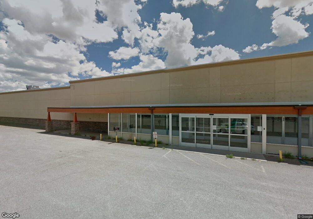
2100 E Cedar St Rawlins, WY 82301
Studio
--
Bath
31,500
Sq Ft
136,909
Sq Ft Lot
About This Home
This home is located at 2100 E Cedar St, Rawlins, WY 82301. 2100 E Cedar St is a home located in Carbon County with nearby schools including Rawlins Elementary School, Rawlins Middle School, and Rawlins High School.
Ownership History
Date
Name
Owned For
Owner Type
Purchase Details
Closed on
Dec 21, 2020
Sold by
Rawlins Property Llc
Bought by
Holmes Properties Llc
Home Financials for this Owner
Home Financials are based on the most recent Mortgage that was taken out on this home.
Original Mortgage
$243,077
Outstanding Balance
$215,912
Interest Rate
2.7%
Mortgage Type
Commercial
Purchase Details
Closed on
Jun 19, 2018
Sold by
Spirit Spe Portfollio 26
Bought by
Rawlins Property Llc
Purchase Details
Closed on
Jan 27, 2006
Sold by
Pamida Inc
Bought by
Pamida Spe Real Estate Llc
Home Financials for this Owner
Home Financials are based on the most recent Mortgage that was taken out on this home.
Original Mortgage
$700,000,000
Interest Rate
6.24%
Mortgage Type
Purchase Money Mortgage
Create a Home Valuation Report for This Property
The Home Valuation Report is an in-depth analysis detailing your home's value as well as a comparison with similar homes in the area
Purchase History
| Date | Buyer | Sale Price | Title Company |
|---|---|---|---|
| Holmes Properties Llc | -- | First American Title | |
| Holmes Properties Llc | -- | First American Title | |
| Rawlins Property Llc | -- | -- | |
| Pamida Spe Real Estate Llc | -- | None Available |
Source: Public Records
Mortgage History
| Date | Status | Borrower | Loan Amount |
|---|---|---|---|
| Open | Holmes Properties Llc | $243,077 | |
| Closed | Holmes Properties Llc | $243,077 | |
| Previous Owner | Pamida Spe Real Estate Llc | $700,000,000 |
Source: Public Records
Tax History
| Year | Tax Paid | Tax Assessment Tax Assessment Total Assessment is a certain percentage of the fair market value that is determined by local assessors to be the total taxable value of land and additions on the property. | Land | Improvement |
|---|---|---|---|---|
| 2025 | $3,673 | $62,506 | $14,857 | $47,649 |
| 2024 | $37 | $50,875 | $14,857 | $36,018 |
| 2023 | $3,627 | $50,235 | $13,481 | $36,754 |
| 2022 | $2,790 | $38,118 | $8,754 | $29,364 |
| 2021 | $2,790 | $47,119 | $8,754 | $38,365 |
| 2020 | $3,332 | $92,166 | $17,508 | $74,658 |
| 2019 | $3,408 | $47,395 | $8,754 | $38,641 |
| 2018 | $3,346 | $45,766 | $8,754 | $37,012 |
| 2017 | $7,461 | $102,623 | $8,754 | $93,869 |
| 2016 | $7,445 | $102,407 | $8,754 | $93,653 |
| 2015 | -- | $101,507 | $8,754 | $92,753 |
| 2014 | -- | $99,501 | $8,754 | $90,747 |
Source: Public Records
Map
Nearby Homes
- 460 Airport Rd
- 821 Ash St
- 805 Apple Ave
- 901 Daley St
- Tbd
- 510 Rodeo Ct
- 309 E Center St
- 305 E Center St
- Tract 1 Blk 2 Monroe St
- Tract 3 Blk 1 Monroe St
- PT NW 1/4 Sec Monroe St
- 508 Rodeo Ct
- 0 Mobile Only Unit 20260953
- 504 Rodeo St
- 506 Rodeo St
- 205 E State St
- 120 E Water St
- 503 E Maple St
- 500 Madison St
- 413 E Maple St
- 1906 E Cedar St
- 0 Highway 287
- 1999-A Highway 287
- 1806 E Cedar St
- 2217 Mahoney St
- 1712 E Cedar St
- 1811 Mahoney St
- 1812 Daley St
- 507 Airport
- 1007 N Higley Blvd
- 1012 Seiloff St
- 1005 Ash Ave
- 923 Ash Ave
- 319 Elk Ct
- 319 Elk Ct Unit Harshman
- 411 Ash St Unit Ash Ave
- 411 Ash St
- 1016 Higley Blvd
- 921 Ash St Unit State
- 919 Ash St
Your Personal Tour Guide
Ask me questions while you tour the home.