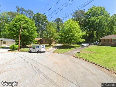
2100 John Wesley Ct Unit 2 Decatur, GA 30035
Southwest DeKalb NeighborhoodEstimated Value: $170,000 - $222,000
3
Beds
2
Baths
1,128
Sq Ft
$177/Sq Ft
Est. Value
About This Home
This home is located at 2100 John Wesley Ct Unit 2, Decatur, GA 30035 and is currently estimated at $199,763, approximately $177 per square foot. 2100 John Wesley Ct Unit 2 is a home located in DeKalb County with nearby schools including Canby Lane Elementary School, Mary McLeod Bethune Middle School, and Towers High School.
Ownership History
Date
Name
Owned For
Owner Type
Purchase Details
Closed on
Jul 6, 1998
Sold by
Bolds Cheryle A and Bolds Fudee F
Bought by
Mack Curtis L and Mack Verenda
Current Estimated Value
Home Financials for this Owner
Home Financials are based on the most recent Mortgage that was taken out on this home.
Original Mortgage
$64,020
Outstanding Balance
$15,622
Interest Rate
7.1%
Mortgage Type
New Conventional
Estimated Equity
$173,308
Create a Home Valuation Report for This Property
The Home Valuation Report is an in-depth analysis detailing your home's value as well as a comparison with similar homes in the area
Home Values in the Area
Average Home Value in this Area
Purchase History
| Date | Buyer | Sale Price | Title Company |
|---|---|---|---|
| Mack Curtis L | $66,000 | -- |
Source: Public Records
Mortgage History
| Date | Status | Borrower | Loan Amount |
|---|---|---|---|
| Open | Mack Curtis L | $64,020 |
Source: Public Records
Tax History Compared to Growth
Tax History
| Year | Tax Paid | Tax Assessment Tax Assessment Total Assessment is a certain percentage of the fair market value that is determined by local assessors to be the total taxable value of land and additions on the property. | Land | Improvement |
|---|---|---|---|---|
| 2023 | $2,232 | $75,880 | $5,720 | $70,160 |
| 2022 | $1,832 | $63,760 | $5,720 | $58,040 |
| 2021 | $1,286 | $40,120 | $5,720 | $34,400 |
| 2020 | $1,271 | $39,280 | $5,720 | $33,560 |
| 2019 | $1,243 | $38,560 | $5,720 | $32,840 |
| 2018 | $747 | $27,200 | $5,720 | $21,480 |
| 2017 | $733 | $22,600 | $5,720 | $16,880 |
| 2016 | $732 | $23,000 | $5,720 | $17,280 |
| 2014 | $354 | $9,720 | $5,680 | $4,040 |
Source: Public Records
Map
Nearby Homes
- 2087 John Wesley Ct
- 4371 Aldergate Dr
- 4326 Aldergate Dr
- 4379 Cross Ln
- 2469 Newgate Dr
- 5094 Covington Hwy
- 5159 Covington Hwy
- 4376 Riverwood Cir
- 4481 Buckingham Cir
- 5004 Covington Hwy
- 4296 Langdon Dr
- 5169 Covington Hwy
- 2251 S Hairston Rd
- 4262 Lindsey Dr
- 5181 Covington Hwy
- 4244 Lindsey Dr
- 4251 Canby Ln
- 2419 Leslie Brook Dr
- 5148 Covington Hwy
- 4135 Brenda Dr
- 2100 John Wesley Ct Unit 2
- 2099 John Wesley Ct
- 2094 John Wesley Ct
- 4430 Aldergate Dr
- 4418 Aldergate Dr
- 4410 Aldergate Dr
- 4402 Aldergate Dr
- 2093 John Wesley Ct
- 2084 John Wesley Ct
- 4426 Aldergate Dr
- 4394 Aldergate Dr
- 0 Aldergate Dr Unit 7134864
- 0 Aldergate Dr Unit 7139121
- 0 Aldergate Dr Unit 8292567
- 0 Aldergate Dr Unit 7630106
- 0 Aldergate Dr Unit 7160494
- 0 Aldergate Dr Unit 7125580
- 0 Aldergate Dr Unit 7022425
- 0 Aldergate Dr Unit 7010358
- 0 Aldergate Dr Unit 3190270
