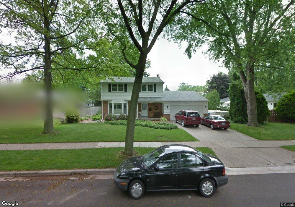
2100 Northampton Way Lansing, MI 48912
Groesbeck NeighborhoodEstimated Value: $291,261 - $320,000
4
Beds
3
Baths
1,947
Sq Ft
$157/Sq Ft
Est. Value
About This Home
This home is located at 2100 Northampton Way, Lansing, MI 48912 and is currently estimated at $305,065, approximately $156 per square foot. 2100 Northampton Way is a home located in Ingham County with nearby schools including Pattengill Academy, Gier Park School, and Eastern High School.
Ownership History
Date
Name
Owned For
Owner Type
Purchase Details
Closed on
Feb 11, 2021
Sold by
Guysky Daniel T and Guysky Amy E
Bought by
Guysky Daniel T and Guysky Amy E
Current Estimated Value
Purchase Details
Closed on
Jul 3, 1997
Sold by
Roach Charles and Roach Mary
Bought by
Guysky Daniel T and Guysky Amy E
Create a Home Valuation Report for This Property
The Home Valuation Report is an in-depth analysis detailing your home's value as well as a comparison with similar homes in the area
Home Values in the Area
Average Home Value in this Area
Purchase History
| Date | Buyer | Sale Price | Title Company |
|---|---|---|---|
| Guysky Daniel T | -- | None Available | |
| Guysky Daniel T | $139,500 | -- |
Source: Public Records
Tax History Compared to Growth
Tax History
| Year | Tax Paid | Tax Assessment Tax Assessment Total Assessment is a certain percentage of the fair market value that is determined by local assessors to be the total taxable value of land and additions on the property. | Land | Improvement |
|---|---|---|---|---|
| 2025 | $4,887 | $124,100 | $19,200 | $104,900 |
| 2024 | $39 | $113,200 | $19,200 | $94,000 |
| 2023 | $4,579 | $101,800 | $19,200 | $82,600 |
| 2022 | $794 | $95,400 | $16,400 | $79,000 |
| 2021 | $4,036 | $87,800 | $15,800 | $72,000 |
| 2020 | $4,012 | $85,400 | $15,800 | $69,600 |
| 2019 | $3,850 | $78,000 | $15,800 | $62,200 |
| 2018 | $3,603 | $76,300 | $15,800 | $60,500 |
| 2017 | $3,451 | $76,300 | $15,800 | $60,500 |
| 2016 | $3,300 | $65,900 | $15,800 | $50,100 |
| 2015 | $3,300 | $63,500 | $31,600 | $31,900 |
| 2014 | $3,300 | $61,700 | $31,600 | $30,100 |
Source: Public Records
Map
Nearby Homes
- 14120 Wood St
- 1923 Gay Ln
- 2625 Groesbeck Ave
- 1706 Autumn Ln
- 1610 Autumn Ln
- 2521 Hopkins Ave
- 1226 N Hayford Ave
- 1418 Chester Rd
- 1811 Vermont Ave
- 0 Lake Lansing Rd Unit 289258
- 1107 N Hayford Ave
- 1312 Otto St
- 2318 N High St
- 1613 Massachusetts Ave
- 1317 Illinois Ave
- 1007 N Foster Ave
- 1016 Lake Lansing Rd
- 1527 Massachusetts Ave
- 1017 Whyte St
- 1530 New York Ave
- 2001 Tulane Dr
- 2100 Montego Dr
- 2120 Montego Dr
- 2013 Tulane Dr
- 2021 Tulane Dr
- 2101 Northampton Way
- 2111 Northampton Way
- 2126 Montego Dr
- 2031 Northampton Way
- 2101 Montego Dr
- 2000 Tulane Dr
- 2119 Northampton Way
- 2101 Tulane Dr
- 2025 Northampton Way
- 2016 Tulane Dr
- 2127 Montego Dr
- 2134 Montego Dr
- 2142 Northampton Way
- 2127 Northampton Way
- 2017 Northampton Way