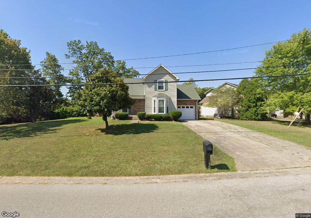
2100 Single Tree Dr Clarksville, TN 37040
Estimated Value: $215,000 - $277,000
Studio
2
Baths
1,372
Sq Ft
$183/Sq Ft
Est. Value
About This Home
This home is located at 2100 Single Tree Dr, Clarksville, TN 37040 and is currently estimated at $251,534, approximately $183 per square foot. 2100 Single Tree Dr is a home located in Montgomery County with nearby schools including Glenellen Elementary School, Kenwood Middle School, and Kenwood High School.
Ownership History
Date
Name
Owned For
Owner Type
Purchase Details
Closed on
Jan 16, 2025
Sold by
Ingram John L
Bought by
Carver Investments Llc
Current Estimated Value
Home Financials for this Owner
Home Financials are based on the most recent Mortgage that was taken out on this home.
Original Mortgage
$166,950
Interest Rate
6.6%
Mortgage Type
Construction
Purchase Details
Closed on
Nov 12, 1998
Sold by
Green Tree Financial Servi
Bought by
Ingram John L
Purchase Details
Closed on
Jul 31, 1998
Sold by
Blackledge Robert E
Bought by
Green Tree Financial Servi
Purchase Details
Closed on
Dec 12, 1994
Sold by
Putman Mark S
Bought by
Blackledge Robert E
Purchase Details
Closed on
Dec 6, 1994
Sold by
Maetzold Daniel A
Bought by
Mark Putman
Create a Home Valuation Report for This Property
The Home Valuation Report is an in-depth analysis detailing your home's value as well as a comparison with similar homes in the area
Purchase History
We collect this data history from publicly available records. To have your information removed, we recommend requesting removal directly through your county’s website.
| Date | Buyer | Sale Price | Title Company |
|---|---|---|---|
| Carver Investments Llc | $162,000 | None Listed On Document | |
| Ingram John L | $85,000 | -- | |
| Green Tree Financial Servi | $88,000 | -- | |
| Blackledge Robert E | $77,500 | -- | |
| Mark Putman | $62,553 | -- |
Source: Public Records
Mortgage History
We collect this data history from publicly available records. To have your information removed, we recommend requesting removal directly through your county’s website.
| Date | Status | Borrower | Loan Amount |
|---|---|---|---|
| Closed | Carver Investments Llc | $166,950 |
Source: Public Records
Tax History
| Year | Tax Paid | Tax Assessment Tax Assessment Total Assessment is a certain percentage of the fair market value that is determined by local assessors to be the total taxable value of land and additions on the property. | Land | Improvement |
|---|---|---|---|---|
| 2025 | $1,713 | $56,725 | $0 | $0 |
| 2024 | $1,713 | $56,725 | $0 | $0 |
| 2023 | $1,690 | $31,750 | $0 | $0 |
| 2022 | $1,340 | $31,750 | $0 | $0 |
| 2021 | $1,340 | $31,800 | $0 | $0 |
| 2020 | $1,278 | $31,800 | $0 | $0 |
| 2019 | $1,278 | $31,800 | $0 | $0 |
| 2018 | $1,266 | $23,100 | $0 | $0 |
| 2017 | $364 | $29,375 | $0 | $0 |
| 2016 | $902 | $29,375 | $0 | $0 |
| 2015 | $902 | $29,375 | $0 | $0 |
| 2014 | $1,221 | $29,375 | $0 | $0 |
| 2013 | $1,257 | $28,700 | $0 | $0 |
Source: Public Records
Map
Nearby Homes
- 482 Bamburg Dr
- 402 Boscobel Ct
- 403 Old Trenton Rd
- 2161 Amadeus Dr
- 2186 Blakemore Dr
- 324 Welchwood Dr
- 589 Briarwood Dr
- 2114 Trophy Trace
- 105 Echelon Preserve
- 102 Echelon Preserve
- 101 Echelon Preserve
- 107 Echelon Preserve
- 106 Echelon Preserve
- 104 Echelon Preserve
- 103 Echelon Preserve
- 412 Calamian Ct
- 209 Old Trenton Rd
- 2216 Trophy Trace
- 580 Tracy Ln
- 28 Hayes St
- 490 Bamburg Dr
- 2104 Single Tree Dr
- 1304 Abby Lou Dr
- 2105 Single Tree Dr
- 1300 Abby Lou Dr
- 2106 Single Tree Dr
- 32 Broc's Corner
- 33 Broc's Corner
- 488 Bamburg Dr
- 1308 Abby Lou Dr
- 2107 Single Tree Dr
- 2108 Single Tree Dr
- 1329 Abby Lou Dr
- 39 Broc's Corner
- 486 Bamburg Dr
- 1312 Abby Lou Dr
- 26 Broc's Corner
- 497 Old Trenton Rd
- 35 Broc's Corner
- 2109 Single Tree Dr
Your Personal Tour Guide
Ask me questions while you tour the home.