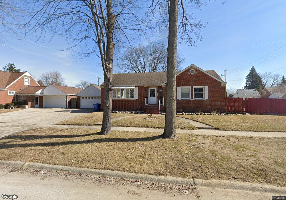
21004 Curie Ave Unit Bldg-Unit Warren, MI 48091
Southwest Warren NeighborhoodEstimated Value: $200,000 - $231,000
3
Beds
2
Baths
1,443
Sq Ft
$153/Sq Ft
Est. Value
About This Home
This home is located at 21004 Curie Ave Unit Bldg-Unit, Warren, MI 48091 and is currently estimated at $220,425, approximately $152 per square foot. 21004 Curie Ave Unit Bldg-Unit is a home located in Macomb County with nearby schools including Mound Park Elementary School, Schofield Elementary School, and Westview Elementary School.
Ownership History
Date
Name
Owned For
Owner Type
Purchase Details
Closed on
Jan 8, 2018
Sold by
Foster Jennifer Rose and Williams Jennifer
Bought by
Gould David and Korzec Amber
Current Estimated Value
Home Financials for this Owner
Home Financials are based on the most recent Mortgage that was taken out on this home.
Original Mortgage
$127,645
Outstanding Balance
$107,690
Interest Rate
3.93%
Mortgage Type
FHA
Estimated Equity
$112,735
Purchase Details
Closed on
May 15, 2007
Sold by
Fults Roy D and Fults Lisa J
Bought by
Foster Jennifer Rose
Create a Home Valuation Report for This Property
The Home Valuation Report is an in-depth analysis detailing your home's value as well as a comparison with similar homes in the area
Home Values in the Area
Average Home Value in this Area
Purchase History
| Date | Buyer | Sale Price | Title Company |
|---|---|---|---|
| Gould David | $130,000 | None Available | |
| Foster Jennifer Rose | $145,083 | Title One Inc |
Source: Public Records
Mortgage History
| Date | Status | Borrower | Loan Amount |
|---|---|---|---|
| Open | Gould David | $127,645 |
Source: Public Records
Tax History Compared to Growth
Tax History
| Year | Tax Paid | Tax Assessment Tax Assessment Total Assessment is a certain percentage of the fair market value that is determined by local assessors to be the total taxable value of land and additions on the property. | Land | Improvement |
|---|---|---|---|---|
| 2025 | $3,215 | $119,780 | $0 | $0 |
| 2024 | $3,128 | $104,760 | $0 | $0 |
| 2023 | $2,958 | $91,800 | $0 | $0 |
| 2022 | $2,794 | $78,950 | $0 | $0 |
| 2021 | $2,903 | $74,470 | $0 | $0 |
| 2020 | $2,776 | $68,160 | $0 | $0 |
| 2019 | $2,609 | $48,290 | $0 | $0 |
| 2018 | $1,692 | $37,960 | $0 | $0 |
| 2017 | $1,809 | $37,160 | $5,520 | $31,640 |
| 2016 | $1,814 | $37,160 | $0 | $0 |
| 2015 | -- | $34,570 | $0 | $0 |
| 2013 | $1,635 | $30,500 | $0 | $0 |
Source: Public Records
Map
Nearby Homes
- 20818 Atlantic Ave
- 21139 Curie Ave
- 21029 Blackmar Ave
- 20821 Blackmar Ave
- 21222 Audrey Ave
- 21441 Atlantic Ave
- 21115 Albany Ave
- 21485 Blackmar Ave
- 20511 Caldwell St
- 21535 Syracuse Ave
- 5584 Toepfer Rd
- 20253 Moenart St
- 21869 Curie Ave
- 20258 Caldwell St
- 21907 Panama Ave
- 21844 Hill St
- 20200 Caldwell St
- 20059 Bloom St
- 20057 Keystone St
- 21044 Sunset Ave
- 21004 Curie Ave
- 21052 Curie Ave
- 21003 Cyman Ave
- 21019 Cyman Ave
- 21045 Cyman Ave
- 21062 Curie Ave
- 21051 Cyman Ave
- 20867 Cyman Ave
- 21061 Cyman Ave
- 21003 Curie Ave
- 21045 Curie Ave
- 20861 Cyman Ave
- 20869 Curie Ave
- 21090 Curie Ave
- 21071 Cyman Ave
- 21051 Curie Ave
- 20861 Curie Ave
- 20853 Curie Ave
- 21079 Curie Ave
- 20837 Cyman Ave