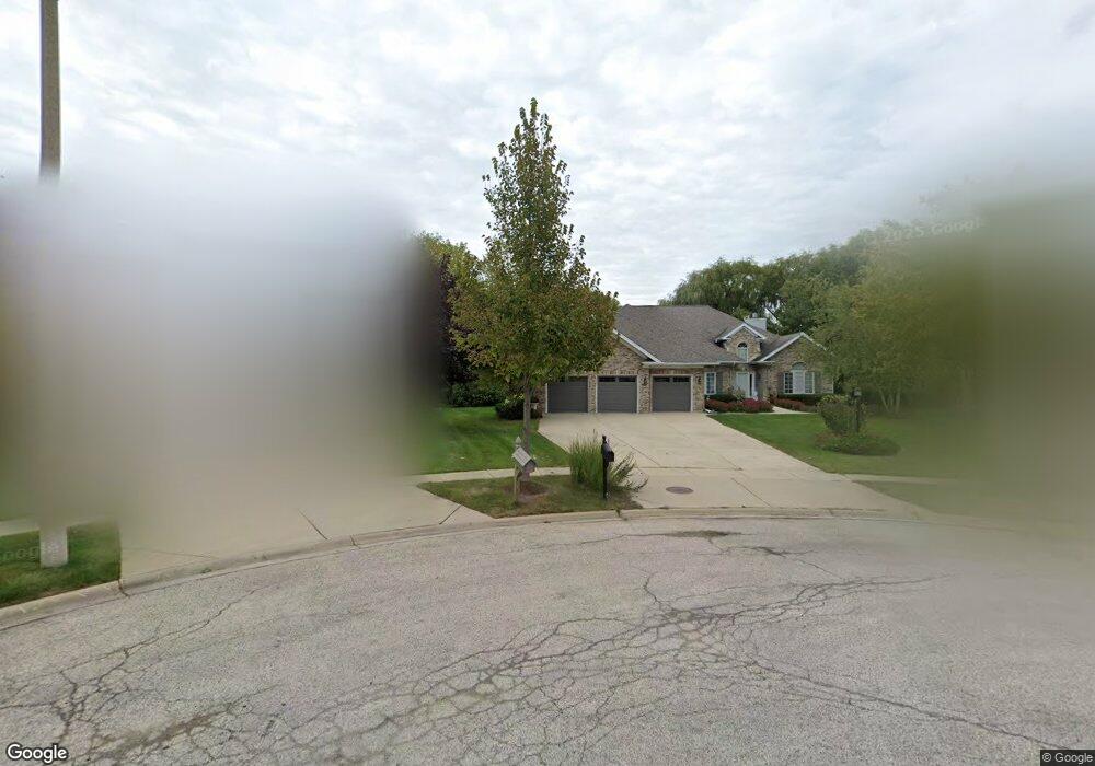
2101 Burnham Ct Algonquin, IL 60102
Estimated Value: $499,000 - $634,000
4
Beds
4
Baths
3,080
Sq Ft
$187/Sq Ft
Est. Value
About This Home
This home is located at 2101 Burnham Ct, Algonquin, IL 60102 and is currently estimated at $576,209, approximately $187 per square foot. 2101 Burnham Ct is a home located in McHenry County with nearby schools including Westfield Community School, Kenneth E Neubert Elementary School, and Harry D Jacobs High School.
Ownership History
Date
Name
Owned For
Owner Type
Purchase Details
Closed on
Feb 23, 2022
Sold by
Loobey Thomas J and Loobey Deborah K
Bought by
Loobey Thomas J and Loobey Deborah K
Current Estimated Value
Purchase Details
Closed on
Nov 28, 2011
Sold by
Rankin Richard L and Rankin Judy L
Bought by
Loobey Thomas J and Loobey Deborah K
Home Financials for this Owner
Home Financials are based on the most recent Mortgage that was taken out on this home.
Original Mortgage
$175,000
Interest Rate
4.02%
Mortgage Type
New Conventional
Purchase Details
Closed on
Aug 21, 2002
Sold by
Greshik James H and Greshik Kathryn V
Bought by
Rankin Richard L and Rankin Judith L
Home Financials for this Owner
Home Financials are based on the most recent Mortgage that was taken out on this home.
Original Mortgage
$75,000
Interest Rate
6.39%
Create a Home Valuation Report for This Property
The Home Valuation Report is an in-depth analysis detailing your home's value as well as a comparison with similar homes in the area
Purchase History
| Date | Buyer | Sale Price | Title Company |
|---|---|---|---|
| Loobey Thomas J | -- | English Steven G | |
| Loobey Thomas J | $353,500 | First United Title Svcs Inc | |
| Rankin Richard L | $400,000 | -- |
Source: Public Records
Mortgage History
| Date | Status | Borrower | Loan Amount |
|---|---|---|---|
| Previous Owner | Loobey Thomas J | $175,000 | |
| Previous Owner | Rankin Richard L | $75,000 |
Source: Public Records
Tax History
| Year | Tax Paid | Tax Assessment Tax Assessment Total Assessment is a certain percentage of the fair market value that is determined by local assessors to be the total taxable value of land and additions on the property. | Land | Improvement |
|---|---|---|---|---|
| 2024 | $12,612 | $177,228 | $42,940 | $134,288 |
| 2023 | $11,930 | $158,508 | $38,404 | $120,104 |
| 2022 | $12,080 | $151,856 | $41,601 | $110,255 |
| 2021 | $11,577 | $141,472 | $38,756 | $102,716 |
| 2020 | $11,266 | $136,464 | $37,384 | $99,080 |
| 2019 | $10,983 | $130,613 | $35,781 | $94,832 |
| 2018 | $10,452 | $120,659 | $33,054 | $87,605 |
| 2017 | $10,224 | $113,668 | $31,139 | $82,529 |
| 2016 | $10,054 | $106,611 | $29,206 | $77,405 |
| 2013 | -- | $99,427 | $27,246 | $72,181 |
Source: Public Records
Map
Nearby Homes
- 2051 Carlisle St
- 20 Peach Tree Ct Unit 4153
- 18 Peach Tree Ct Unit 4154
- 2069 Peach Tree Ln Unit 4116
- 1900 Waverly Ln
- 1157 Sawmill Ln
- 760 Regal Ln
- 1002 Interloch Ct Unit 152
- 1820 Crofton Dr
- 2380 Dawson Ln Unit 165
- 1181 Glenmont St
- 681 Majestic Dr
- 1453 Millbrook Dr
- 2612 Loren Ln Unit 293
- 1030 Glenmont St
- 1221 Glenmont St
- 1231 Glenmont St
- 1233 Glenmont St
- 1000 Glenmont St
- 1237 Glenmont St
- 2121 Burnham Ct
- 2060 Carlisle St
- 2071 Carlisle St
- 2080 Carlisle St
- 2141 Burnham Ct
- 2090 Burnham Ct
- 2040 Carlisle St
- 2031 Carlisle St
- 2091 Carlisle St
- 2020 Carlisle St
- 2100 Carlisle St
- 2110 Burnham Ct
- 2111 Carlisle St
- 1425 Carlisle St
- 2120 Carlisle St
- 2000 Carlisle St
- 1425 Stonegate Rd
- 2030 Carlisle St
- 2050 Carlisle St
- 1430 Darlington Ct
Your Personal Tour Guide
Ask me questions while you tour the home.