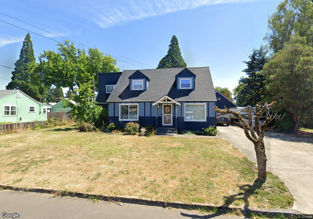
2101 Laurel St Forest Grove, OR 97116
Estimated Value: $533,000 - $646,279
5
Beds
3
Baths
2,851
Sq Ft
$206/Sq Ft
Est. Value
About This Home
This home is located at 2101 Laurel St, Forest Grove, OR 97116 and is currently estimated at $587,070, approximately $205 per square foot. 2101 Laurel St is a home located in Washington County with nearby schools including Fern Hill Elementary School, Neil Armstrong Middle School, and Tom McCall Upper Elementary School.
Ownership History
Date
Name
Owned For
Owner Type
Purchase Details
Closed on
Nov 23, 2015
Sold by
Robarts Lonnie R and Robarts Patricia L
Bought by
Willard Michael Duane and Willard Michelle Renee
Current Estimated Value
Home Financials for this Owner
Home Financials are based on the most recent Mortgage that was taken out on this home.
Original Mortgage
$293,322
Outstanding Balance
$229,442
Interest Rate
3.71%
Mortgage Type
New Conventional
Estimated Equity
$357,628
Purchase Details
Closed on
Jan 4, 1996
Sold by
Va
Bought by
Robarts Lonnie R and Robarts Patricia L
Create a Home Valuation Report for This Property
The Home Valuation Report is an in-depth analysis detailing your home's value as well as a comparison with similar homes in the area
Home Values in the Area
Average Home Value in this Area
Purchase History
| Date | Buyer | Sale Price | Title Company |
|---|---|---|---|
| Willard Michael Duane | $308,760 | Ticor Title | |
| Robarts Lonnie R | $73,500 | Transamerica Title Insurance |
Source: Public Records
Mortgage History
| Date | Status | Borrower | Loan Amount |
|---|---|---|---|
| Open | Willard Michael Duane | $293,322 |
Source: Public Records
Tax History Compared to Growth
Tax History
| Year | Tax Paid | Tax Assessment Tax Assessment Total Assessment is a certain percentage of the fair market value that is determined by local assessors to be the total taxable value of land and additions on the property. | Land | Improvement |
|---|---|---|---|---|
| 2026 | $6,472 | $363,440 | -- | -- |
| 2025 | $6,472 | $352,860 | -- | -- |
| 2024 | $6,244 | $342,590 | -- | -- |
| 2023 | $6,244 | $332,620 | $0 | $0 |
| 2022 | $5,460 | $332,620 | $0 | $0 |
| 2021 | $5,389 | $313,540 | $0 | $0 |
| 2020 | $5,360 | $304,410 | $0 | $0 |
| 2019 | $5,240 | $295,550 | $0 | $0 |
| 2018 | $5,080 | $286,950 | $0 | $0 |
| 2017 | $4,923 | $278,600 | $0 | $0 |
| 2016 | $4,245 | $240,010 | $0 | $0 |
| 2015 | $4,082 | $233,020 | $0 | $0 |
| 2014 | $4,062 | $226,240 | $0 | $0 |
Source: Public Records
Map
Nearby Homes
- 0 Kingwood St
- 2828 22nd Ave Unit 3
- 2828 22nd Ave Unit 5
- 2366 Kingwood St
- 2902 19th Ave
- 2824 19th Ave
- 2358 Kingwood St
- 3404 19th Ave Unit 103
- 3404 19th Ave Unit 215
- 2815 18th Ave
- 2820 23rd Place
- 2321 Annie Lou Ct
- 1822 Hawthorne St
- 2962 26th Ave
- 1615 Kingwood St
- 2837 25th Place
- 2622 Princeton Place
- 1813 Filbert St
- 3128 Brittany Dr
- 2802 26th Ave
- 2109 Laurel St
- 3118 22nd Ave
- 3120 22nd Ave Unit 14
- 2025 Thenrt St
- 2025 Laurel St Unit 1
- 2025 Laurel St
- 2119 Laurel St
- 3200 22nd Ave
- 3128 22nd Ave
- 3128 22nd Ave Unit B
- 3128 22nd Ave Unit A
- 3128 22nd Ave Unit C
- 2017 Laurel St
- 2112 Laurel St Unit 2118
- 2129 Laurel St
- 3116 22nd Ave
- 3122 22nd Ave Unit E
- 3122 22nd Ave Unit A BLD
- 3122 22nd Ave Unit C
- 3122 22nd Ave Unit B