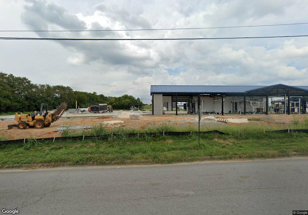
2101 N Locust Ave Lawrenceburg, TN 38464
Estimated Value: $7,316,191
--
Bed
2
Baths
9,880
Sq Ft
$741/Sq Ft
Est. Value
About This Home
This home is located at 2101 N Locust Ave, Lawrenceburg, TN 38464 and is currently estimated at $7,316,191, approximately $740 per square foot. 2101 N Locust Ave is a home located in Lawrence County with nearby schools including Ingram Sowell Elementary School, Lawrenceburg Public Elementary School, and Ethridge Elementary School.
Ownership History
Date
Name
Owned For
Owner Type
Purchase Details
Closed on
Oct 31, 2022
Sold by
Twas Properties Llc
Bought by
Tennessee-Lewis Llc
Current Estimated Value
Home Financials for this Owner
Home Financials are based on the most recent Mortgage that was taken out on this home.
Original Mortgage
$3,864,865
Outstanding Balance
$3,735,374
Interest Rate
6.7%
Mortgage Type
New Conventional
Estimated Equity
$3,580,817
Purchase Details
Closed on
Feb 16, 2022
Sold by
Old Iii Ephriam M
Bought by
Twas Properties Llc
Purchase Details
Closed on
Jul 20, 2021
Sold by
Walgreen Co
Bought by
Old Iii Ephram M and Hudson Will Thomas
Purchase Details
Closed on
Dec 19, 2017
Sold by
Eckerd Corporation
Bought by
Walgreen Co
Purchase Details
Closed on
Jun 17, 2003
Sold by
Charles Heffington
Bought by
Southmark Llc
Home Financials for this Owner
Home Financials are based on the most recent Mortgage that was taken out on this home.
Original Mortgage
$525,000
Interest Rate
5.43%
Mortgage Type
Commercial
Purchase Details
Closed on
Jun 13, 2003
Bought by
Heffington Charles A and Heffington Kathlyn
Home Financials for this Owner
Home Financials are based on the most recent Mortgage that was taken out on this home.
Original Mortgage
$525,000
Interest Rate
5.43%
Mortgage Type
Commercial
Purchase Details
Closed on
May 5, 2003
Sold by
Scroggins Margaret R
Bought by
Heffington Charles A and Heffington Kathlyn
Home Financials for this Owner
Home Financials are based on the most recent Mortgage that was taken out on this home.
Original Mortgage
$525,000
Interest Rate
5.43%
Mortgage Type
Commercial
Purchase Details
Closed on
Jan 9, 1989
Bought by
Scroggins M R
Purchase Details
Closed on
Apr 13, 1987
Bought by
Gladish Gladish and Gladish Scroggins
Purchase Details
Closed on
Apr 14, 1986
Create a Home Valuation Report for This Property
The Home Valuation Report is an in-depth analysis detailing your home's value as well as a comparison with similar homes in the area
Home Values in the Area
Average Home Value in this Area
Purchase History
| Date | Buyer | Sale Price | Title Company |
|---|---|---|---|
| Tennessee-Lewis Llc | $5,945,946 | -- | |
| Twas Properties Llc | $1,225,000 | Boston Holt Sockwell & Durham | |
| Twas Properties Llc | $1,225,000 | None Listed On Document | |
| Old Iii Ephram M | $725,000 | None Available | |
| Walgreen Co | $2,780,000 | First American Title | |
| Southmark Llc | $985,000 | -- | |
| Heffington Charles A | -- | -- | |
| Heffington Charles A | -- | -- | |
| Scroggins M R | $54,000 | -- | |
| Gladish Gladish | -- | -- | |
| -- | $200,000 | -- |
Source: Public Records
Mortgage History
| Date | Status | Borrower | Loan Amount |
|---|---|---|---|
| Open | Tennessee-Lewis Llc | $3,864,865 | |
| Previous Owner | Not Available | $525,000 |
Source: Public Records
Tax History Compared to Growth
Tax History
| Year | Tax Paid | Tax Assessment Tax Assessment Total Assessment is a certain percentage of the fair market value that is determined by local assessors to be the total taxable value of land and additions on the property. | Land | Improvement |
|---|---|---|---|---|
| 2025 | $16,120 | $518,640 | $0 | $0 |
| 2024 | $16,120 | $518,640 | $201,000 | $317,640 |
| 2023 | $16,120 | $518,640 | $201,000 | $317,640 |
| 2022 | $8,904 | $286,480 | $201,000 | $85,480 |
| 2021 | $22,539 | $512,760 | $201,000 | $311,760 |
| 2020 | $22,539 | $512,760 | $201,000 | $311,760 |
| 2019 | $22,539 | $512,760 | $201,000 | $311,760 |
| 2018 | $22,539 | $512,760 | $201,000 | $311,760 |
| 2017 | $22,539 | $512,760 | $201,000 | $311,760 |
| 2016 | $22,539 | $512,760 | $201,000 | $311,760 |
| 2015 | $21,341 | $512,760 | $201,000 | $311,760 |
| 2014 | $19,393 | $465,960 | $182,760 | $283,200 |
Source: Public Records
Map
Nearby Homes
- 413 Kirk St
- 335 Robins St
- 48 Woodland Cir
- 0 Woodland Cir Unit RTC3033314
- 1306 Hart Ave
- 1216 Poplar Dr
- 314 Avon St
- 301 Simpson St
- 313 Simpson St
- 1050 Baylee Cir
- 4951 Weakley Creek Rd
- 975 Weakley Creek Rd
- 4000 Weakley Creek Rd
- 717 Toben Terrace
- 97 Crawfish Ln
- 502 9th St
- 1303 5th Ave
- 801 Douglas Dr
- 806 Fair Ave
- 14 Delana Ave
- 2019 N Locust Ave
- 0 N Locust Ave
- 2005 N Locust Ave
- 21128 N Locust Ave
- 1954 N Locust Ave
- 1954 Business Ave
- 1901 N Locust Ave
- 2119 1/2 N Locust Ave
- 2111 Massey Ave
- 0 Business Ave Unit 1903434
- 0 Business Ave Unit 1545582
- 0 Business Ave Unit 1616011
- 0 Business Ave Unit 1686891
- 0 Business Ave Unit 1670903
- 0 Business Ave Unit 1722129
- 0 Business Ave Unit 1753599
- 0 Business Ave Unit 1816726
- 0 Business Ave Unit RTC1503951
- 0 Business Ave Unit RTC1423147
- 0 Business Ave Unit RTC1371967