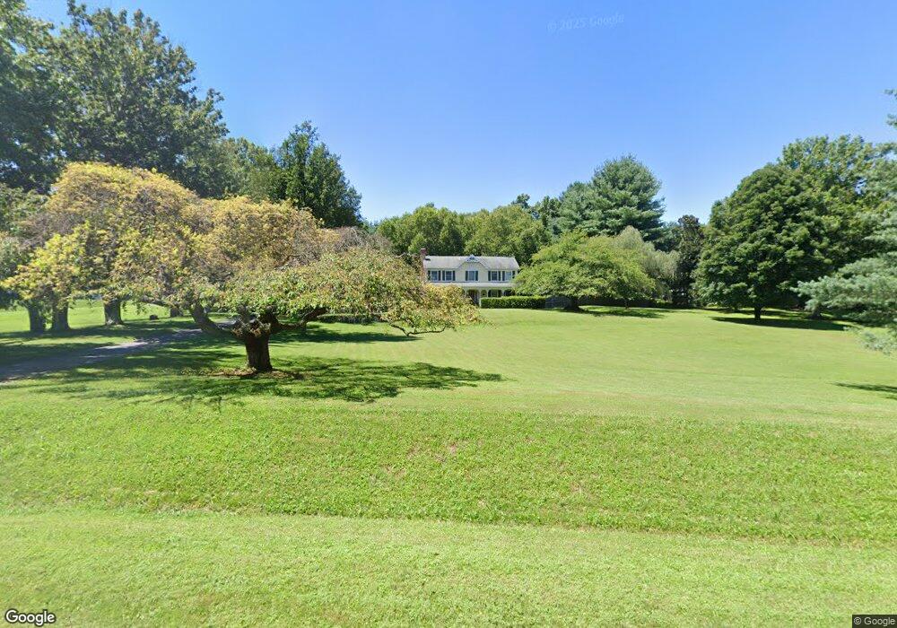
21010 Blunt Rd Germantown, MD 20876
Estimated Value: $776,464 - $936,000
4
Beds
4
Baths
2,236
Sq Ft
$382/Sq Ft
Est. Value
About This Home
This home is located at 21010 Blunt Rd, Germantown, MD 20876 and is currently estimated at $854,616, approximately $382 per square foot. 21010 Blunt Rd is a home located in Montgomery County with nearby schools including William B. Gibbs Jr., Neelsville Middle, and Seneca Valley High School.
Ownership History
Date
Name
Owned For
Owner Type
Purchase Details
Closed on
Jun 8, 2011
Sold by
Conley Louis W
Bought by
Crothe Christopher T and Grothe Mary Elizabeth
Current Estimated Value
Purchase Details
Closed on
May 27, 2011
Sold by
Ricci Roberta A
Bought by
Grothe Christopher T and Grothe Mary Elizabeth
Purchase Details
Closed on
Jul 2, 1999
Sold by
Six Daniel L
Bought by
Conley Louis W and Ricci Roberta A
Purchase Details
Closed on
Feb 6, 1998
Sold by
L Donald S and L Miller L
Bought by
Six Daniel L
Create a Home Valuation Report for This Property
The Home Valuation Report is an in-depth analysis detailing your home's value as well as a comparison with similar homes in the area
Home Values in the Area
Average Home Value in this Area
Purchase History
| Date | Buyer | Sale Price | Title Company |
|---|---|---|---|
| Crothe Christopher T | $550,000 | -- | |
| Grothe Christopher T | $550,000 | First American Title Ins Co | |
| Crothe Christopher T | $550,000 | -- | |
| Conley Louis W | $360,000 | -- | |
| Six Daniel L | $335,000 | -- |
Source: Public Records
Tax History
| Year | Tax Paid | Tax Assessment Tax Assessment Total Assessment is a certain percentage of the fair market value that is determined by local assessors to be the total taxable value of land and additions on the property. | Land | Improvement |
|---|---|---|---|---|
| 2025 | $7,624 | $640,167 | -- | -- |
| 2024 | $7,624 | $600,433 | $0 | $0 |
| 2023 | $6,437 | $560,700 | $264,000 | $296,700 |
| 2022 | $6,082 | $555,233 | $0 | $0 |
| 2021 | $5,865 | $549,767 | $0 | $0 |
| 2020 | $5,865 | $544,300 | $264,000 | $280,300 |
| 2019 | $5,844 | $544,300 | $264,000 | $280,300 |
| 2018 | $5,847 | $544,300 | $264,000 | $280,300 |
| 2017 | $6,193 | $565,300 | $0 | $0 |
| 2016 | $6,643 | $556,067 | $0 | $0 |
| 2015 | $6,643 | $546,833 | $0 | $0 |
| 2014 | $6,643 | $537,600 | $0 | $0 |
Source: Public Records
Map
Nearby Homes
- 21113 Kaul Ln
- 20728 Bell Bluff Rd
- 9743 Winery Ct
- 10012 Forest View Place
- 9935 Forest View Place
- 20812 Aspenwood Ln
- 9804 Brookridge Ct
- 9707 Meggs Point Place
- 9923 Maple Leaf Dr
- 20725 Bountyfield Ct
- 20713 Bountyfield Ct
- 20605 Pruitt Ct
- 20592 Strath Haven Dr
- 9900 Tambay Ct
- 20720 Warfield Ct
- 9214 Warfield Rd
- HOMESITE 202 Village Walk Dr
- Homesite A20301 Village Walk Dr
- HOMESITE 101 Village Walk Dr
- 20610 Highland Hall Dr
- 21014 Blunt Rd
- 21006 Blunt Rd
- 21101 Kaul Ln
- 21018 Blunt Rd
- 21105 Kaul Ln
- 21022 Blunt Rd
- 21109 Kaul Ln
- 21100 Kaul Ln
- 21026 Blunt Rd
- 21000 Blunt Rd
- 21104 Kaul Ln
- 21108 Kaul Ln
- 21001 Cog Wheel Way
- 21005 Cog Wheel Way
- 21210 Blunt Rd
- 21200 Blunt Rd
- 10121 Brink Rd
- 9910 Brink Rd
- 21000 Cog Wheel Way
- 21009 Cog Wheel Way
Your Personal Tour Guide
Ask me questions while you tour the home.