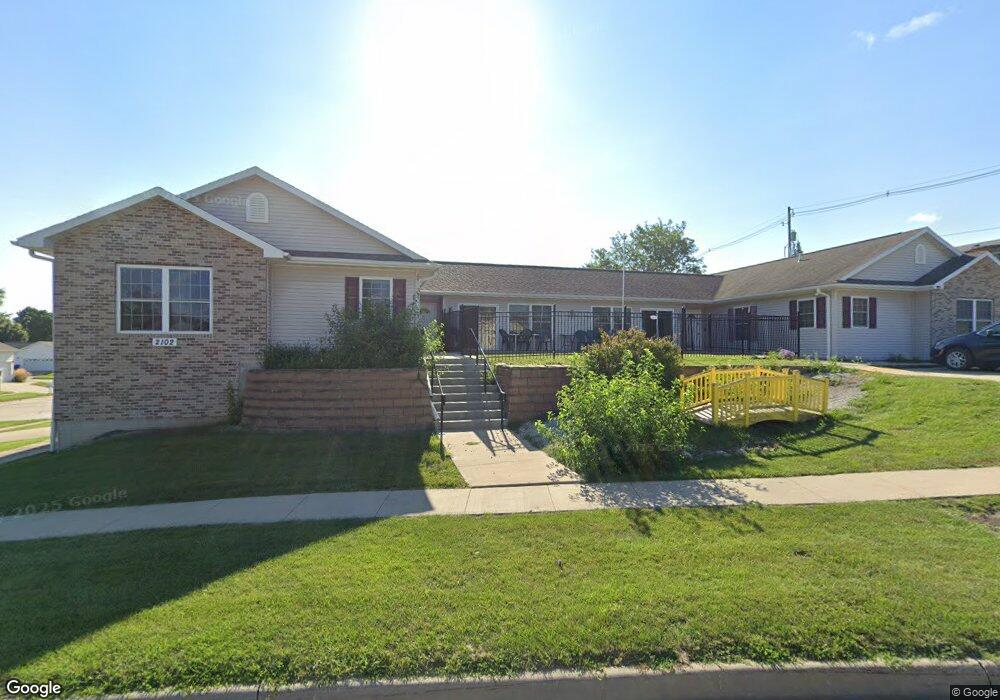
2102 S 5th Ave Unit 21 Marshalltown, IA 50158
Estimated Value: $172,607 - $220,000
3
Beds
2
Baths
6,144
Sq Ft
$32/Sq Ft
Est. Value
About This Home
This home is located at 2102 S 5th Ave Unit 21, Marshalltown, IA 50158 and is currently estimated at $197,652, approximately $32 per square foot. 2102 S 5th Ave Unit 21 is a home located in Marshall County with nearby schools including J.C. Hoglan Elementary School, B.R. Miller Middle School, and Marshalltown High School.
Ownership History
Date
Name
Owned For
Owner Type
Purchase Details
Closed on
Sep 6, 2023
Sold by
Good Marjorie J
Bought by
Good Julie C and Garlich Jeri L
Current Estimated Value
Purchase Details
Closed on
Jun 30, 2009
Sold by
The Estate Of C Wilbur Galloway
Bought by
Good Marjorie J
Home Financials for this Owner
Home Financials are based on the most recent Mortgage that was taken out on this home.
Original Mortgage
$40,000
Interest Rate
4.86%
Mortgage Type
Credit Line Revolving
Create a Home Valuation Report for This Property
The Home Valuation Report is an in-depth analysis detailing your home's value as well as a comparison with similar homes in the area
Home Values in the Area
Average Home Value in this Area
Purchase History
| Date | Buyer | Sale Price | Title Company |
|---|---|---|---|
| Good Julie C | -- | None Listed On Document | |
| Good Julie C | -- | None Listed On Document | |
| Good Marjorie J | $102,000 | None Available | |
| Good Marjorie J | $102,000 | None Available |
Source: Public Records
Mortgage History
| Date | Status | Borrower | Loan Amount |
|---|---|---|---|
| Previous Owner | Good Marjorie J | $40,000 |
Source: Public Records
Tax History
| Year | Tax Paid | Tax Assessment Tax Assessment Total Assessment is a certain percentage of the fair market value that is determined by local assessors to be the total taxable value of land and additions on the property. | Land | Improvement |
|---|---|---|---|---|
| 2025 | $2,510 | $158,350 | $25,040 | $133,310 |
| 2024 | $2,510 | $153,870 | $25,040 | $128,830 |
| 2023 | $2,550 | $153,870 | $25,040 | $128,830 |
| 2022 | $2,578 | $122,790 | $24,540 | $98,250 |
| 2021 | $2,512 | $122,790 | $24,540 | $98,250 |
| 2020 | $2,715 | $115,210 | $24,540 | $90,670 |
Source: Public Records
Map
Nearby Homes
- 801 E Southridge Rd
- 901 E Southridge Rd
- 903 E Southridge Rd
- 803 E Southridge Rd
- 504 Thomas Dr
- 201 Thunderbird Dr
- 1001 E Southridge Rd
- 1011 E Southridge Rd
- 2103 Governor Rd
- 514 E Olive St Unit 105
- 1704 S 3rd Ave
- 1918 S Center St
- 6 W Meadow Ln
- 509 Dennis Dr
- 2304 Maple Blvd
- 2307 Maple Blvd
- 806 Henry Dr
- 302 Richard Ln
- 1207 Glenwood Terrace
- 630 Ratcliffe Dr
- 504 New Castle Rd
- 502 New Castle Rd
- 509 Thunderbird Dr
- 504 Newcastle Rd
- 2101 S 5th Ave Unit 21
- 2020 S 5th Ave
- 506 New Castle Rd
- 506 Newcastle Rd
- 2013 Bailey Dr
- 2023 S 5th St
- 2023 S 5th Ave
- 414 New Castle Rd
- 502 Newcastle Rd
- 508 New Castle Rd
- 411 Thunderbird Dr
- 2016 S 5th Ave
- 603 Thunderbird Dr
- 2011 Bailey Dr
- 2019 S 5th Ave
- 412 New Castle Rd
Your Personal Tour Guide
Ask me questions while you tour the home.