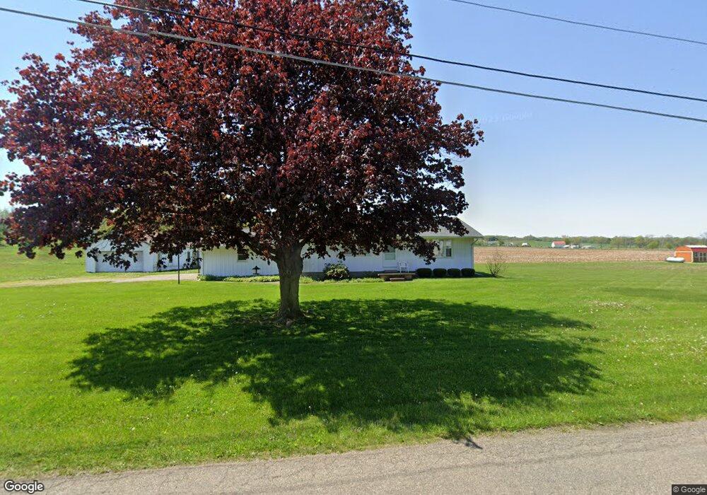
21024 Schenck Creek Rd Howard, OH 43028
Estimated Value: $209,444 - $252,000
3
Beds
1
Bath
1,064
Sq Ft
$220/Sq Ft
Est. Value
About This Home
This home is located at 21024 Schenck Creek Rd, Howard, OH 43028 and is currently estimated at $234,111, approximately $220 per square foot. 21024 Schenck Creek Rd is a home located in Knox County with nearby schools including East Knox Elementary School and East Knox High School.
Ownership History
Date
Name
Owned For
Owner Type
Purchase Details
Closed on
Jul 19, 2002
Sold by
Vernon Lance L and Vernon Susan N
Bought by
Cox Deborah J and Korns Jan
Current Estimated Value
Purchase Details
Closed on
Dec 16, 1994
Sold by
Simpson Ronald and Simpson Kathy
Bought by
Vernon Lance L and Vernon Susan N
Purchase Details
Closed on
Nov 15, 1994
Sold by
Simpson Robert G and Simpson Stout
Bought by
Simpson Ronald and Simpson Kathy
Create a Home Valuation Report for This Property
The Home Valuation Report is an in-depth analysis detailing your home's value as well as a comparison with similar homes in the area
Home Values in the Area
Average Home Value in this Area
Purchase History
| Date | Buyer | Sale Price | Title Company |
|---|---|---|---|
| Cox Deborah J | $74,000 | -- | |
| Vernon Lance L | $65,000 | -- | |
| Simpson Ronald | $25,500 | -- |
Source: Public Records
Tax History Compared to Growth
Tax History
| Year | Tax Paid | Tax Assessment Tax Assessment Total Assessment is a certain percentage of the fair market value that is determined by local assessors to be the total taxable value of land and additions on the property. | Land | Improvement |
|---|---|---|---|---|
| 2024 | $1,881 | $45,960 | $13,830 | $32,130 |
| 2023 | $1,881 | $45,960 | $13,830 | $32,130 |
| 2022 | $1,679 | $36,770 | $11,060 | $25,710 |
| 2021 | $1,679 | $36,770 | $11,060 | $25,710 |
| 2020 | $1,658 | $36,770 | $11,060 | $25,710 |
| 2019 | $1,678 | $34,370 | $10,890 | $23,480 |
| 2018 | $1,572 | $34,370 | $10,890 | $23,480 |
| 2017 | $1,558 | $34,370 | $10,890 | $23,480 |
| 2016 | $1,465 | $31,820 | $10,080 | $21,740 |
| 2015 | $1,335 | $31,820 | $10,080 | $21,740 |
| 2014 | $1,337 | $31,820 | $10,080 | $21,740 |
| 2013 | $1,331 | $30,920 | $9,470 | $21,450 |
Source: Public Records
Map
Nearby Homes
- 21311 Coshocton Rd
- 20561 Canada Rd
- 1257 Apple Valley Dr
- 0 Apple Valley Dr Unit 9069389
- 0 Apple Valley Dr Unit 5159791
- 0 Apple Valley Dr Unit BALDWIN HEIGHTS LOT
- 0 Apple Valley Dr Unit 225014019
- 0 Apple Valley Dr Unit 225009912
- 0 Apple Valley Dr Unit 20250175
- 31 Apple Valley Blvd
- 1176 Apple Valley Dr
- 882 Winesap Dr
- 882 Winesap Dr Unit 197
- 890 Winesap Dr
- 558 Crabapple Dr
- 214 Crabapple Dr
- 667 Winesap Cir
- 360 Baldwin Dr
- 129 Hasbrouck Cir
- 610 Crabapple Dr
- 20980 Schenck Creek Rd
- 21080 Schenck Creek Rd
- 20930 Schenck Creek Rd
- 21080 Schenck Creek Rd
- 21100 Schenck Creek Rd
- 21060 Coshocton Rd
- 20890 Schenck Creek Rd
- 21140 Schenck Creek Rd
- 21162 Coshocton Rd
- 21156 Schenck Creek Rd
- 20820 Coshocton Rd
- 20870 Coshocton Rd
- 20820 Coshocton Rd
- 20903 Coshocton Rd
- 21178 Schenck Creek Rd
- 20875 Coshocton Rd
- 0 Coshocton Road (3 26 Acres)
- 21220 Coshocton Rd
- 11191 Monroe Mills Rd
- 11241 Monroe Mills Rd