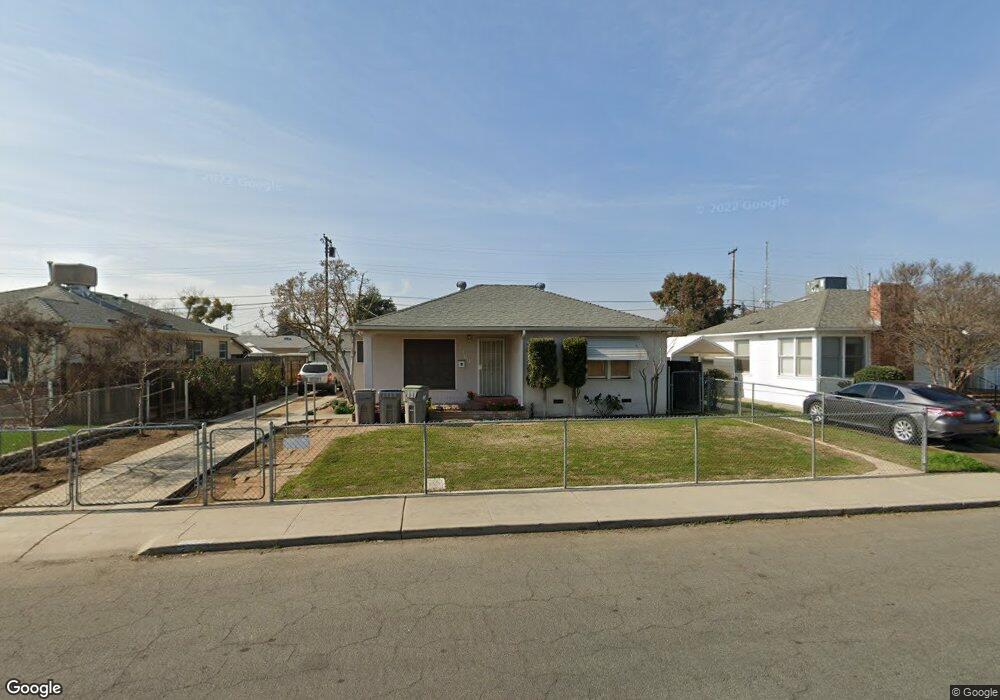
2103 Norris Dr W Fresno, CA 93703
McLane NeighborhoodEstimated Value: $240,955 - $264,000
2
Beds
1
Bath
993
Sq Ft
$254/Sq Ft
Est. Value
About This Home
This home is located at 2103 Norris Dr W, Fresno, CA 93703 and is currently estimated at $251,989, approximately $253 per square foot. 2103 Norris Dr W is a home located in Fresno County with nearby schools including Birney Elementary School, Scandinavian Middle School, and Mclane High School.
Ownership History
Date
Name
Owned For
Owner Type
Purchase Details
Closed on
Dec 6, 2005
Sold by
Edwards Marilyn J
Bought by
Edwards Marilyn L
Current Estimated Value
Purchase Details
Closed on
Aug 6, 1996
Sold by
Hud
Bought by
Edwards Marilyn J
Home Financials for this Owner
Home Financials are based on the most recent Mortgage that was taken out on this home.
Original Mortgage
$60,050
Outstanding Balance
$4,608
Interest Rate
7.88%
Mortgage Type
FHA
Estimated Equity
$247,381
Purchase Details
Closed on
Apr 1, 1996
Sold by
Harbourton Mtg Co Lp
Bought by
Hud
Purchase Details
Closed on
Mar 28, 1996
Sold by
Williams William Orace
Bought by
Harbourton Mtg Co Lp
Create a Home Valuation Report for This Property
The Home Valuation Report is an in-depth analysis detailing your home's value as well as a comparison with similar homes in the area
Home Values in the Area
Average Home Value in this Area
Purchase History
| Date | Buyer | Sale Price | Title Company |
|---|---|---|---|
| Edwards Marilyn L | -- | None Available | |
| Edwards Marilyn J | $45,000 | North American Title | |
| Hud | -- | Fidelity National Title Ins | |
| Harbourton Mtg Co Lp | $65,423 | Fidelity National Title Ins |
Source: Public Records
Mortgage History
| Date | Status | Borrower | Loan Amount |
|---|---|---|---|
| Open | Edwards Marilyn J | $60,050 |
Source: Public Records
Tax History Compared to Growth
Tax History
| Year | Tax Paid | Tax Assessment Tax Assessment Total Assessment is a certain percentage of the fair market value that is determined by local assessors to be the total taxable value of land and additions on the property. | Land | Improvement |
|---|---|---|---|---|
| 2025 | $821 | $73,260 | $32,558 | $40,702 |
| 2023 | $804 | $70,417 | $31,295 | $39,122 |
| 2022 | $791 | $69,037 | $30,682 | $38,355 |
| 2021 | $768 | $67,684 | $30,081 | $37,603 |
| 2020 | $764 | $66,991 | $29,773 | $37,218 |
| 2019 | $733 | $65,679 | $29,190 | $36,489 |
| 2018 | $716 | $64,392 | $28,618 | $35,774 |
| 2017 | $702 | $63,130 | $28,057 | $35,073 |
| 2016 | $678 | $61,893 | $27,507 | $34,386 |
| 2015 | $666 | $60,964 | $27,094 | $33,870 |
| 2014 | -- | $59,771 | $26,564 | $33,207 |
Source: Public Records
Map
Nearby Homes
- 2044 Mayfair Dr W
- 2126 N First St
- 2136 N First St
- 2128 N First St
- 3140 E Weldon Ave
- 3250 E Clinton Ave
- 3256 Mayfair Blvd
- 2414 N 1st St
- 2513 N 2nd St
- 2154 Norris Dr E
- 3514 Mayfair Dr N
- 3415 E Terrace Ave
- 3525 Mayfair Dr N
- 2042 Mayfair Dr E
- 3007 E Home Ave
- 3404 E Home Ave
- 2904 N First St
- 3803 E Clinton Ave
- 2240
- 0 Tba Unit 634245
- 2113 Norris Dr W
- 2043 Norris Dr W
- 2054 Mayfair Dr W
- 2123 Norris Dr W
- 2033 Norris Dr W
- 2104 Mayfair Dr W
- 2106 Mayfair Dr W
- 2034 Mayfair Dr W
- 3205 Circle Ct W
- 3206 Circle Ct W
- 2023 Norris Dr W
- 2133 Norris Dr W
- 2126 Norris Dr W
- 2024 Mayfair Dr W
- 2026 Norris Dr W
- 2013 Norris Dr W
- 3216 Circle Ct W
- 2016 Norris Dr W
- 2146 Norris Dr W
- 3215 Circle Ct W