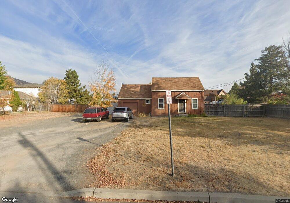
21030 Carl St Bend, OR 97701
Larkspur NeighborhoodEstimated Value: $366,000 - $526,066
2
Beds
1
Bath
752
Sq Ft
$600/Sq Ft
Est. Value
About This Home
This home is located at 21030 Carl St, Bend, OR 97701 and is currently estimated at $451,517, approximately $600 per square foot. 21030 Carl St is a home located in Deschutes County with nearby schools including Bear Creek Elementary School, Bend Senior High School, and Eastmont Community School.
Ownership History
Date
Name
Owned For
Owner Type
Purchase Details
Closed on
Apr 20, 2009
Sold by
U S Bank National Association
Bought by
Lemke Carl and Lemke Sue D
Current Estimated Value
Home Financials for this Owner
Home Financials are based on the most recent Mortgage that was taken out on this home.
Original Mortgage
$75,000
Interest Rate
5.02%
Mortgage Type
Unknown
Purchase Details
Closed on
Jan 20, 2009
Sold by
Tucker Robert and Abualhaija Mazen
Bought by
U S Bank National Association
Purchase Details
Closed on
Aug 14, 2006
Sold by
Dupont Mike
Bought by
Tucker Robert and Abualhaija Mazen
Home Financials for this Owner
Home Financials are based on the most recent Mortgage that was taken out on this home.
Original Mortgage
$340,000
Interest Rate
8.12%
Mortgage Type
Unknown
Create a Home Valuation Report for This Property
The Home Valuation Report is an in-depth analysis detailing your home's value as well as a comparison with similar homes in the area
Home Values in the Area
Average Home Value in this Area
Purchase History
| Date | Buyer | Sale Price | Title Company |
|---|---|---|---|
| Lemke Carl | $96,000 | First American Title | |
| U S Bank National Association | $152,184 | Accommodation | |
| Tucker Robert | $425,000 | First Amer Title Ins Co Or |
Source: Public Records
Mortgage History
| Date | Status | Borrower | Loan Amount |
|---|---|---|---|
| Closed | Lemke Carl | $75,000 | |
| Previous Owner | Tucker Robert | $340,000 |
Source: Public Records
Tax History Compared to Growth
Tax History
| Year | Tax Paid | Tax Assessment Tax Assessment Total Assessment is a certain percentage of the fair market value that is determined by local assessors to be the total taxable value of land and additions on the property. | Land | Improvement |
|---|---|---|---|---|
| 2025 | $2,221 | $131,450 | -- | -- |
| 2024 | $2,137 | $127,630 | -- | -- |
| 2023 | $1,981 | $123,920 | $0 | $0 |
| 2022 | $1,848 | $116,820 | $0 | $0 |
| 2021 | $1,851 | $113,420 | $0 | $0 |
| 2020 | $1,756 | $113,420 | $0 | $0 |
| 2019 | $1,707 | $110,120 | $0 | $0 |
| 2018 | $1,659 | $106,920 | $0 | $0 |
| 2017 | $1,611 | $103,810 | $0 | $0 |
| 2016 | $1,536 | $100,790 | $0 | $0 |
| 2015 | $1,494 | $97,860 | $0 | $0 |
| 2014 | $1,450 | $95,010 | $0 | $0 |
Source: Public Records
Map
Nearby Homes
- 21019 Carl St
- 62025 NE Nate's Place
- 62001 NE Nates Place
- 98 NE Telima Ln
- 940 NE Purcell Blvd
- 940 NE Paula Dr Unit 21
- 61969 SE 27th St
- 61635 Pettigrew Rd Unit 12
- 61839 Avonlea Cir
- 1072 NE Parkview Ct
- 61807 SE Rolo Ct
- 61847 SE 27th St
- 61839 SE 27th St
- 21489 Oconnor Way Unit 17
- 21493 Oconnor Way Unit 15
- 21491 Oconnor Way Unit 16
- 21495 Oconnor Way Unit 14
- 21323 Oconnor Way
- 2876 NE Forum Dr
- 62085 Wolcott Place
- 21026 NE Carl St
- 21026 Carl St
- 62063 Dean Swift Rd
- 21015 Carl St Unit 11
- 21015 Carl St Unit 10
- 21015 Carl St Unit 7
- 21015 Carl St Unit 6
- 21015 Carl St Unit 1
- 21015 Carl St
- 21031 Carl St
- 21027 Carl St
- 21035 Carl St
- 2115 NE Highway 20
- 2115 NE Highway 20 Unit 107&8
- 2115 NE Highway 20 Unit 106
- 21016 Carl St
- 62049 Dean Swift Rd
- 21034 Damascus Ln
- 62043 Dean Swift Rd
- 62043 Dean Swift Rd Unit A&B