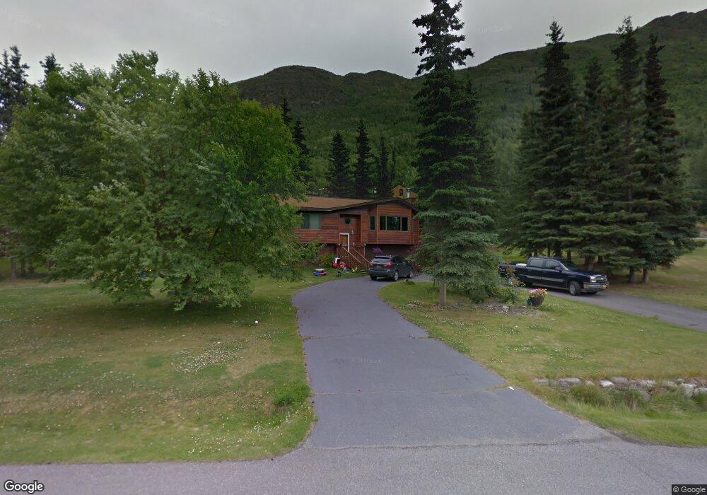
21043 Upper Lowland Ave Eagle River, AK 99577
Eagle River Valley NeighborhoodEstimated Value: $377,000 - $499,000
3
Beds
2
Baths
1,732
Sq Ft
$250/Sq Ft
Est. Value
About This Home
This home is located at 21043 Upper Lowland Ave, Eagle River, AK 99577 and is currently estimated at $433,077, approximately $250 per square foot. 21043 Upper Lowland Ave is a home located in Anchorage Municipality with nearby schools including Ravenwood Elementary School, Gruening Middle School, and Eagle River High School.
Ownership History
Date
Name
Owned For
Owner Type
Purchase Details
Closed on
Sep 9, 2009
Sold by
Lozano Dennis J and Lozano Marie E
Bought by
Lawson Eric B and Lawson Angela M
Current Estimated Value
Home Financials for this Owner
Home Financials are based on the most recent Mortgage that was taken out on this home.
Original Mortgage
$245,000
Outstanding Balance
$157,527
Interest Rate
5.18%
Mortgage Type
Seller Take Back
Estimated Equity
$275,550
Purchase Details
Closed on
Aug 8, 2005
Sold by
Frieser Michael J and Dern Robin E
Bought by
Lozano Dennis J and Lozano Marie E
Purchase Details
Closed on
Jun 2, 2003
Sold by
Mangold Brian G and Mangold Carleen A
Bought by
Frieser Michael J and Dern Robin E
Home Financials for this Owner
Home Financials are based on the most recent Mortgage that was taken out on this home.
Original Mortgage
$228,000
Interest Rate
5.75%
Mortgage Type
Purchase Money Mortgage
Create a Home Valuation Report for This Property
The Home Valuation Report is an in-depth analysis detailing your home's value as well as a comparison with similar homes in the area
Home Values in the Area
Average Home Value in this Area
Purchase History
| Date | Buyer | Sale Price | Title Company |
|---|---|---|---|
| Lawson Eric B | -- | Stewart | |
| Lozano Dennis J | -- | -- | |
| Frieser Michael J | -- | First American Title Of Alas |
Source: Public Records
Mortgage History
| Date | Status | Borrower | Loan Amount |
|---|---|---|---|
| Open | Lawson Eric B | $245,000 | |
| Previous Owner | Frieser Michael J | $228,000 |
Source: Public Records
Tax History
| Year | Tax Paid | Tax Assessment Tax Assessment Total Assessment is a certain percentage of the fair market value that is determined by local assessors to be the total taxable value of land and additions on the property. | Land | Improvement |
|---|---|---|---|---|
| 2025 | $4,748 | $391,600 | $136,200 | $255,400 |
| 2024 | $4,748 | $372,300 | $120,500 | $251,800 |
| 2023 | $4,777 | $349,400 | $117,000 | $232,400 |
| 2022 | $4,771 | $337,600 | $113,100 | $224,500 |
| 2021 | $5,648 | $319,300 | $113,100 | $206,200 |
| 2020 | $4,131 | $310,800 | $113,100 | $197,700 |
| 2019 | $4,158 | $308,900 | $113,100 | $195,800 |
| 2018 | $3,964 | $296,700 | $105,000 | $191,700 |
| 2017 | $4,463 | $302,100 | $105,000 | $197,100 |
| 2016 | $3,808 | $297,200 | $99,400 | $197,800 |
| 2015 | $3,808 | $290,500 | $100,600 | $189,900 |
| 2014 | $3,808 | $287,500 | $97,300 | $190,200 |
Source: Public Records
Map
Nearby Homes
- 20786 Melody Ln
- L4 Sheppard Dr
- 20514 Birch Crest Ln
- 20779 Mountain Vista Dr
- 9545 Grey Owl Way
- L7 Grey Owl Way
- 9621 Nizki Cir
- 20610 Mountainside Dr
- 20413 Icefall Dr
- 19817 Belknap Cir
- 20638 Driftwood Bay Dr
- 19413 First St
- 8935 Birch Park Cir
- 19950 Driftwood Bay Dr Unit 7
- 19862 Driftwood Bay Dr
- 19351 Verdant Cir
- 9607 Saint George Cir
- 19110 War Admiral Rd
- 9500 Puffin Cir
- 10821 Sushana Cir
- L3 Upper Lowland Ave
- Lot 3 Upper Lowland Ave
- NHN Upper Lowland Ave
- 21027 Upper Lowland Ave
- 10230 Silvertip Cir
- L9 B2 Silvertip Cir
- 21042 Upper Lowland Ave
- 21007 Upper Lowland Ave
- 20976 Upper Lowland Ave
- 21026 Upper Lowland Ave
- 10143 Stewart Dr
- 10225 Silvertip Cir
- 10244 Silvertip Cir
- 21125 Lowland Ave
- 21008 Upper Lowland Ave
- 10219 Silvertip Cir
- 10207 Stewart Dr
- 10235 Silvertip Cir
- 20975 Upper Lowland Ave
- 10245 Silvertip Cir
Your Personal Tour Guide
Ask me questions while you tour the home.