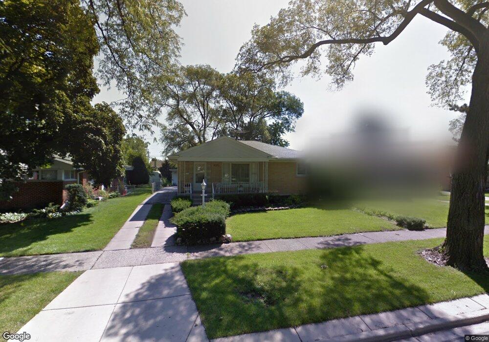
2105 Bristol Ave Westchester, IL 60154
Estimated Value: $290,000 - $332,000
2
Beds
1
Bath
1,089
Sq Ft
$289/Sq Ft
Est. Value
About This Home
This home is located at 2105 Bristol Ave, Westchester, IL 60154 and is currently estimated at $314,229, approximately $288 per square foot. 2105 Bristol Ave is a home located in Cook County with nearby schools including Westchester Primary School, Westchester Intermediate School, and Westchester Middle School.
Ownership History
Date
Name
Owned For
Owner Type
Purchase Details
Closed on
May 18, 2010
Sold by
Harris Robert F and Senuta Antoinette
Bought by
Chicago Title Land Trust Company and Trust #8002355074
Current Estimated Value
Purchase Details
Closed on
Apr 17, 2009
Sold by
Lejcar William J
Bought by
Senuta Antoinette
Purchase Details
Closed on
May 16, 2007
Sold by
Orr David D
Bought by
Suburban Tax Lien
Create a Home Valuation Report for This Property
The Home Valuation Report is an in-depth analysis detailing your home's value as well as a comparison with similar homes in the area
Home Values in the Area
Average Home Value in this Area
Purchase History
| Date | Buyer | Sale Price | Title Company |
|---|---|---|---|
| Chicago Title Land Trust Company | -- | Chicago Title Land Trust Co | |
| Senuta Antoinette | $184,000 | None Available | |
| Suburban Tax Lien | -- | None Available |
Source: Public Records
Tax History Compared to Growth
Tax History
| Year | Tax Paid | Tax Assessment Tax Assessment Total Assessment is a certain percentage of the fair market value that is determined by local assessors to be the total taxable value of land and additions on the property. | Land | Improvement |
|---|---|---|---|---|
| 2024 | $1,252 | $25,000 | $4,655 | $20,345 |
| 2023 | $1,501 | $25,000 | $4,655 | $20,345 |
| 2022 | $1,501 | $20,100 | $3,990 | $16,110 |
| 2021 | $1,415 | $20,100 | $3,990 | $16,110 |
| 2020 | $1,288 | $20,100 | $3,990 | $16,110 |
| 2019 | $1,394 | $20,394 | $3,657 | $16,737 |
| 2018 | $1,378 | $20,394 | $3,657 | $16,737 |
| 2017 | $1,328 | $20,394 | $3,657 | $16,737 |
| 2016 | $3,728 | $17,064 | $3,325 | $13,739 |
| 2015 | $2,199 | $17,064 | $3,325 | $13,739 |
| 2014 | $3,045 | $17,064 | $3,325 | $13,739 |
| 2013 | $4,337 | $19,883 | $3,325 | $16,558 |
Source: Public Records
Map
Nearby Homes
- 1900 Manchester Ave
- 1840 Gardner Rd
- 1907 Suffolk Ave
- 1813 Manchester Ave
- 1816 Manchester Ave
- 1847 Newcastle Ave
- 213 Pine Tree Ln
- 1500 Bristol Ave
- 205 Huntington Ct
- 1803 Balmoral Ave
- 1406 Portsmouth Ave
- 4 Garden Dr Unit 4
- 10324 Wight St
- 2246 S 18th Ave
- 1427 Homestead Rd Unit H
- 2204 W 14th St
- 1518 Cleveland Ave
- 1908 Belleview Ave
- 2440 S 20th Ave
- 1436 Kemman Ave
- 2101 Bristol Ave
- 2113 Bristol Ave
- 2104 Gardner Rd
- 2100 Gardner Rd
- 2110 Gardner Rd
- 2119 Bristol Ave
- 1957 Bristol Ave
- 2114 Gardner Rd
- 2125 Bristol Ave
- 2104 Bristol Ave
- 2108 Bristol Ave
- 2100 Bristol Ave
- 1958 Gardner Rd
- 1958 Gardner Rd
- 2112 Bristol Ave
- 1951 Bristol Ave
- 2118 Gardner Rd
- 2118 Gardner Rd
- 2118 Bristol Ave