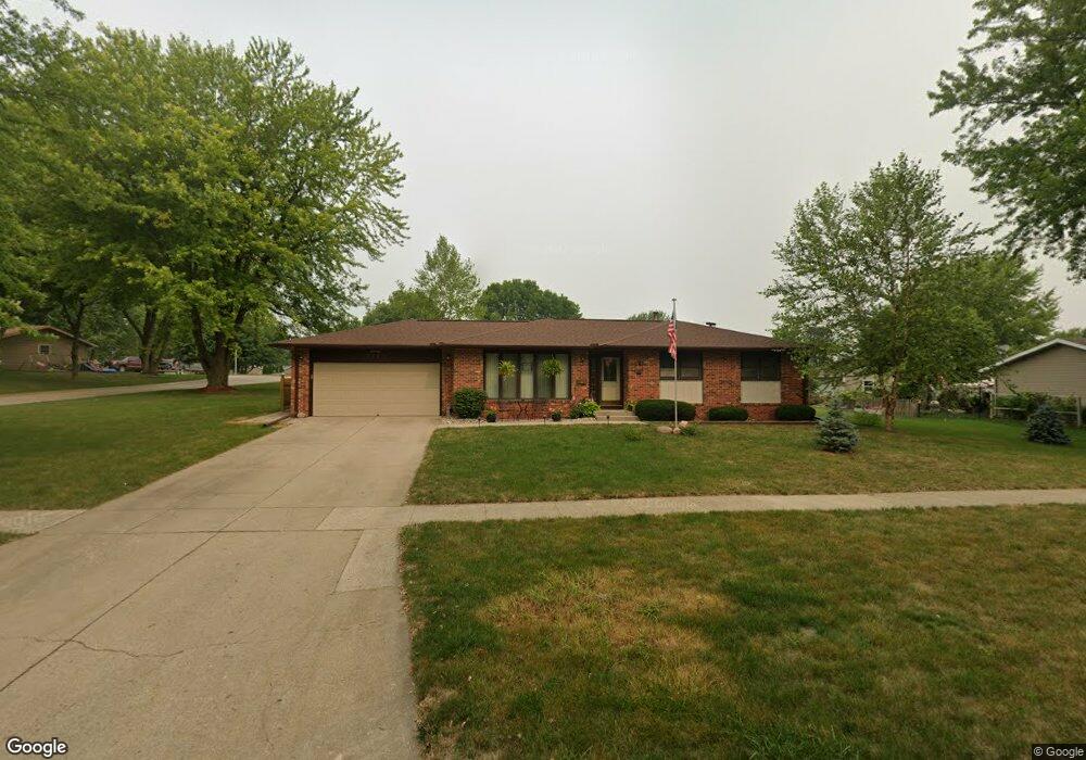
2105 N Main St Carroll, IA 51401
Estimated Value: $213,000 - $281,000
3
Beds
3
Baths
1,244
Sq Ft
$207/Sq Ft
Est. Value
About This Home
This home is located at 2105 N Main St, Carroll, IA 51401 and is currently estimated at $257,456, approximately $206 per square foot. 2105 N Main St is a home with nearby schools including Fairview Elementary School, Adams Elementary School, and Carroll Middle School.
Ownership History
Date
Name
Owned For
Owner Type
Purchase Details
Closed on
Oct 14, 2020
Sold by
Lane Steven E and Lane Robyn L
Bought by
Horn Wesley R and Horn Judy A
Current Estimated Value
Home Financials for this Owner
Home Financials are based on the most recent Mortgage that was taken out on this home.
Original Mortgage
$50,000
Outstanding Balance
$44,391
Interest Rate
2.8%
Mortgage Type
New Conventional
Estimated Equity
$213,065
Create a Home Valuation Report for This Property
The Home Valuation Report is an in-depth analysis detailing your home's value as well as a comparison with similar homes in the area
Home Values in the Area
Average Home Value in this Area
Purchase History
| Date | Buyer | Sale Price | Title Company |
|---|---|---|---|
| Horn Wesley R | $203,000 | None Available |
Source: Public Records
Mortgage History
| Date | Status | Borrower | Loan Amount |
|---|---|---|---|
| Open | Horn Wesley R | $50,000 |
Source: Public Records
Tax History Compared to Growth
Tax History
| Year | Tax Paid | Tax Assessment Tax Assessment Total Assessment is a certain percentage of the fair market value that is determined by local assessors to be the total taxable value of land and additions on the property. | Land | Improvement |
|---|---|---|---|---|
| 2025 | $2,420 | $231,920 | $35,650 | $196,270 |
| 2024 | $2,420 | $205,720 | $35,650 | $170,070 |
| 2023 | $2,475 | $205,720 | $35,650 | $170,070 |
| 2022 | $2,346 | $170,840 | $34,570 | $136,270 |
| 2021 | $2,346 | $170,840 | $34,570 | $136,270 |
| 2020 | $2,406 | $170,840 | $34,570 | $136,270 |
| 2019 | $2,404 | $170,840 | $34,570 | $136,270 |
| 2018 | $2,262 | $170,840 | $34,570 | $136,270 |
| 2017 | $2,262 | $166,599 | $30,645 | $135,954 |
| 2016 | $2,104 | $155,700 | $0 | $0 |
| 2015 | $2,104 | $146,420 | $0 | $0 |
| 2014 | $1,948 | $146,420 | $0 | $0 |
Source: Public Records
Map
Nearby Homes
- 328 W 21st St
- 2017 N West St
- 265 Perch St
- 1601 Pike Ave
- 2340 Skyline Dr
- 611 W 21st St
- 222 Bass St
- 1844 Benjamin St
- 260 Bass St
- 746 Granada Rd
- 1852 Quint Ave
- 1408 N Adams St
- 711 W 21st St
- 226 W 13th St
- 638 Capistrano Ave
- 1217 N Main St
- 621 Alta Vista Dr
- 1620 Edgewood Dr
- 1810 Crestview Dr
- 1608 Salinger Ave
- 112 W 21st St
- 2117 N Main St
- 113 W Randall Rd
- 2051 N Main St
- 123 W Randall Rd
- 123 W 21st St
- 120 W 21st St
- 111 Lois Ave
- 133 W Randall Rd
- 2050 N Main St
- 2039 N Main St
- 110 E Randall Rd
- 104 W Randall Rd
- 110 W Randall Rd
- 133 W 21st St
- 120 W Randall Rd
- 141 W Randall Rd
- 2040 N Main St
- 118 Lois Ave
- 105 E Randall Rd