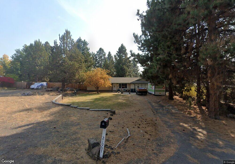
21067 Thomas Dr Bend, OR 97702
Larkspur NeighborhoodEstimated Value: $555,554 - $587,000
3
Beds
2
Baths
1,402
Sq Ft
$411/Sq Ft
Est. Value
About This Home
This home is located at 21067 Thomas Dr, Bend, OR 97702 and is currently estimated at $576,889, approximately $411 per square foot. 21067 Thomas Dr is a home located in Deschutes County with nearby schools including Bear Creek Elementary School, Pilot Butte Middle School, and Bend Senior High School.
Ownership History
Date
Name
Owned For
Owner Type
Purchase Details
Closed on
Oct 30, 2021
Sold by
Alan E Damon Trust and Damon Lara D
Bought by
Damon Lara D and Johnson Lisa M
Current Estimated Value
Home Financials for this Owner
Home Financials are based on the most recent Mortgage that was taken out on this home.
Original Mortgage
$856,500
Outstanding Balance
$772,343
Interest Rate
2.36%
Mortgage Type
FHA
Estimated Equity
-$195,454
Create a Home Valuation Report for This Property
The Home Valuation Report is an in-depth analysis detailing your home's value as well as a comparison with similar homes in the area
Home Values in the Area
Average Home Value in this Area
Purchase History
| Date | Buyer | Sale Price | Title Company |
|---|---|---|---|
| Damon Lara D | -- | None Listed On Document |
Source: Public Records
Mortgage History
| Date | Status | Borrower | Loan Amount |
|---|---|---|---|
| Open | Damon Lara D | $856,500 |
Source: Public Records
Tax History
| Year | Tax Paid | Tax Assessment Tax Assessment Total Assessment is a certain percentage of the fair market value that is determined by local assessors to be the total taxable value of land and additions on the property. | Land | Improvement |
|---|---|---|---|---|
| 2025 | $3,055 | $180,830 | -- | -- |
| 2024 | $2,940 | $175,570 | -- | -- |
| 2023 | $2,725 | $170,460 | $0 | $0 |
| 2022 | $2,543 | $160,680 | $0 | $0 |
| 2021 | $2,546 | $156,000 | $0 | $0 |
| 2020 | $2,416 | $156,000 | $0 | $0 |
| 2019 | $2,349 | $151,460 | $0 | $0 |
| 2018 | $2,282 | $147,050 | $0 | $0 |
| 2017 | $2,215 | $142,770 | $0 | $0 |
| 2016 | $2,113 | $138,620 | $0 | $0 |
| 2015 | $2,054 | $134,590 | $0 | $0 |
| 2014 | $1,994 | $130,670 | $0 | $0 |
Source: Public Records
Map
Nearby Homes
- 61813 Azalia Place
- 21024 SE Azalia Ave
- 61839 Avonlea Cir
- 301 SE Springer Ct
- 61725 SE Daly Estates Rd
- 61839 SE 27th St
- 21177 Ritz Place
- 21182 Desert Skies Place
- 61683 Daly Estates Dr
- 21191 SE Kayla Ct
- 789 SE Airpark Dr
- 61632 Pettigrew Rd Unit 18
- 61635 Daly Estates Dr Unit 17
- 61620 Daly Estates Dr
- 21116 SE Reed Market Rd
- 21130 SE Reed Market Rd
- 161 SE Rice Way
- 1761 SE Ironwood Ct
- 98 NE Telima Ln
- 62062 Dean Swift Rd
- 21059 Thomas Dr
- 21075 Thomas Dr
- 21049 Thomas Dr
- 21070 Azalia Ave
- 21083 Thomas Dr
- 21070 Thomas Dr
- 21062 Thomas Dr
- 21048 Azalia Ave
- 21052 Thomas Dr
- 21082 Azalia Ave
- 21069 Azalia Ave
- 21086 Thomas Dr
- 21041 Thomas Dr
- 21093 Thomas Dr
- 21057 Azalia Ave
- 21044 Thomas Dr
- 21081 Azalia Ave
- 21094 Thomas Dr
- 21036 SE Azalia Ave
Your Personal Tour Guide
Ask me questions while you tour the home.