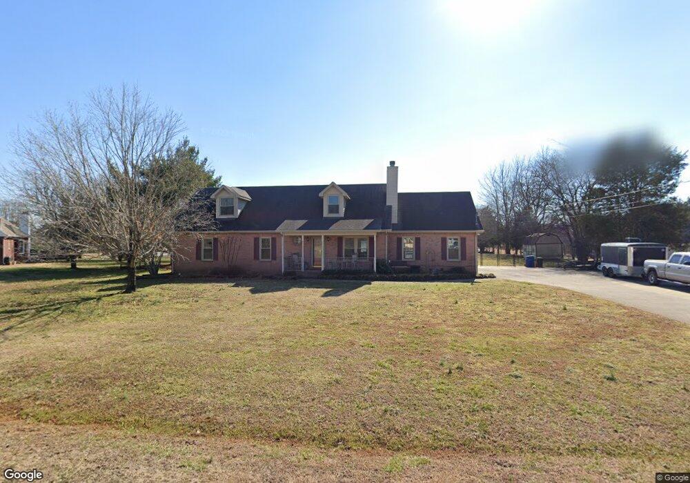
2107 Wood Ridge St Murfreesboro, TN 37128
Estimated Value: $331,794 - $394,000
--
Bed
2
Baths
1,372
Sq Ft
$269/Sq Ft
Est. Value
About This Home
This home is located at 2107 Wood Ridge St, Murfreesboro, TN 37128 and is currently estimated at $368,699, approximately $268 per square foot. 2107 Wood Ridge St is a home located in Rutherford County with nearby schools including Barfield Elementary School, Rockvale Middle School, and Rockvale High School.
Ownership History
Date
Name
Owned For
Owner Type
Purchase Details
Closed on
Feb 15, 2008
Sold by
Randy Porter
Bought by
Malone James S
Current Estimated Value
Home Financials for this Owner
Home Financials are based on the most recent Mortgage that was taken out on this home.
Original Mortgage
$147,150
Outstanding Balance
$90,809
Interest Rate
5.65%
Mortgage Type
Purchase Money Mortgage
Estimated Equity
$277,890
Purchase Details
Closed on
Aug 9, 1994
Sold by
Brashear Russell A
Bought by
Randy Porter
Create a Home Valuation Report for This Property
The Home Valuation Report is an in-depth analysis detailing your home's value as well as a comparison with similar homes in the area
Home Values in the Area
Average Home Value in this Area
Purchase History
| Date | Buyer | Sale Price | Title Company |
|---|---|---|---|
| Malone James S | $157,000 | -- | |
| Randy Porter | -- | -- |
Source: Public Records
Mortgage History
| Date | Status | Borrower | Loan Amount |
|---|---|---|---|
| Open | Randy Porter | $147,150 |
Source: Public Records
Tax History Compared to Growth
Tax History
| Year | Tax Paid | Tax Assessment Tax Assessment Total Assessment is a certain percentage of the fair market value that is determined by local assessors to be the total taxable value of land and additions on the property. | Land | Improvement |
|---|---|---|---|---|
| 2025 | $1,347 | $71,775 | $13,750 | $58,025 |
| 2024 | $1,347 | $71,775 | $13,750 | $58,025 |
| 2023 | $1,341 | $71,500 | $13,750 | $57,750 |
| 2022 | $1,156 | $71,500 | $13,750 | $57,750 |
| 2021 | $1,202 | $54,175 | $13,750 | $40,425 |
| 2020 | $1,202 | $54,175 | $13,750 | $40,425 |
| 2019 | $1,202 | $54,175 | $13,750 | $40,425 |
| 2018 | $1,137 | $54,175 | $0 | $0 |
| 2017 | $1,001 | $37,350 | $0 | $0 |
| 2016 | $1,001 | $37,350 | $0 | $0 |
| 2015 | $1,001 | $37,350 | $0 | $0 |
| 2014 | $929 | $37,350 | $0 | $0 |
| 2013 | -- | $34,175 | $0 | $0 |
Source: Public Records
Map
Nearby Homes
- 1856 Orchard Park Dr
- 2165 Barringer Ln
- 2189 Barringer Ln
- 2203 Barringer Ln
- 2174 Barringer Ln
- 2223 Barringer Ln
- 2219 Barringer Ln
- 2160 Welltown Ln
- 2192 Welltown Ln
- 2117 Hospitality Ln
- 0 Audubon Ln Unit GTRTBD RTC2905239
- 2207 Hospitality Ln Unit 28B
- 2126 Hospitality Ln
- 1234 Audubon Ln
- 36 Audubon Ln
- 35 Audubon Ln
- 2015 Audubon Ln
- 2205 Cason Ln
- 57 Audubon Ln
- 2138 Cason Ln
- 2103 Wood Ridge St
- 2208 Sassafras Dr
- 2108 Wood Ridge St
- 2111 Wood Ridge St
- 2104 Wood Ridge St
- 2212 Sassafras Dr
- 2207 Sassafras Dr
- 2216 Sassafras Dr
- 2132 Sassafras Dr
- 2213 Sassafras Dr
- 2220 Sassafras Dr
- 2016 Wood Ridge St
- 2217 Sassafras Dr
- 2128 Sassafras Dr
- 2133 Sassafras Dr
- 2224 Sassafras Dr
- 2115 Wood Ridge St
- 2013 Wood Ridge St
- 106 Lilac Ct
- 2221 Sassafras Dr