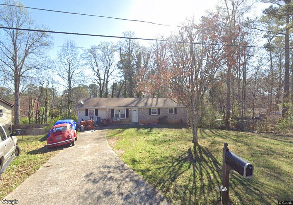
2109 Mulkey Rd SW Marietta, GA 30008
Estimated Value: $276,000 - $313,627
3
Beds
2
Baths
1,375
Sq Ft
$215/Sq Ft
Est. Value
About This Home
This home is located at 2109 Mulkey Rd SW, Marietta, GA 30008 and is currently estimated at $295,157, approximately $214 per square foot. 2109 Mulkey Rd SW is a home located in Cobb County with nearby schools including Sanders Elementary School, Garrett Middle School, and South Cobb High School.
Ownership History
Date
Name
Owned For
Owner Type
Purchase Details
Closed on
Aug 10, 2007
Sold by
Kaushal Inc
Bought by
Todman Keith
Current Estimated Value
Home Financials for this Owner
Home Financials are based on the most recent Mortgage that was taken out on this home.
Original Mortgage
$128,000
Outstanding Balance
$80,255
Interest Rate
6.56%
Mortgage Type
New Conventional
Estimated Equity
$214,902
Purchase Details
Closed on
Dec 5, 2006
Sold by
Gates Mark L
Bought by
Kaushal Inc
Create a Home Valuation Report for This Property
The Home Valuation Report is an in-depth analysis detailing your home's value as well as a comparison with similar homes in the area
Home Values in the Area
Average Home Value in this Area
Purchase History
| Date | Buyer | Sale Price | Title Company |
|---|---|---|---|
| Todman Keith | $128,000 | -- | |
| Kaushal Inc | $71,320 | -- |
Source: Public Records
Mortgage History
| Date | Status | Borrower | Loan Amount |
|---|---|---|---|
| Open | Todman Keith | $128,000 |
Source: Public Records
Tax History Compared to Growth
Tax History
| Year | Tax Paid | Tax Assessment Tax Assessment Total Assessment is a certain percentage of the fair market value that is determined by local assessors to be the total taxable value of land and additions on the property. | Land | Improvement |
|---|---|---|---|---|
| 2025 | $3,629 | $120,448 | $26,000 | $94,448 |
| 2024 | $3,632 | $120,448 | $26,000 | $94,448 |
| 2023 | $3,283 | $108,896 | $26,000 | $82,896 |
| 2022 | $2,840 | $93,588 | $16,000 | $77,588 |
| 2021 | $1,690 | $55,676 | $13,200 | $42,476 |
| 2020 | $1,564 | $51,528 | $12,000 | $39,528 |
| 2019 | $1,267 | $41,748 | $12,000 | $29,748 |
| 2018 | $1,267 | $41,748 | $12,000 | $29,748 |
| 2017 | $891 | $31,004 | $9,600 | $21,404 |
| 2016 | $891 | $31,004 | $9,600 | $21,404 |
| 2015 | $754 | $25,584 | $7,200 | $18,384 |
| 2014 | $760 | $25,584 | $0 | $0 |
Source: Public Records
Map
Nearby Homes
- 3782 Mulkey Cir SW Unit 18
- 2058 Mulkey Rd SW
- 3530 Argent Way
- 3559 Ashley Station Dr SW
- 1763 Merry Oak Rd SW
- 3580 Main Station Dr SW
- 1905 Azure Grove Ct
- 2289 Clare Cottage Cove SW
- 3726 Willingham Run SW
- 3722 Willingham Run SW
- 3730 Willingham Run SW
- Reynolds Plan at Hampton Trace
- Forsyth Plan at Hampton Trace
- 1810 Killarney Dr SW
- 1745 Lansmere St SW
- 1688 Lansmere St SW
- 3661 Willingham Run SW
- 1570 Halbrook Place SW
- 1717 Lansmere St SW
- 1713 Lansmere St SW
- 2107 Mulkey Rd SW
- 2111 Mulkey Rd SW
- 3682 Merry Oak Dr SW
- 3690 Merry Oak Dr SW Unit 2
- 2105 Mulkey Rd SW
- 3674 Merry Oak Dr SW
- 2106 Mulkey Rd SW
- 1988 Calvary Hill Ct SW
- 1946 Calvary Hill Ct SW Unit 2
- 3668 Merry Oak Dr SW Unit 2
- 2104 Mulkey Rd SW
- 3700 Merry Oak Dr SW Unit 2
- 2103 Mulkey Rd SW
- 3660 Merry Oak Dr SW
- 1975 Calvary Hill Ct SW
- 2010 Calvary Hill Ct SW
- 3681 Merry Oak Dr SW Unit 2
- 2101 Mulkey Rd SW Unit RO
- 2101 Mulkey Rd SW
- 3675 Merry Oak Dr SW