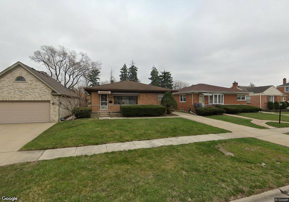
2109 Norfolk Ave Westchester, IL 60154
Estimated Value: $328,000 - $371,000
3
Beds
2
Baths
1,258
Sq Ft
$282/Sq Ft
Est. Value
About This Home
This home is located at 2109 Norfolk Ave, Westchester, IL 60154 and is currently estimated at $354,168, approximately $281 per square foot. 2109 Norfolk Ave is a home located in Cook County with nearby schools including Westchester Primary School, Westchester Intermediate School, and Westchester Middle School.
Ownership History
Date
Name
Owned For
Owner Type
Purchase Details
Closed on
Jul 29, 2022
Sold by
Moline Brian P and Moline Lisa M
Bought by
Lisa Moline And Brian Moline Joint Tenancy Tr
Current Estimated Value
Purchase Details
Closed on
Nov 5, 2012
Sold by
Moline Brian P
Bought by
Moline Brian P
Create a Home Valuation Report for This Property
The Home Valuation Report is an in-depth analysis detailing your home's value as well as a comparison with similar homes in the area
Home Values in the Area
Average Home Value in this Area
Purchase History
| Date | Buyer | Sale Price | Title Company |
|---|---|---|---|
| Lisa Moline And Brian Moline Joint Tenancy Tr | -- | None Listed On Document | |
| Moline Brian P | -- | None Available |
Source: Public Records
Tax History Compared to Growth
Tax History
| Year | Tax Paid | Tax Assessment Tax Assessment Total Assessment is a certain percentage of the fair market value that is determined by local assessors to be the total taxable value of land and additions on the property. | Land | Improvement |
|---|---|---|---|---|
| 2024 | $7,611 | $29,000 | $4,655 | $24,345 |
| 2023 | $6,327 | $29,000 | $4,655 | $24,345 |
| 2022 | $6,327 | $20,738 | $3,990 | $16,748 |
| 2021 | $6,124 | $20,737 | $3,990 | $16,747 |
| 2020 | $5,983 | $20,737 | $3,990 | $16,747 |
| 2019 | $6,185 | $21,894 | $3,657 | $18,237 |
| 2018 | $6,104 | $21,894 | $3,657 | $18,237 |
| 2017 | $5,987 | $21,894 | $3,657 | $18,237 |
| 2016 | $5,449 | $18,684 | $3,325 | $15,359 |
| 2015 | $5,379 | $18,684 | $3,325 | $15,359 |
| 2014 | $5,255 | $18,684 | $3,325 | $15,359 |
| 2013 | $5,235 | $20,823 | $3,325 | $17,498 |
Source: Public Records
Map
Nearby Homes
- 1900 Manchester Ave
- 1907 Suffolk Ave
- 1932 Newcastle Ave
- 1840 Gardner Rd
- 2128 Hull Ave
- 1623 Manchester Ave
- 1601 Bristol Ave
- 1500 Bristol Ave
- 1433 Bristol Ave
- 1542 Homestead Rd
- 1427 Homestead Rd Unit H
- 1518 Cleveland Ave
- 10072 Drury Ln
- 10511 Preston St
- 10630 W Cermak Rd Unit 2E
- 10551 Essex St
- 10567 Waterford Dr
- 1860 Buckingham Ave
- 2320 S 22nd Ave
- 2330 S 17th Ave
- 2105 Norfolk Ave
- 2113 Norfolk Ave
- 2101 Norfolk Ave
- 2119 Norfolk Ave
- 2108 Manchester Ave
- 2104 Manchester Ave
- 2112 Manchester Ave
- 2125 Norfolk Ave
- 2100 Manchester Ave
- 2118 Manchester Ave
- 2131 Norfolk Ave
- 2124 Manchester Ave
- 2104 Norfolk Ave
- 2112 Norfolk Ave
- 2102 Norfolk Ave
- 2118 Norfolk Ave
- 2134 Manchester Ave
- 2137 Norfolk Ave