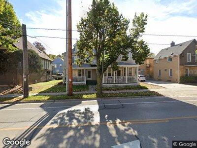
2109 University Ave Madison, WI 53726
Regent NeighborhoodEstimated Value: $935,347 - $1,019,000
7
Beds
4
Baths
3,065
Sq Ft
$315/Sq Ft
Est. Value
About This Home
This home is located at 2109 University Ave, Madison, WI 53726 and is currently estimated at $965,837, approximately $315 per square foot. 2109 University Ave is a home located in Dane County with nearby schools including Randall Elementary School, Hamilton Middle School, and West High School.
Ownership History
Date
Name
Owned For
Owner Type
Purchase Details
Closed on
Apr 25, 2024
Sold by
Deluxe Properties Llc
Bought by
219 Properties Llc
Current Estimated Value
Purchase Details
Closed on
Dec 29, 2010
Sold by
Struck Michael C
Bought by
Deluxe Properties Llc
Home Financials for this Owner
Home Financials are based on the most recent Mortgage that was taken out on this home.
Original Mortgage
$351,200
Interest Rate
4.87%
Mortgage Type
Commercial
Create a Home Valuation Report for This Property
The Home Valuation Report is an in-depth analysis detailing your home's value as well as a comparison with similar homes in the area
Home Values in the Area
Average Home Value in this Area
Purchase History
| Date | Buyer | Sale Price | Title Company |
|---|---|---|---|
| 219 Properties Llc | $925,000 | Fidelity National Title | |
| Deluxe Properties Llc | -- | None Available | |
| Struck Michael C | $439,000 | None Available |
Source: Public Records
Mortgage History
| Date | Status | Borrower | Loan Amount |
|---|---|---|---|
| Previous Owner | Deluxe Properties Llc | $342,000 | |
| Previous Owner | Struck Michael C | $351,200 |
Source: Public Records
Tax History Compared to Growth
Tax History
| Year | Tax Paid | Tax Assessment Tax Assessment Total Assessment is a certain percentage of the fair market value that is determined by local assessors to be the total taxable value of land and additions on the property. | Land | Improvement |
|---|---|---|---|---|
| 2024 | $31,344 | $890,000 | $220,000 | $670,000 |
| 2023 | $14,694 | $808,700 | $200,000 | $608,700 |
| 2021 | $12,104 | $567,000 | $164,000 | $403,000 |
| 2020 | $12,660 | $567,000 | $164,000 | $403,000 |
| 2019 | $12,102 | $540,000 | $164,000 | $376,000 |
| 2018 | $11,475 | $513,000 | $163,400 | $349,600 |
| 2017 | $11,889 | $513,000 | $163,400 | $349,600 |
| 2016 | $11,642 | $489,000 | $148,400 | $340,600 |
| 2015 | $11,423 | $452,000 | $148,400 | $303,600 |
| 2014 | $10,873 | $452,000 | $148,400 | $303,600 |
| 2013 | $10,037 | $439,000 | $148,400 | $290,600 |
Source: Public Records
Map
Nearby Homes
- 2140 Kendall Ave
- 2206 van Hise Ave
- 113 N Spooner St
- 2248 Rowley Ave
- 1731 Regent St
- 2321 Regent St
- 2629 Mason St
- 508 Edgewood Ave
- 2229 Fox Ave
- 2232 W Lawn Ave
- 1520 Chandler St
- 1922 Adams St
- 1505 Adams St
- 2434 Fox Ave
- 2332 Monroe St
- 2907 Mckinley St
- 2416 Gregory St
- 2809 Columbia Rd
- 1112 Mound St Unit D
- 2538 Commonwealth Ave
- 2109 University Ave
- 2107 University Ave
- 2107-09 University
- 302 Forest St
- 2106 Kendall Ave Unit 12
- 2106 Kendall Ave Unit 2108
- 2110 Kendall Ave Unit 1
- 2110 University Ave
- 2110 University Ave
- 2102 Kendall Ave
- 2114 Kendall Ave
- 2037 University Ave
- 311 Forest St
- 311 Forest St Unit 2F
- 311 Forest St Unit 2E
- 311 Forest St Unit 2D
- 311 Forest St Unit 2C
- 311 Forest St Unit 2B
- 311 Forest St Unit 2A
- 309 Forest St
