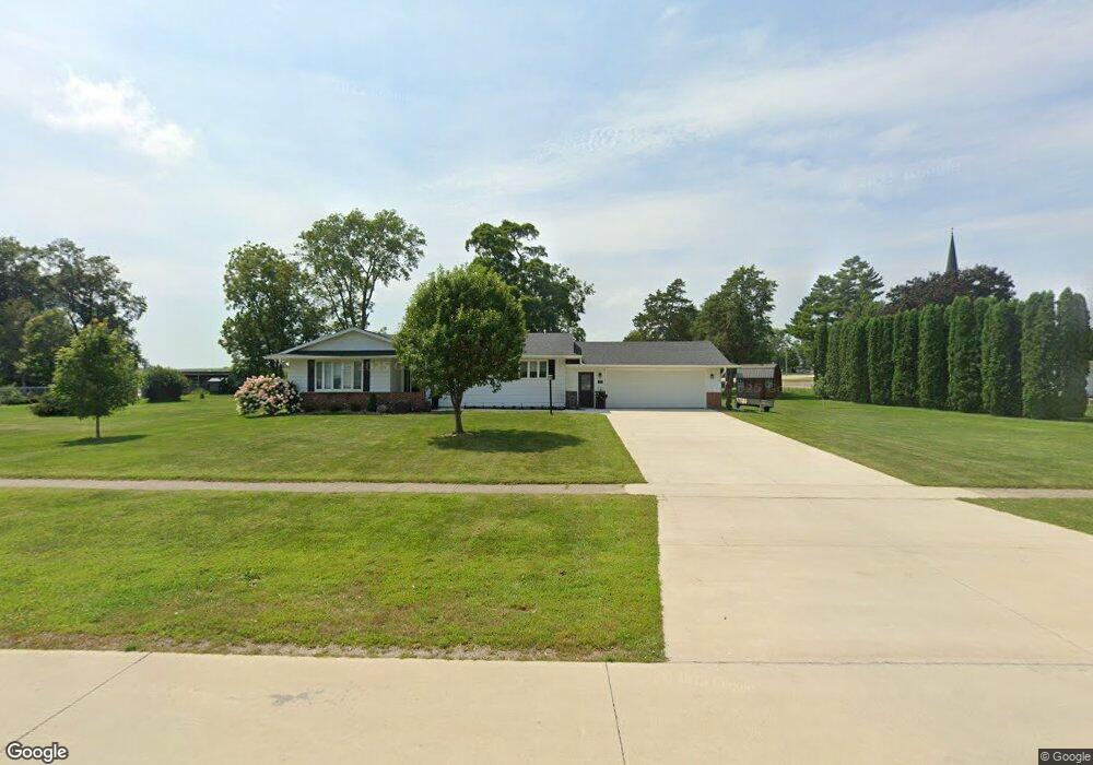
211 3rd Ave NW Waucoma, IA 52171
Estimated Value: $98,000 - $180,661
2
Beds
2
Baths
1,320
Sq Ft
$111/Sq Ft
Est. Value
About This Home
This home is located at 211 3rd Ave NW, Waucoma, IA 52171 and is currently estimated at $147,165, approximately $111 per square foot. 211 3rd Ave NW is a home located in Fayette County with nearby schools including Turkey Valley Elementary School and Turkey Valley Junior/Senior High School.
Ownership History
Date
Name
Owned For
Owner Type
Purchase Details
Closed on
Jun 13, 2014
Sold by
Mihm Leslie
Bought by
Wenthold Vanessa K
Current Estimated Value
Home Financials for this Owner
Home Financials are based on the most recent Mortgage that was taken out on this home.
Original Mortgage
$72,000
Outstanding Balance
$22,417
Interest Rate
4.18%
Mortgage Type
New Conventional
Estimated Equity
$124,748
Create a Home Valuation Report for This Property
The Home Valuation Report is an in-depth analysis detailing your home's value as well as a comparison with similar homes in the area
Purchase History
| Date | Buyer | Sale Price | Title Company |
|---|---|---|---|
| Wenthold Vanessa K | $80,000 | None Available |
Source: Public Records
Mortgage History
| Date | Status | Borrower | Loan Amount |
|---|---|---|---|
| Open | Wenthold Vanessa K | $72,000 |
Source: Public Records
Tax History
| Year | Tax Paid | Tax Assessment Tax Assessment Total Assessment is a certain percentage of the fair market value that is determined by local assessors to be the total taxable value of land and additions on the property. | Land | Improvement |
|---|---|---|---|---|
| 2025 | $2,072 | $155,600 | $15,250 | $140,350 |
| 2024 | $2,072 | $138,880 | $15,250 | $123,630 |
| 2023 | $1,682 | $138,880 | $15,250 | $123,630 |
| 2022 | $1,558 | $111,190 | $12,710 | $98,480 |
| 2021 | $1,558 | $111,190 | $12,710 | $98,480 |
| 2020 | $1,680 | $116,700 | $7,420 | $109,280 |
| 2019 | $1,494 | $99,560 | $0 | $0 |
| 2018 | $1,448 | $99,560 | $0 | $0 |
| 2017 | $1,564 | $97,480 | $0 | $0 |
| 2016 | $1,580 | $97,480 | $0 | $0 |
| 2015 | $1,580 | $0 | $0 | $0 |
| 2014 | $1,580 | $0 | $0 | $0 |
Source: Public Records
Map
Nearby Homes
- 3355 220th St
- 115 S Main St
- 306 N Brush St
- 2240 Roanoke Ave
- 0 Unit NBR20260667
- 213 W Main St
- 2584 Wild Rose Rd
- 1882 Timber Rd
- Lot 3 Schult Ridge & Lions Rd
- Lot 2 Schult Ridge & Lions Rd
- Lot 4 Schult Ridge & Lions Rd
- Lot 1 Schult Ridge & Lions Rd
- Lot 5 Schult Ridge & Lions Rd
- Lot 6 Schult Ridge & Lions Rd
- 402 S Washington Ave
- 119 Pearl St
- 0 Old Borax Rd Unit NBR20255211
- 3074 Union Ave
- 15453 200th St
- 302 S West St
Your Personal Tour Guide
Ask me questions while you tour the home.