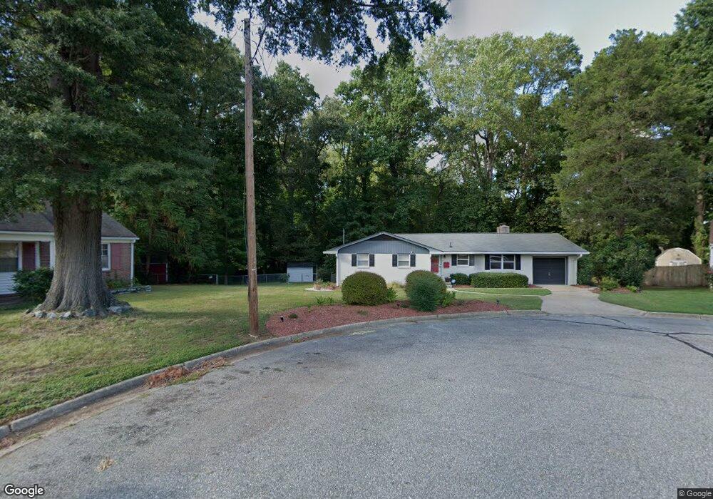
211 Alberta Dr Newport News, VA 23602
Charles NeighborhoodEstimated Value: $290,000 - $301,000
3
Beds
2
Baths
1,307
Sq Ft
$227/Sq Ft
Est. Value
About This Home
This home is located at 211 Alberta Dr, Newport News, VA 23602 and is currently estimated at $296,121, approximately $226 per square foot. 211 Alberta Dr is a home located in Newport News City with nearby schools including B.C. Charles Elementary School, Ethel M. Gildersleeve Middle School, and Menchville High School.
Ownership History
Date
Name
Owned For
Owner Type
Purchase Details
Closed on
Oct 30, 2018
Sold by
Padro Xenlee and Zink David M
Bought by
Wilcox Constance L
Current Estimated Value
Home Financials for this Owner
Home Financials are based on the most recent Mortgage that was taken out on this home.
Original Mortgage
$172,137
Outstanding Balance
$151,360
Interest Rate
4.8%
Mortgage Type
VA
Estimated Equity
$144,761
Purchase Details
Closed on
Nov 8, 2013
Sold by
Pettiss Carol C
Bought by
Padro Xenlee
Purchase Details
Closed on
Nov 23, 1998
Sold by
Bullock Randall A
Bought by
Pettiss Carol C
Home Financials for this Owner
Home Financials are based on the most recent Mortgage that was taken out on this home.
Original Mortgage
$87,820
Interest Rate
6.68%
Create a Home Valuation Report for This Property
The Home Valuation Report is an in-depth analysis detailing your home's value as well as a comparison with similar homes in the area
Home Values in the Area
Average Home Value in this Area
Purchase History
| Date | Buyer | Sale Price | Title Company |
|---|---|---|---|
| Wilcox Constance L | $184,900 | Attorney | |
| Padro Xenlee | $165,000 | -- | |
| Pettiss Carol C | $89,900 | -- |
Source: Public Records
Mortgage History
| Date | Status | Borrower | Loan Amount |
|---|---|---|---|
| Open | Wilcox Constance L | $172,137 | |
| Previous Owner | Pettiss Carol C | $87,820 |
Source: Public Records
Tax History Compared to Growth
Tax History
| Year | Tax Paid | Tax Assessment Tax Assessment Total Assessment is a certain percentage of the fair market value that is determined by local assessors to be the total taxable value of land and additions on the property. | Land | Improvement |
|---|---|---|---|---|
| 2024 | $3,283 | $278,200 | $60,500 | $217,700 |
| 2023 | $3,155 | $254,900 | $60,500 | $194,400 |
| 2022 | $2,837 | $224,200 | $60,500 | $163,700 |
| 2021 | $2,452 | $201,000 | $55,000 | $146,000 |
| 2020 | $2,377 | $182,800 | $55,000 | $127,800 |
| 2019 | $2,327 | $179,100 | $55,000 | $124,100 |
| 2018 | $2,149 | $164,700 | $55,000 | $109,700 |
| 2017 | $2,110 | $161,500 | $55,000 | $106,500 |
| 2016 | $2,105 | $161,500 | $55,000 | $106,500 |
| 2015 | $2,099 | $161,500 | $55,000 | $106,500 |
| 2014 | $1,817 | $161,500 | $55,000 | $106,500 |
Source: Public Records
Map
Nearby Homes
- 179 Bret Harte Dr
- 239 Yoder Ln
- 140 Lowell Place
- 300 Colony Rd
- 119 Menchville Rd
- 461 Dunmore Dr
- 151 Princess Margaret Dr
- 178 Colony Rd
- 411 Eastwood Dr
- 114 Linbrook Dr
- 474 Dunmore Dr
- 6 Gwynn Cir
- 165 Little John Place
- 109 Fischer Dr
- 432 Eastwood Dr
- 436 Eastwood Dr
- 157 Robinhood Ln
- 203 Tabbs Ln
- 525 Helm Dr
- 9 Lakeview Dr