Estimated Value: $227,288 - $286,000
2
Beds
2
Baths
1,368
Sq Ft
$187/Sq Ft
Est. Value
About This Home
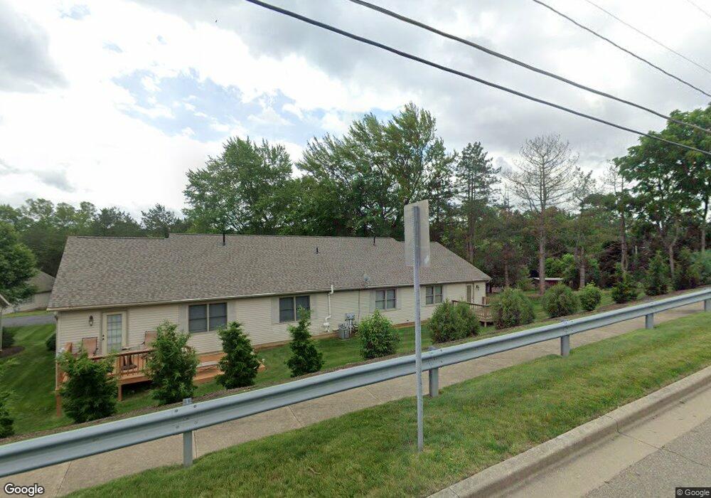
This home is located at 211 Aspen Dr Unit 209, Dover, OH 44622 and is currently estimated at $255,822, approximately $187 per square foot. 211 Aspen Dr Unit 209 is a home located in Tuscarawas County with nearby schools including Dover High School and Tuscarawas Central Catholic Elementary School.
Ownership History
Date
Name
Owned For
Owner Type
Purchase Details
Closed on
Sep 26, 2022
Sold by
Jarr Of Tuscarawas County Ltd
Bought by
Pietro Enrico
Current Estimated Value
Purchase Details
Closed on
Dec 21, 2012
Sold by
M & P Realty Ltd
Bought by
Jarr Of Tuscarawas County Ltd
Purchase Details
Closed on
Jan 30, 2008
Sold by
Rem Construction Inc
Bought by
M & P Realty Ltd
Purchase Details
Closed on
Apr 13, 2005
Sold by
M & P Developemtn Tuscarawas County Ltd
Bought by
Rem Construction Inc
Create a Home Valuation Report for This Property
The Home Valuation Report is an in-depth analysis detailing your home's value as well as a comparison with similar homes in the area
Home Values in the Area
Average Home Value in this Area
Purchase History
| Date | Buyer | Sale Price | Title Company |
|---|---|---|---|
| Pietro Enrico | -- | Connolly Hillyer & Welch Title | |
| Jarr Of Tuscarawas County Ltd | -- | None Available | |
| M & P Realty Ltd | -- | Titlesource | |
| Rem Construction Inc | $35,000 | Camco Title |
Source: Public Records
Tax History
| Year | Tax Paid | Tax Assessment Tax Assessment Total Assessment is a certain percentage of the fair market value that is determined by local assessors to be the total taxable value of land and additions on the property. | Land | Improvement |
|---|---|---|---|---|
| 2024 | $2,731 | $62,300 | $8,500 | $53,800 |
| 2023 | $2,731 | $177,990 | $24,280 | $153,710 |
| 2022 | $2,759 | $62,297 | $8,498 | $53,799 |
| 2021 | $2,653 | $56,270 | $6,223 | $50,047 |
| 2020 | $2,653 | $56,270 | $6,223 | $50,047 |
| 2019 | $2,672 | $56,270 | $6,223 | $50,047 |
| 2018 | $2,394 | $47,680 | $5,270 | $42,410 |
| 2017 | $2,394 | $47,680 | $5,270 | $42,410 |
| 2016 | $2,398 | $47,680 | $5,270 | $42,410 |
| 2014 | $1,957 | $42,130 | $5,270 | $36,860 |
| 2013 | $1,978 | $42,130 | $5,270 | $36,860 |
Source: Public Records
Map
Nearby Homes
- 209 Aspen Dr Unit 209
- 213 E 27th St
- 2815 Race St
- 312 E 21st St
- 0 Ohio Ave Unit 5188259
- 107 W 21st St
- 0 W Ohio Ave
- 3030 N Wooster Ave
- 201 E 12th St
- 1220 Chestnut St
- 212 E 11th St
- 1108 N Walnut St
- 2404 Lowden St NW
- 0 Blacksnake Hill Rd Unit 5190300
- 601 E 4th St
- 715 N Walnut St
- 3156 Josephine St NW
- 1102 E Front St
- 3222 Circleview Dr NW
- 210 W 4th St
- 449 Shawnee Dr
- 445 Shawnee Dr
- 207 Aspen Dr Unit 205
- 205 Aspen Dr Unit 205
- 453 Shawnee Dr
- 439 Shawnee Dr
- 219 Aspen Dr
- 217 Aspen Dr
- 459 Shawnee Dr
- 203 Aspen Dr Unit 203
- 201 Aspen Dr Unit 201
- 215 Aspen Dr
- 501 Shawnee Dr
- 431 Shawnee Dr
- 446 Shawnee Dr
- 213 Aspen Dr Unit 213
- 456 Shawnee Dr
- 505 Shawnee Dr
- 223 Aspen Dr
- 440 Shawnee Dr
Your Personal Tour Guide
Ask me questions while you tour the home.