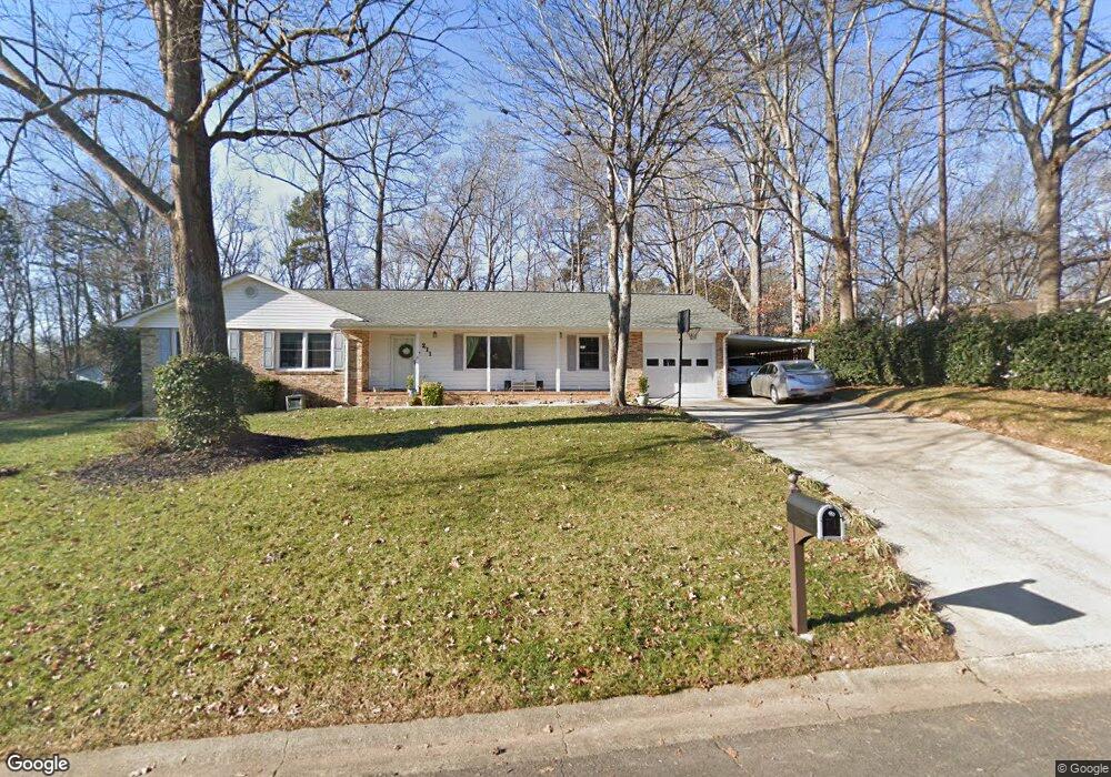
211 Brookside Dr Fort Mill, SC 29715
Springfield NeighborhoodEstimated Value: $338,000 - $380,000
3
Beds
2
Baths
1,450
Sq Ft
$248/Sq Ft
Est. Value
About This Home
This home is located at 211 Brookside Dr, Fort Mill, SC 29715 and is currently estimated at $360,044, approximately $248 per square foot. 211 Brookside Dr is a home located in York County with nearby schools including Fort Mill Elementary School, Fort Mill Middle School, and Nation Ford High School.
Ownership History
Date
Name
Owned For
Owner Type
Purchase Details
Closed on
Aug 9, 2011
Sold by
Cardona John A
Bought by
Cardona John A and Cardona Luz A
Current Estimated Value
Purchase Details
Closed on
Jun 26, 2008
Sold by
Joy Todd N and Joy Amanda B
Bought by
Cardona John A
Home Financials for this Owner
Home Financials are based on the most recent Mortgage that was taken out on this home.
Original Mortgage
$155,500
Outstanding Balance
$98,628
Interest Rate
6.08%
Mortgage Type
VA
Estimated Equity
$261,416
Purchase Details
Closed on
Aug 23, 2006
Sold by
Stepnoski James Allen
Bought by
Joy Amanda B and Joy Todd N
Home Financials for this Owner
Home Financials are based on the most recent Mortgage that was taken out on this home.
Original Mortgage
$26,300
Interest Rate
6.67%
Mortgage Type
Unknown
Create a Home Valuation Report for This Property
The Home Valuation Report is an in-depth analysis detailing your home's value as well as a comparison with similar homes in the area
Home Values in the Area
Average Home Value in this Area
Purchase History
| Date | Buyer | Sale Price | Title Company |
|---|---|---|---|
| Cardona John A | -- | -- | |
| Cardona John A | $155,500 | -- | |
| Joy Amanda B | $131,500 | None Available |
Source: Public Records
Mortgage History
| Date | Status | Borrower | Loan Amount |
|---|---|---|---|
| Open | Cardona John A | $155,500 | |
| Previous Owner | Joy Amanda B | $26,300 | |
| Previous Owner | Joy Amanda B | $105,200 |
Source: Public Records
Tax History
| Year | Tax Paid | Tax Assessment Tax Assessment Total Assessment is a certain percentage of the fair market value that is determined by local assessors to be the total taxable value of land and additions on the property. | Land | Improvement |
|---|---|---|---|---|
| 2025 | $1,268 | $7,221 | $1,189 | $6,032 |
| 2024 | $1,108 | $6,279 | $1,848 | $4,431 |
| 2023 | $1,074 | $6,279 | $1,848 | $4,431 |
| 2022 | $1,065 | $6,279 | $1,848 | $4,431 |
| 2021 | -- | $6,279 | $1,848 | $4,431 |
| 2020 | $1,143 | $6,279 | $0 | $0 |
| 2019 | $1,142 | $5,460 | $0 | $0 |
| 2018 | $1,206 | $5,460 | $0 | $0 |
| 2017 | $1,138 | $5,460 | $0 | $0 |
| 2016 | $1,123 | $5,460 | $0 | $0 |
| 2014 | $787 | $5,460 | $1,600 | $3,860 |
| 2013 | $787 | $5,520 | $1,600 | $3,920 |
Source: Public Records
Map
Nearby Homes
- 105 Redcoat Dr
- 001 Roanoke Dr
- 000 Roanoke Dr
- 002 Roanoke Dr
- 1710 Merritt Rd Unit 3
- 1565 Kennel Rd
- 9786 Verdun Ct
- 3175 Montreaux Valley Dr
- 4008 Pinot Way
- 3534 Jumprock Rd
- 3954 Kestrel Ln
- 6517 Ardenne Way
- 3995 Kestrel Ln
- 2185 Loire Valley Dr
- 336 Newington Ct
- 1123 Regions Blvd
- 10822 Pettus Farm Rd
- 10891 Pettus Rd
- 2289 Tatton Hall Rd
- 711 Mendenhall Ct
- 209 Brookside Dr
- 210 Swamp Fox Dr
- 216 Brookside Dr
- 207 Brookside Dr
- 214 Brookside Dr
- 214 Brookside Dr Unit 8
- 206 Swamp Fox Dr
- 208 Swamp Fox Dr
- 212 Brookside Dr
- 212 Brookside Dr Unit 7
- 298 Swamp Fox Dr
- 205 Brookside Dr
- 213 Swamp Fox Dr
- 211 Swamp Fox Dr
- 217 Swamp Fox Dr
- 215 Swamp Fox Dr
- 209 Swamp Fox Dr
- 210 Brookside Dr
- 203 Brookside Dr
- 300 Swamp Fox Dr
Your Personal Tour Guide
Ask me questions while you tour the home.