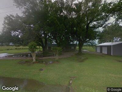
211 C S Harmon Rd Hankamer, TX 77560
Winnie NeighborhoodEstimated Value: $240,240 - $336,000
3
Beds
2
Baths
1,768
Sq Ft
$172/Sq Ft
Est. Value
About This Home
This home is located at 211 C S Harmon Rd, Hankamer, TX 77560 and is currently estimated at $304,560, approximately $172 per square foot. 211 C S Harmon Rd is a home located in Chambers County with nearby schools including Anahuac Elementary School, Anahuac Middle School, and Anahuac High School.
Ownership History
Date
Name
Owned For
Owner Type
Purchase Details
Closed on
Oct 22, 2018
Sold by
Chance Derrick and Chance Mellissa
Bought by
Stearns Lending Llc
Current Estimated Value
Home Financials for this Owner
Home Financials are based on the most recent Mortgage that was taken out on this home.
Original Mortgage
$251,750
Interest Rate
4.5%
Mortgage Type
New Conventional
Purchase Details
Closed on
Mar 10, 2010
Sold by
Malahy Russell A and Schmitt Christy R
Bought by
Chance Derrick and Chance Melissa
Home Financials for this Owner
Home Financials are based on the most recent Mortgage that was taken out on this home.
Original Mortgage
$123,677
Interest Rate
5.25%
Mortgage Type
FHA
Create a Home Valuation Report for This Property
The Home Valuation Report is an in-depth analysis detailing your home's value as well as a comparison with similar homes in the area
Home Values in the Area
Average Home Value in this Area
Purchase History
| Date | Buyer | Sale Price | Title Company |
|---|---|---|---|
| Stearns Lending Llc | -- | None Available | |
| Chance Derrick | -- | None Available |
Source: Public Records
Mortgage History
| Date | Status | Borrower | Loan Amount |
|---|---|---|---|
| Open | Meeks Wesley J | $240,647 | |
| Closed | Stearns Lending Llc | $251,750 | |
| Previous Owner | Chance Derrick | $126,400 | |
| Previous Owner | Chance Derrick | $123,677 |
Source: Public Records
Tax History Compared to Growth
Tax History
| Year | Tax Paid | Tax Assessment Tax Assessment Total Assessment is a certain percentage of the fair market value that is determined by local assessors to be the total taxable value of land and additions on the property. | Land | Improvement |
|---|---|---|---|---|
| 2024 | $42 | $252,000 | $34,440 | $217,560 |
| 2023 | $3,845 | $202,660 | $34,440 | $168,220 |
| 2022 | $3,974 | $172,280 | $34,440 | $137,840 |
| 2021 | $4,116 | $147,020 | $9,180 | $137,840 |
| 2020 | $4,116 | $147,020 | $9,180 | $137,840 |
| 2019 | $3,716 | $126,600 | $9,180 | $117,420 |
| 2018 | $1,936 | $110,810 | $9,200 | $101,610 |
| 2017 | $2,903 | $97,540 | $9,200 | $88,340 |
| 2016 | $2,811 | $94,430 | $6,090 | $88,340 |
| 2015 | $1,738 | $94,430 | $6,090 | $88,340 |
| 2014 | $1,738 | $96,120 | $6,090 | $90,030 |
Source: Public Records
Map
Nearby Homes
- 402 C S Harmon Rd
- TBD I-10
- TBD Hwy 61
- SUPERMANZANA-307
- 424 Hankamer Loop
- 0 Hwy 61 Unit 69293197
- 319 Wallace Rd
- 31901 I-10
- 9313 Texas 61
- 0 Wilson Rd
- 413 Speights Loop Rd
- 000 Speights Rd
- TBD Cr 112
- 1265 Farm To Market 1724
- 132 Caroline Trail
- TBD Rhonda Rosa Rd
- 0 Tbd Hwy 61
- 106 Kickapoo Dr
- 117 Big Spring Dr
- 121 Big Sandy Ln
- 211 C S Harmon Rd
- 306 Cs Harmon Rd
- 175 Cs Harmon Rd
- 175B Cs Harmon Rd
- 175 Cs Harmon Rd
- 175 C S Harmon Rd
- 175B C S Harmon Rd
- 461 Cs Harmon Rd
- 461 C S Harmon Rd
- 175 Harmon Rd
- 327 Cs Harmon Rd
- 402 Harmon Rd
- 675 Cs Harmon Rd
- 2033 Hankamer Loop
- 605 Cs Harmon Rd
- 00 Hankamer Loop Rd
- 463 Hankamer Loop
- 1703 Hankamer Loop
- 1703 Hankamer Loop
- 1621 Hankamer Loop