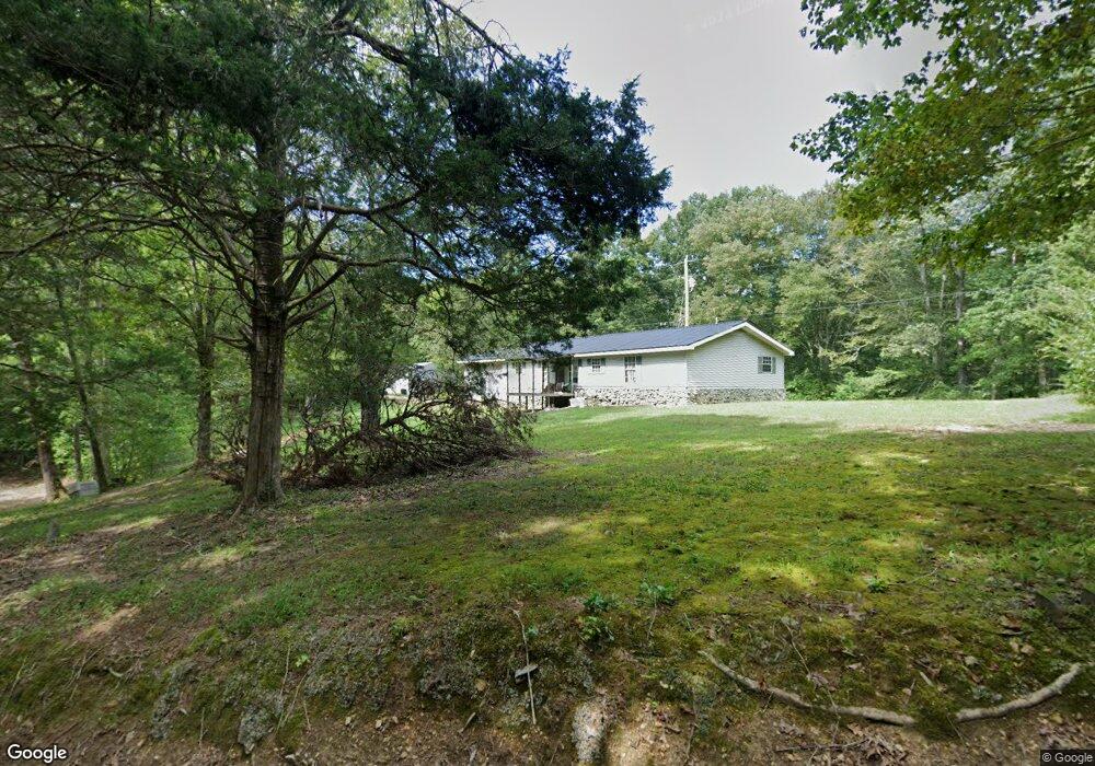
211 Catron St Linden, TN 37096
Estimated Value: $119,000 - $228,000
--
Bed
2
Baths
1,624
Sq Ft
$104/Sq Ft
Est. Value
About This Home
This home is located at 211 Catron St, Linden, TN 37096 and is currently estimated at $168,320, approximately $103 per square foot. 211 Catron St is a home located in Perry County.
Ownership History
Date
Name
Owned For
Owner Type
Purchase Details
Closed on
Mar 19, 2012
Sold by
Community First Bank & Tru
Bought by
Yarbro Billy R
Current Estimated Value
Purchase Details
Closed on
Mar 21, 2011
Bought by
Community First Bank & Tru
Purchase Details
Closed on
Mar 21, 2010
Sold by
Sparks Curtis Ray
Bought by
Community First Bank
Purchase Details
Closed on
Feb 14, 2008
Sold by
Community First Bank Trust
Bought by
Ray Sparks Curtis
Purchase Details
Closed on
Jul 9, 2007
Bought by
The First National Bank
Purchase Details
Closed on
Apr 7, 1999
Bought by
Sparks Curtis Ray
Purchase Details
Closed on
Jul 10, 1989
Bought by
Cochital Et
Purchase Details
Closed on
May 24, 1980
Bought by
Sparks Curtis
Create a Home Valuation Report for This Property
The Home Valuation Report is an in-depth analysis detailing your home's value as well as a comparison with similar homes in the area
Home Values in the Area
Average Home Value in this Area
Purchase History
| Date | Buyer | Sale Price | Title Company |
|---|---|---|---|
| Yarbro Billy R | $30,000 | -- | |
| Community First Bank & Tru | -- | -- | |
| Community First Bank | $51,225 | -- | |
| Ray Sparks Curtis | $45,914 | -- | |
| The First National Bank | $30,000 | -- | |
| Sparks Curtis Ray | -- | -- | |
| Cochital Et | -- | -- | |
| Sparks Curtis | -- | -- |
Source: Public Records
Tax History Compared to Growth
Tax History
| Year | Tax Paid | Tax Assessment Tax Assessment Total Assessment is a certain percentage of the fair market value that is determined by local assessors to be the total taxable value of land and additions on the property. | Land | Improvement |
|---|---|---|---|---|
| 2025 | $502 | $21,875 | $0 | $0 |
| 2024 | $502 | $21,875 | $3,300 | $18,575 |
| 2023 | $502 | $21,875 | $3,300 | $18,575 |
| 2022 | $502 | $21,875 | $3,300 | $18,575 |
| 2021 | $502 | $21,875 | $3,300 | $18,575 |
| 2020 | $502 | $21,875 | $3,300 | $18,575 |
| 2019 | $543 | $21,900 | $3,300 | $18,600 |
| 2018 | $543 | $21,900 | $3,300 | $18,600 |
| 2017 | $537 | $21,900 | $3,300 | $18,600 |
| 2016 | $537 | $21,900 | $3,300 | $18,600 |
| 2015 | $526 | $21,900 | $3,300 | $18,600 |
| 2014 | $526 | $21,900 | $3,300 | $18,600 |
| 2013 | $622 | $25,904 | $0 | $0 |
Source: Public Records
Map
Nearby Homes
- 8884 U S Highway 412
- 2327 Old Highway 13 N
- 0 Treadwell Prong Unit RTC2707562
- 628 Starlight Dr
- 0 Lick Creek Rd Unit 25510476
- 0 Church St
- 141 Maple St
- 245 S Mill St
- 0 U S Highway 412
- Lot 19 Campers Ln
- Lot 13 Campers Ln
- Lot 17 Campers Ln
- Lot 14 Campers Ln
- Lot 34 Campers Ln
- Lot 11 Campers Ln
- Lot 15 Campers Ln
- Lot 7 Campers Ln
- Lot 9 Campers Ln
- Lot 5 Campers Ln
- Lot 32 Campers Ln
- 206 Catron St
- 222 Catron St
- 223 Vaughn Ave
- 215 Vaughn Ave
- 116 Jones St
- 145 Majors St
- 0 Big Buffalo Campground Hwy Unit 3130814
- 0 Big Buffalo Campground Rd Unit 3169120
- 0 Big Buffalo Campground Rd Unit 3177463
- 0 Big Buffalo Campground Rd Unit 3223066
- 0 Copper Dr Unit RTC1353090
- 108 Happy Hollow
- 204 Vaughn Ave
- 217 Pine St
- 217 Pine St
- 219 Pine St
- 223 Pine St
- 213 Pine St
- 225 Pine St
- 237 Pine St