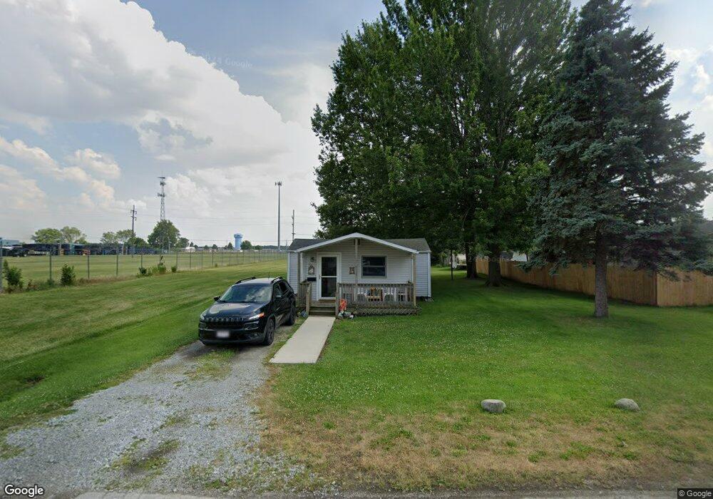
211 E Clark St Fostoria, OH 44830
Estimated Value: $36,000 - $106,000
1
Bed
1
Bath
487
Sq Ft
$138/Sq Ft
Est. Value
About This Home
This home is located at 211 E Clark St, Fostoria, OH 44830 and is currently estimated at $67,131, approximately $137 per square foot. 211 E Clark St is a home with nearby schools including Fostoria Intermediate Elementary School and Fostoria Junior/Senior High School.
Ownership History
Date
Name
Owned For
Owner Type
Purchase Details
Closed on
Oct 22, 2002
Sold by
Augsburger Kenneth R
Bought by
Augsburger Karen L
Current Estimated Value
Purchase Details
Closed on
Dec 19, 1997
Sold by
Mutzabaugh Bonnie J
Bought by
Augsburger Kenneth R
Purchase Details
Closed on
Feb 24, 1997
Sold by
Mutzabaugh Alfred D
Bought by
Mutzabaugh Bonnie J
Purchase Details
Closed on
Oct 28, 1996
Sold by
Mutzabaugh Alfred D
Bought by
Mutzabaugh Alfred D
Purchase Details
Closed on
Jul 1, 1986
Create a Home Valuation Report for This Property
The Home Valuation Report is an in-depth analysis detailing your home's value as well as a comparison with similar homes in the area
Home Values in the Area
Average Home Value in this Area
Purchase History
| Date | Buyer | Sale Price | Title Company |
|---|---|---|---|
| Augsburger Karen L | -- | -- | |
| Augsburger Kenneth R | $8,000 | -- | |
| Mutzabaugh Bonnie J | -- | -- | |
| Mutzabaugh Alfred D | -- | -- | |
| -- | $6,800 | -- |
Source: Public Records
Tax History Compared to Growth
Tax History
| Year | Tax Paid | Tax Assessment Tax Assessment Total Assessment is a certain percentage of the fair market value that is determined by local assessors to be the total taxable value of land and additions on the property. | Land | Improvement |
|---|---|---|---|---|
| 2024 | $11 | $6,190 | $1,450 | $4,740 |
| 2023 | $1 | $6,190 | $1,450 | $4,740 |
| 2022 | $278 | $4,720 | $1,560 | $3,160 |
| 2021 | $279 | $4,720 | $1,560 | $3,160 |
| 2020 | $280 | $4,722 | $1,565 | $3,157 |
| 2019 | $266 | $4,365 | $1,446 | $2,919 |
| 2018 | $271 | $4,365 | $1,446 | $2,919 |
| 2017 | $258 | $4,365 | $1,446 | $2,919 |
| 2016 | $247 | $4,424 | $1,596 | $2,828 |
| 2015 | $242 | $4,424 | $1,596 | $2,828 |
| 2014 | $229 | $4,424 | $1,596 | $2,828 |
| 2013 | $269 | $4,809 | $1,736 | $3,073 |
Source: Public Records
Map
Nearby Homes
- 0 Bradner St
- 514 E Lytle St
- 461 W Lytle St
- 461 W Lytle St Unit 145
- 461 W Lytle St Unit 106
- 0 W South Route 12
- 8 Christopher Dr
- 73 Christopher Dr
- 412 E Center St
- 77 Barcelona Dr
- 351 W South St
- 348 W South St
- 0 Bugner St Unit 6131864
- 321 Mcdougal St
- 203 N Union St
- 11598 W Township Road 114 County Rd
- 509 College Ave
- 540 N Poplar St
- 520 N Union St
- 481 Beverly Dr
- 205 E Clark St
- 216 E Clark St
- 208 E Clark St
- 220 E Clark St
- 214 E Clark St
- 212 E Clark St
- 248 W Hissong Ave
- 206 E Clark St
- 244 W Hissong Ave
- 275 E Clark St
- 0 Hissong Ave
- 1100 S Poplar St
- 1088 S Poplar St
- 1022 S Poplar St
- 1047 State St
- 237 E Eagle St
- 229 E Eagle St
- 241 E Eagle St
- 205 E Eagle St
- 1035 State St