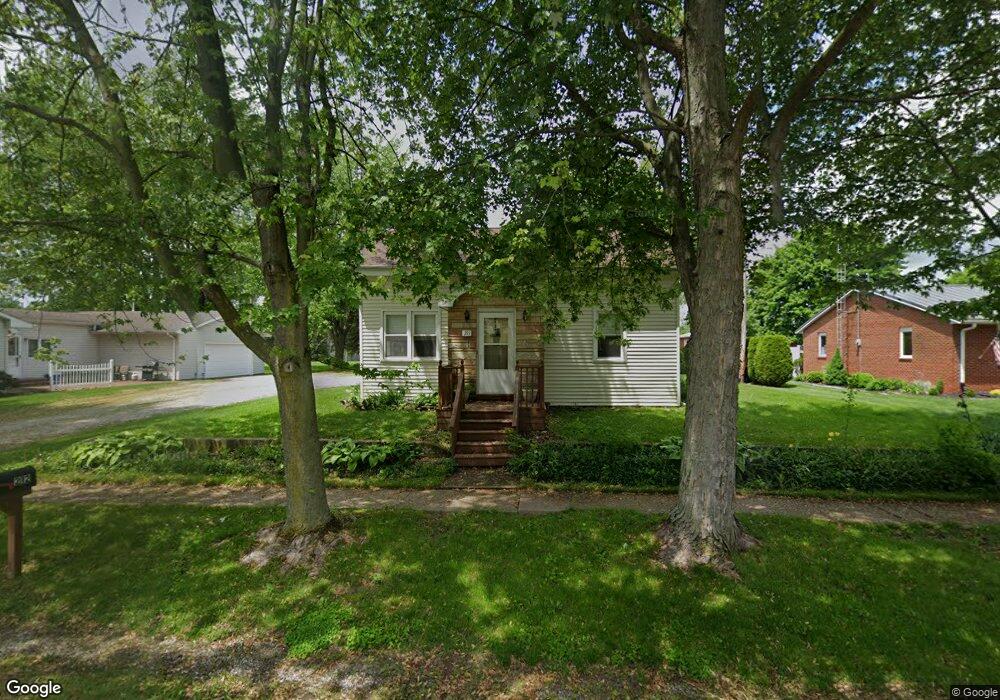
211 E High St Napoleon, OH 43545
Estimated Value: $145,000 - $246,011
2
Beds
1
Bath
1,415
Sq Ft
$128/Sq Ft
Est. Value
About This Home
This home is located at 211 E High St, Napoleon, OH 43545 and is currently estimated at $181,253, approximately $128 per square foot. 211 E High St is a home located in Henry County with nearby schools including Napoleon Elementary School and Napoleon Junior/Senior High School.
Ownership History
Date
Name
Owned For
Owner Type
Purchase Details
Closed on
Aug 12, 2022
Sold by
Lockridge Christopher D
Bought by
Leatherman Zach A
Current Estimated Value
Home Financials for this Owner
Home Financials are based on the most recent Mortgage that was taken out on this home.
Original Mortgage
$137,464
Outstanding Balance
$130,923
Interest Rate
5.7%
Mortgage Type
FHA
Estimated Equity
$50,330
Purchase Details
Closed on
Jun 7, 2021
Sold by
Long Lloyd L and Lulfs Linda L
Bought by
Lockridge Christopher D
Home Financials for this Owner
Home Financials are based on the most recent Mortgage that was taken out on this home.
Original Mortgage
$92,297
Interest Rate
2.9%
Mortgage Type
FHA
Purchase Details
Closed on
Feb 14, 2008
Sold by
Long Arthur L and Long Helen L
Bought by
Rose Judith A and Long Leonard M
Create a Home Valuation Report for This Property
The Home Valuation Report is an in-depth analysis detailing your home's value as well as a comparison with similar homes in the area
Purchase History
| Date | Buyer | Sale Price | Title Company |
|---|---|---|---|
| Leatherman Zach A | $165,000 | None Listed On Document | |
| Lockridge Christopher D | -- | None Listed On Document | |
| Rose Judith A | -- | Attorney |
Source: Public Records
Mortgage History
| Date | Status | Borrower | Loan Amount |
|---|---|---|---|
| Open | Leatherman Zach A | $137,464 | |
| Previous Owner | Lockridge Christopher D | $92,297 |
Source: Public Records
Tax History
| Year | Tax Paid | Tax Assessment Tax Assessment Total Assessment is a certain percentage of the fair market value that is determined by local assessors to be the total taxable value of land and additions on the property. | Land | Improvement |
|---|---|---|---|---|
| 2024 | $1,566 | $35,720 | $6,810 | $28,910 |
| 2023 | $1,567 | $35,720 | $6,810 | $28,910 |
| 2022 | $1,720 | $68,380 | $7,740 | $60,640 |
| 2021 | $1,716 | $34,190 | $3,870 | $30,320 |
| 2020 | $1,583 | $34,090 | $3,870 | $30,220 |
| 2019 | $1,562 | $29,840 | $3,690 | $26,150 |
| 2018 | $1,577 | $29,840 | $3,690 | $26,150 |
| 2017 | $1,541 | $29,840 | $3,690 | $26,150 |
| 2016 | $904 | $25,480 | $3,690 | $21,790 |
| 2015 | $948 | $25,480 | $3,690 | $21,790 |
| 2014 | $948 | $25,480 | $3,690 | $21,790 |
| 2013 | $948 | $25,480 | $3,690 | $21,790 |
Source: Public Records
Map
Nearby Homes
- 104 W High St
- O-083 County Road 17
- H011 County Road 17
- 150 Wayne Park Dr
- 140 Wayne Park Dr
- 8205 Independence Rd
- 907 Huddle Rd
- 0 Westmoreland Ave
- 00 Westmoreland Ave
- 29232 Coressel Rd
- 814 Park St
- 1384 Clairmont Ave
- 538 Huddle Rd
- 1123 Clairmont Ave
- 1113 Clairmont Ave
- Integrity 2280 Plan at Lynnefield Estates
- 1314 Clairmont Ave
- 1324 Clairmont Ave
- 1304 Clairmont Ave
- 1354 Clairmont Ave
Your Personal Tour Guide
Ask me questions while you tour the home.