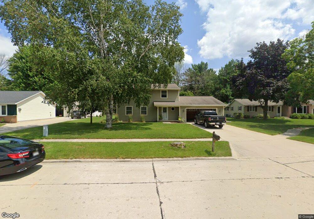
211 Harvest Ct Manitowoc, WI 54220
Estimated Value: $341,000 - $375,000
4
Beds
3
Baths
832
Sq Ft
$431/Sq Ft
Est. Value
About This Home
This home is located at 211 Harvest Ct, Manitowoc, WI 54220 and is currently estimated at $358,412, approximately $430 per square foot. 211 Harvest Ct is a home located in Manitowoc County with nearby schools including Riverview Elementary School, Wilson Middle School, and Lincoln High School.
Ownership History
Date
Name
Owned For
Owner Type
Purchase Details
Closed on
Feb 18, 2022
Sold by
Sahara Tanner
Bought by
Anschutz Nathan D
Current Estimated Value
Home Financials for this Owner
Home Financials are based on the most recent Mortgage that was taken out on this home.
Original Mortgage
$181,000
Outstanding Balance
$167,752
Interest Rate
3.55%
Mortgage Type
New Conventional
Estimated Equity
$190,660
Purchase Details
Closed on
Jan 29, 2018
Sold by
Yanda David J and Yanda Jennifer M
Bought by
Arthurs Brandi L and Bowe Dustin S
Home Financials for this Owner
Home Financials are based on the most recent Mortgage that was taken out on this home.
Original Mortgage
$178,703
Interest Rate
5.25%
Mortgage Type
FHA
Create a Home Valuation Report for This Property
The Home Valuation Report is an in-depth analysis detailing your home's value as well as a comparison with similar homes in the area
Home Values in the Area
Average Home Value in this Area
Purchase History
| Date | Buyer | Sale Price | Title Company |
|---|---|---|---|
| Anschutz Nathan D | $230,000 | None Listed On Document | |
| Anschutz Nathan D | $230,000 | None Listed On Document | |
| Arthurs Brandi L | $182,000 | First American Title |
Source: Public Records
Mortgage History
| Date | Status | Borrower | Loan Amount |
|---|---|---|---|
| Open | Anschutz Nathan D | $181,000 | |
| Previous Owner | Arthurs Brandi L | $178,703 |
Source: Public Records
Tax History Compared to Growth
Tax History
| Year | Tax Paid | Tax Assessment Tax Assessment Total Assessment is a certain percentage of the fair market value that is determined by local assessors to be the total taxable value of land and additions on the property. | Land | Improvement |
|---|---|---|---|---|
| 2024 | $5,171 | $305,900 | $24,800 | $281,100 |
| 2023 | $4,768 | $305,900 | $24,800 | $281,100 |
| 2022 | $4,219 | $227,500 | $24,800 | $202,700 |
| 2021 | $4,251 | $227,500 | $24,800 | $202,700 |
| 2020 | $3,269 | $162,500 | $24,800 | $137,700 |
| 2019 | $3,226 | $162,500 | $24,800 | $137,700 |
| 2018 | $3,169 | $162,500 | $24,800 | $137,700 |
| 2017 | $3,127 | $162,500 | $24,800 | $137,700 |
| 2016 | $3,244 | $162,500 | $24,800 | $137,700 |
| 2015 | $3,335 | $162,500 | $24,800 | $137,700 |
| 2014 | $3,249 | $162,500 | $24,800 | $137,700 |
| 2013 | $3,288 | $162,500 | $24,800 | $137,700 |
Source: Public Records
Map
Nearby Homes
- 230 Harvest Ct
- 107 Mill Rd
- 501 River Bluff Dr
- 314 Micarl Ct
- 4211 Conroe St
- 625 River Bluff Dr
- 4326 Michigan Ave
- 4729 Vista Rd
- 921 Raton Ct
- 4757 Vista Rd
- 528 W Lawn Blvd
- Lt8 MacKert St
- 3709 W Marshall St
- 956 Circle Dr
- 502 S 29th St
- 3810 Calumet Ave
- 1127 Tanglewood Rd
- 3912 Wildwood Dr
- 2904 Calumet Ave
- 3007 Calumet Ave
- 217 Harvest Ct
- 212 Harvest Ct
- 216 Harvest Ct
- 207 Harvest Ct
- 203 Harvest Ct
- 204 Harvest Ct
- 223 Harvest Ct
- 224 Harvest Ct
- 4427 Broadway St
- 229 Harvest Ct
- 4429 Broadway St
- 4501 Harvest Cir
- 4425 Broadway St
- 325 Harvest Ct
- 109 Carrie Ln
- 4511 Harvest Cir
- 101 Carrie Ln
- 4513 Harvest Cir
- 4503 Broadway St
- 104 Carrie Ln