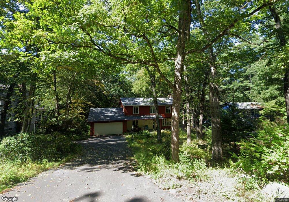
211 Heatherstone Rd Amherst, MA 01002
Estimated Value: $632,000 - $660,000
4
Beds
3
Baths
1,988
Sq Ft
$324/Sq Ft
Est. Value
About This Home
This home is located at 211 Heatherstone Rd, Amherst, MA 01002 and is currently estimated at $643,618, approximately $323 per square foot. 211 Heatherstone Rd is a home located in Hampshire County with nearby schools including Fort River Elementary School, Amherst Regional Middle School, and Amherst Regional High School.
Ownership History
Date
Name
Owned For
Owner Type
Purchase Details
Closed on
Nov 22, 2021
Sold by
Dillon Nt
Bought by
Dillon Ft
Current Estimated Value
Purchase Details
Closed on
Jun 5, 2003
Sold by
Dillon David A and Dillon Sally A
Bought by
Dillon Nt and Dillon David A
Purchase Details
Closed on
Aug 3, 1998
Sold by
Nober Linda W
Bought by
Dillon David A and Dillon Sally A
Home Financials for this Owner
Home Financials are based on the most recent Mortgage that was taken out on this home.
Original Mortgage
$106,000
Interest Rate
6.92%
Mortgage Type
Purchase Money Mortgage
Create a Home Valuation Report for This Property
The Home Valuation Report is an in-depth analysis detailing your home's value as well as a comparison with similar homes in the area
Home Values in the Area
Average Home Value in this Area
Purchase History
| Date | Buyer | Sale Price | Title Company |
|---|---|---|---|
| Dillon Ft | -- | None Available | |
| Dillon Nt | -- | -- | |
| Dillon David A | $212,000 | -- |
Source: Public Records
Mortgage History
| Date | Status | Borrower | Loan Amount |
|---|---|---|---|
| Previous Owner | Dillon David A | $106,000 |
Source: Public Records
Tax History Compared to Growth
Tax History
| Year | Tax Paid | Tax Assessment Tax Assessment Total Assessment is a certain percentage of the fair market value that is determined by local assessors to be the total taxable value of land and additions on the property. | Land | Improvement |
|---|---|---|---|---|
| 2025 | $97 | $541,300 | $205,900 | $335,400 |
| 2024 | $9,483 | $512,300 | $194,300 | $318,000 |
| 2023 | $9,192 | $457,300 | $176,700 | $280,600 |
| 2022 | $8,778 | $412,700 | $160,600 | $252,100 |
| 2021 | $8,359 | $383,100 | $148,700 | $234,400 |
| 2020 | $8,168 | $383,100 | $148,700 | $234,400 |
| 2019 | $7,909 | $362,800 | $148,700 | $214,100 |
| 2018 | $7,670 | $362,800 | $148,700 | $214,100 |
| 2017 | $7,713 | $353,300 | $141,700 | $211,600 |
| 2016 | $7,497 | $353,300 | $141,700 | $211,600 |
| 2015 | $6,965 | $339,100 | $141,700 | $197,400 |
Source: Public Records
Map
Nearby Homes
- 14 Pebble Ridge Rd
- 0 Heatherstone Rd
- 61 S Valley Rd
- 9 Harkness Rd
- 96 Logtown Rd
- 265 Stanley St
- 57 Tanglewood Rd
- 41 Arnold Rd
- 53 Pine Grove Unit 53
- 481 Old Farm Rd
- 130 Linden Ridge Rd
- 121 Amherst Rd
- 100 Larkspur Dr
- 305 Strong St
- 48 Gray St
- 0 Red Gate Ln Unit 73348273
- 161 Chestnut St
- 18 N Prospect St
- 65 N Prospect St
- 324 Pomeroy Ln
- 219 Heatherstone Rd
- 203 Heatherstone Rd
- 195 Heatherstone Rd
- 227 Heatherstone Rd
- 208 Heatherstone Rd
- 218 Heatherstone Rd
- 200 Heatherstone Rd
- 187 Heatherstone Rd
- 31 Bridle Path
- 9 Bridle Path
- 234 Heatherstone Rd
- 43 Bridle Path
- 184 Heatherstone Rd
- 179 Heatherstone Rd
- 19 Birchcroff Ln
- 250 Heatherstone Rd
- 176 Heatherstone Rd
- 176 Heatherstone Rd Unit 176
- 19 Pebble Ridge Rd
- 18 Birchcroff Ln