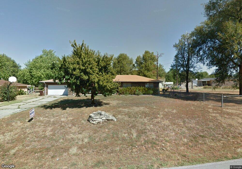
211 John F. Kennedy Dr Willard, MO 65781
Estimated Value: $232,000 - $250,000
3
Beds
2
Baths
1,499
Sq Ft
$160/Sq Ft
Est. Value
About This Home
This home is located at 211 John F. Kennedy Dr, Willard, MO 65781 and is currently estimated at $239,210, approximately $159 per square foot. 211 John F. Kennedy Dr is a home located in Greene County with nearby schools including Willard North Elementary School and Willard Intermediate School North.
Ownership History
Date
Name
Owned For
Owner Type
Purchase Details
Closed on
May 21, 2007
Sold by
Thrift Michael K and Thrift Pamela S
Bought by
Mckay Robert S and Smith Leslie A
Current Estimated Value
Home Financials for this Owner
Home Financials are based on the most recent Mortgage that was taken out on this home.
Original Mortgage
$112,000
Outstanding Balance
$68,312
Interest Rate
6.22%
Mortgage Type
New Conventional
Estimated Equity
$170,898
Purchase Details
Closed on
Jun 19, 2006
Sold by
Hodges Kenneth R and Hodges Metta L
Bought by
Thrift Michael K and Thrift Pamela S
Home Financials for this Owner
Home Financials are based on the most recent Mortgage that was taken out on this home.
Original Mortgage
$87,300
Interest Rate
8.62%
Mortgage Type
Adjustable Rate Mortgage/ARM
Create a Home Valuation Report for This Property
The Home Valuation Report is an in-depth analysis detailing your home's value as well as a comparison with similar homes in the area
Home Values in the Area
Average Home Value in this Area
Purchase History
| Date | Buyer | Sale Price | Title Company |
|---|---|---|---|
| Mckay Robert S | -- | Synergy Title Services Llc | |
| Thrift Michael K | -- | None Available |
Source: Public Records
Mortgage History
| Date | Status | Borrower | Loan Amount |
|---|---|---|---|
| Open | Mckay Robert S | $112,000 | |
| Previous Owner | Thrift Michael K | $87,300 |
Source: Public Records
Tax History
| Year | Tax Paid | Tax Assessment Tax Assessment Total Assessment is a certain percentage of the fair market value that is determined by local assessors to be the total taxable value of land and additions on the property. | Land | Improvement |
|---|---|---|---|---|
| 2025 | $1,521 | $25,230 | $6,650 | $18,580 |
| 2024 | $1,386 | $22,380 | $4,750 | $17,630 |
| 2023 | $1,382 | $22,380 | $4,750 | $17,630 |
| 2022 | $1,267 | $20,860 | $4,750 | $16,110 |
| 2021 | $1,266 | $20,860 | $4,750 | $16,110 |
| 2020 | $1,260 | $20,410 | $4,750 | $15,660 |
| 2019 | $1,254 | $20,410 | $4,750 | $15,660 |
| 2018 | $1,059 | $16,990 | $4,750 | $12,240 |
| 2017 | $1,052 | $16,000 | $4,750 | $11,250 |
| 2016 | $988 | $16,000 | $4,750 | $11,250 |
| 2015 | $979 | $16,000 | $4,750 | $11,250 |
| 2014 | $940 | $15,200 | $4,750 | $10,450 |
Source: Public Records
Map
Nearby Homes
- 000 Mark St
- 708 S Main St
- 716 Daniel Ln
- 413 Cedar Ln
- 825 Pershing St
- 117 Ridgeview Dr
- 710 S State Highway Ab
- 305 Hughes Rd
- 831 Pershing St
- 408 Pine St
- 308 Hughes Rd
- 803 S State Highway Ab
- 464 Baird Ct
- 466 Baird Ct
- 813 Hoffman Hills Blvd
- 506 S Gauge St
- 462 Baird Ct
- 823 Hoffman Hills Blvd
- 479 S Summit Dr
- 460 Baird Ct
- 209 John F. Kennedy Dr
- 210 Jeb St
- 713 John F. Kennedy Dr
- 208 Jeb St
- 212 John F. Kennedy Dr
- 207 John F. Kennedy Dr
- 210 John F. Kennedy Dr
- 206 Jeb St
- 208 John F. Kennedy Dr
- 205 John F. Kennedy Dr
- 204 Jeb St
- 800 Barwick Place
- 703 John F. Kennedy Dr
- 209 Jeb St
- 727 S Miller Rd
- 207 Jeb St
- 203 John F. Kennedy Dr
- 205 Silverleaf Dr
- 802 Barwick Place
- 203 Silverleaf Dr
Your Personal Tour Guide
Ask me questions while you tour the home.