Estimated Value: $139,000 - $184,000
2
Beds
1
Bath
1,000
Sq Ft
$160/Sq Ft
Est. Value
About This Home
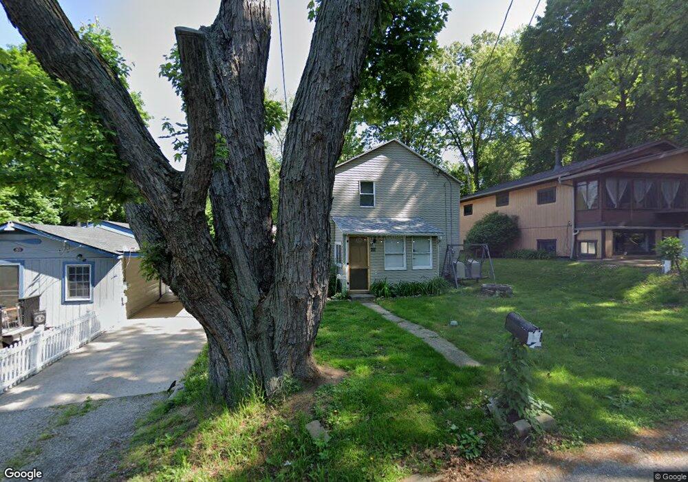
This home is located at 211 Lakota Ave, Akron, OH 44319 and is currently estimated at $159,609, approximately $159 per square foot. 211 Lakota Ave is a home located in Summit County with nearby schools including Coventry Middle School, Coventry High School, and St. Francis de Sales School.
Ownership History
Date
Name
Owned For
Owner Type
Purchase Details
Closed on
Nov 23, 1999
Sold by
Rager Richard D and Rager Bambi L
Bought by
Maynley Investments Inc
Current Estimated Value
Purchase Details
Closed on
Dec 16, 1994
Sold by
Dorando John
Bought by
Rager Richard D and Rager Bambi
Home Financials for this Owner
Home Financials are based on the most recent Mortgage that was taken out on this home.
Original Mortgage
$45,942
Interest Rate
9.06%
Mortgage Type
New Conventional
Create a Home Valuation Report for This Property
The Home Valuation Report is an in-depth analysis detailing your home's value as well as a comparison with similar homes in the area
Home Values in the Area
Average Home Value in this Area
Purchase History
| Date | Buyer | Sale Price | Title Company |
|---|---|---|---|
| Maynley Investments Inc | $44,000 | Approved Statewide Title Age | |
| Rager Richard D | $46,952 | -- |
Source: Public Records
Mortgage History
| Date | Status | Borrower | Loan Amount |
|---|---|---|---|
| Previous Owner | Rager Richard D | $45,942 |
Source: Public Records
Tax History Compared to Growth
Tax History
| Year | Tax Paid | Tax Assessment Tax Assessment Total Assessment is a certain percentage of the fair market value that is determined by local assessors to be the total taxable value of land and additions on the property. | Land | Improvement |
|---|---|---|---|---|
| 2025 | $2,582 | $42,830 | $10,122 | $32,708 |
| 2024 | $2,582 | $42,830 | $10,122 | $32,708 |
| 2023 | $2,582 | $42,830 | $10,122 | $32,708 |
| 2022 | $1,963 | $26,681 | $6,209 | $20,472 |
| 2021 | $1,856 | $26,681 | $6,209 | $20,472 |
| 2020 | $1,804 | $26,680 | $6,210 | $20,470 |
| 2019 | $1,162 | $15,320 | $6,450 | $8,870 |
| 2018 | $1,152 | $15,320 | $6,450 | $8,870 |
| 2017 | $1,051 | $15,320 | $6,450 | $8,870 |
| 2016 | $1,049 | $13,690 | $6,450 | $7,240 |
| 2015 | $1,051 | $13,690 | $6,450 | $7,240 |
| 2014 | $1,025 | $13,690 | $6,450 | $7,240 |
| 2013 | $1,208 | $15,750 | $6,450 | $9,300 |
Source: Public Records
Map
Nearby Homes
- 206 Lakota Ave
- 3101 Wagoner St
- 72 Weil Ave
- 428 Canova Dr
- 2972 N Turkeyfoot Rd
- 449 W Long Lake Blvd
- 61 Leicester Dr
- 202 W Warner Rd
- 0 S Main St
- 0 W Warner Rd
- 2925 Greenwing Ct
- 336 Teal Cir
- 441 Dorwil Dr
- 796 Portage Lakes Dr
- 802 Portage Lakes Dr
- 262 Teal Cir
- 71 Delora Dr
- 552 Saunders Ave
- 584 Apple Dr
- 3025 Lamb Dr
- 215 Lakota Ave
- 207 Lakota Ave
- 3181 N Turkeyfoot Rd
- 217 Radnor Ct
- 215 Falcon Ct
- 219 Falcon Ct
- 3193 N Turkeyfoot Rd
- 187 Lakota Ave
- 3169 Raceside Dr
- 203 Falcon Ct
- 00 Turkeyfoot Rd
- 3165 Raceside Dr
- 197 Lakota Ave
- 185 Lakota Ave
- 208 Radnor Ct
- 3155 Raceside Dr
- 3195 Wagoner St
- 206 Olivet Ave
- 206 Olivet Ave Unit B
- 202 Olivet Ave